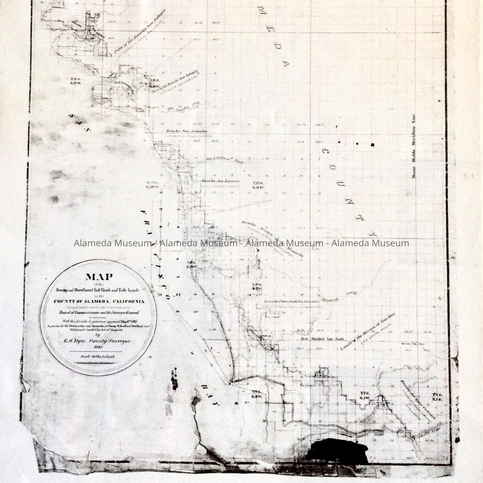
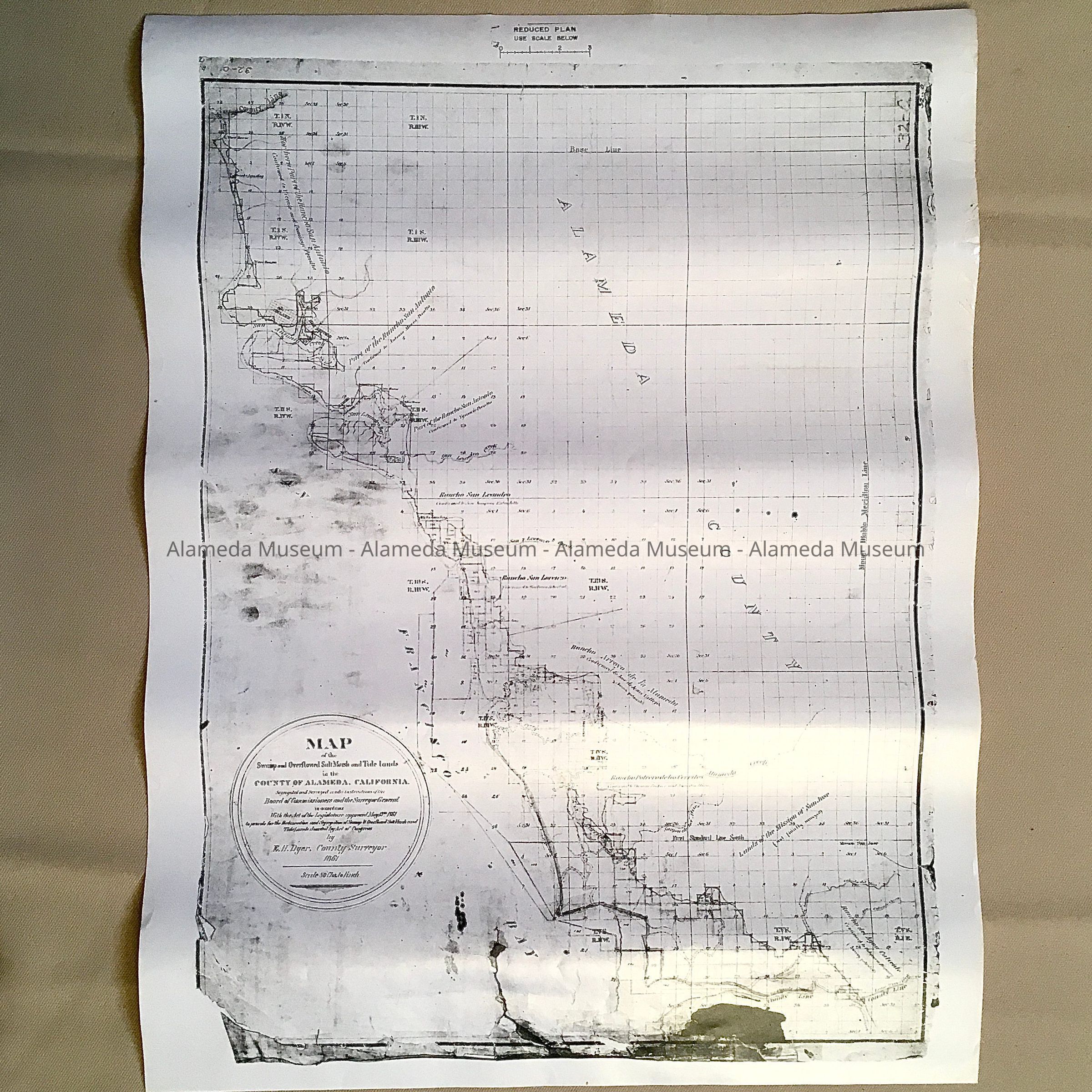
Name/Title
Photocopy of 'Map of the Swamp and Overflow Salt Marsh and Tidelands', 1861Entry/Object ID
1997.262.1Description
ACC. NO. 97.262.1 A, B, C, D.
SUBJECT CATEGORY: MAPS
DATE OR PERIOD: 1861
OBJECT: MAP
DESCRIPTION:
PHOTOCOPY OF A MAP, WITH CAPTION, "MAP OF THE SWAMP AND OVERFLOW SALT MARSH AND TIDELANDS."
SIZE: L 18" X W 14"
HISTORY OF OBJECT: MAP DEPICTING ALAMEDA AND BAY FARM ISLAND TIDELANDS, CREATED BY E H DYER, COUNTY SUPERVISOR, 1861.
A. POSITIVE (WHITE).
B., C., D. NEGATIVES (BLACK).
ACQUIRED FROM:
UNKNOWN
DATE: JUNE 7, 1997