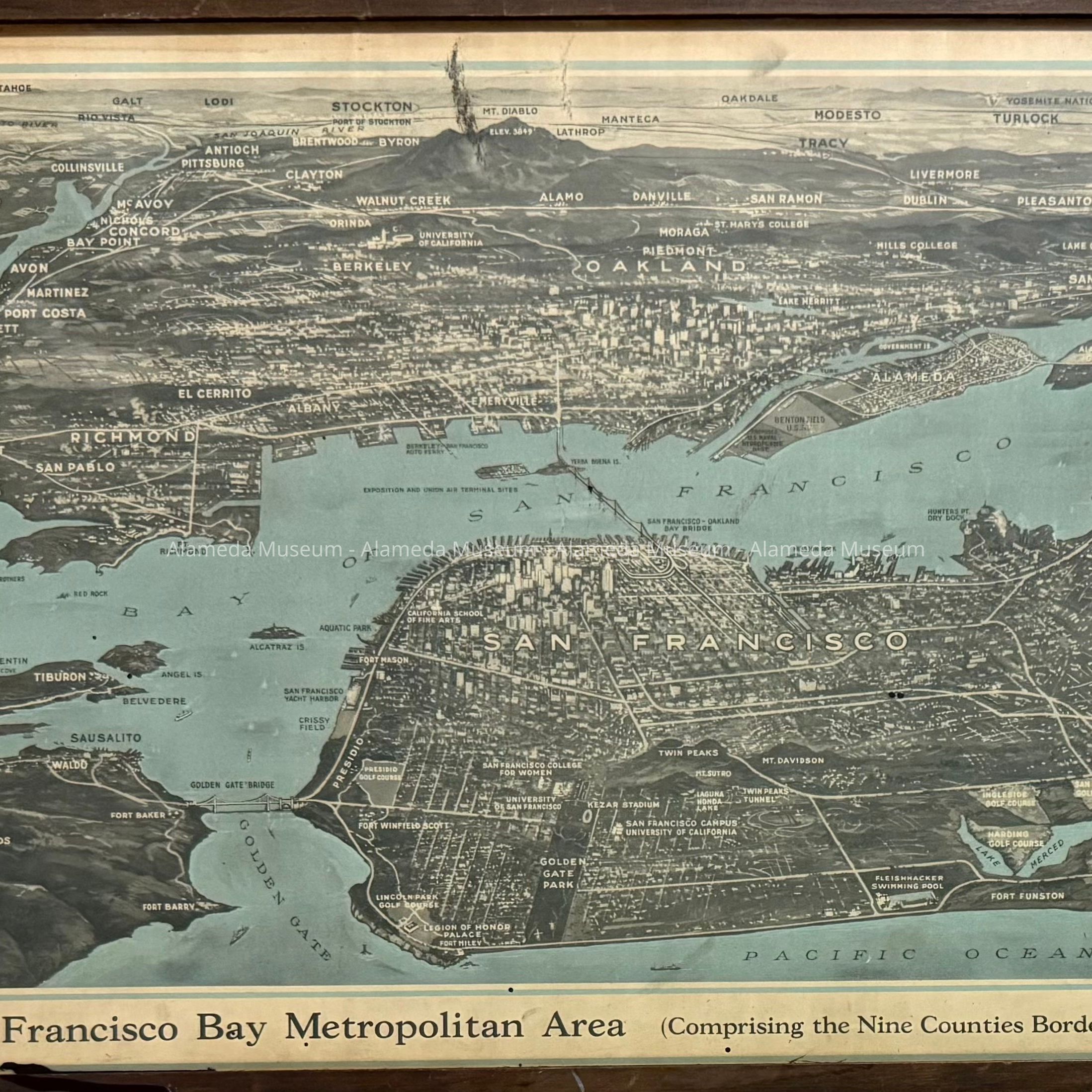
Name/Title
Framed Aerial map of the 'San Francisco Bay Metropolitan Area', c. 1932Entry/Object ID
2012.44.1Description
Acc. No. 12.44.1
Subject Category: Aerial View Map
Date or Period: circa 1932
Object: Aerial view map, framed
Description: Aerial view in blue, black and white colored type with a bold printed caption, "San Francisco Bay Metropolitan Area, comprising the nine counties bordering on the Bay". It is in a wooden frame with a dark walnut colored finish.
Size: L-16” x W-31 1/2”
History of Object: Aerial view illustrating the San Francisco Bay Area including Alameda, which shows the location of Benton Field and the proposed U.S. Naval Hydroplane Base as well as Government Island and the Alameda Municipal Golf Course. This view map was copyrighted by the Pacific Gas & Electric Company in December, 1932 and it was presented to the members of the San Francisco Bay Industrial Committee.
Acquired from: Unknown
Date: 07/18/12