Name/Title
Golf Course Map on aerial photo, c. 1969Entry/Object ID
2025.28.1Description
Acc. No. 25.28.1
Subject Category: Parks, Corica / Municipal Golf Course; Bay Farm Island
Date or Period: c. 1969
Object: map on aerial photo
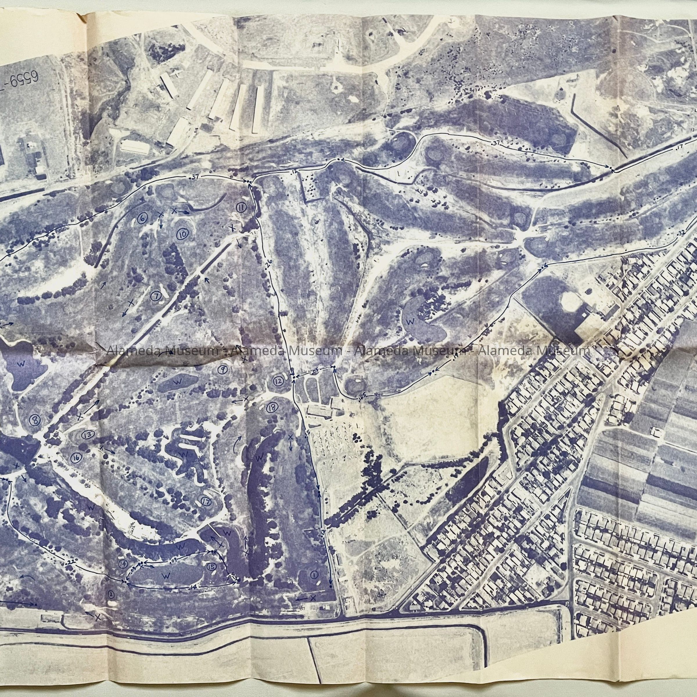
Description: a folded and photocopied map with handdrawn numbers, W’s, and lines on what appears to be a golf course on an aerial photo, printed in blue ink on yellowed paper, with aerial photo sequence number 6559-73. The numbers and letters are readable when the photo sequence number is upside down. Additionally a parking lot and buildings on the golf course can be made out, different colored farm fields and buildings can be seen at bottom right, houses separating the fields and golf course, a field with light-colored baseball diamond, and at the top of the map, long buildings and a large 2-engine aircraft.
Size: L 30 x W 22 inches
History of Object: Map of unknown purpose of the golf course on Bay Farm Island, with numbers in circles apparently indicating the golf holes, and ’W’ indicating water features. In addition, Bay Farm farms, Maitland Drive, Beach Road, Garden Road, Island drive, Mecartney Road, Azalea, Begonia, Camelia, Holly, Magnolia, Lilac, Mangrove Drive. At the top, the ‘old T’s’ hangars of Oakland Airport, and next to the houses, Godfrey Park, can be seen.
Acquired from: Jim Taxiera
Donation Date: 1/25/2025
Catalog Date: 1/29/2025