Name/Title
Maps of Clement Ave. between Broadway and Grand St.Entry/Object ID
2025.80.1Description
Acc. No. 25.80.1 A-P
Subject Category: City of Alameda; Streets of Alameda
Date or Period: 1915 or 1916
Object: 16 Maps
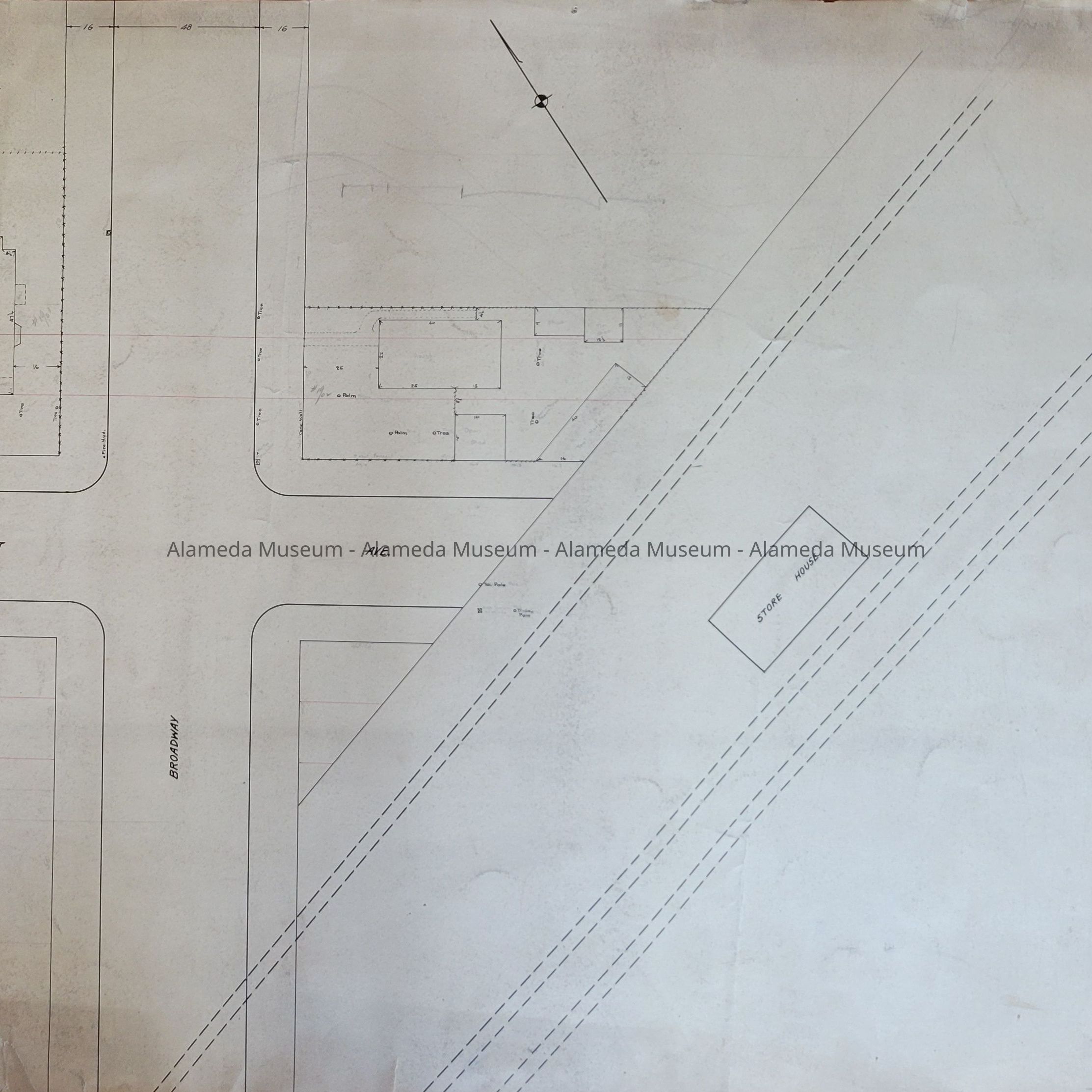
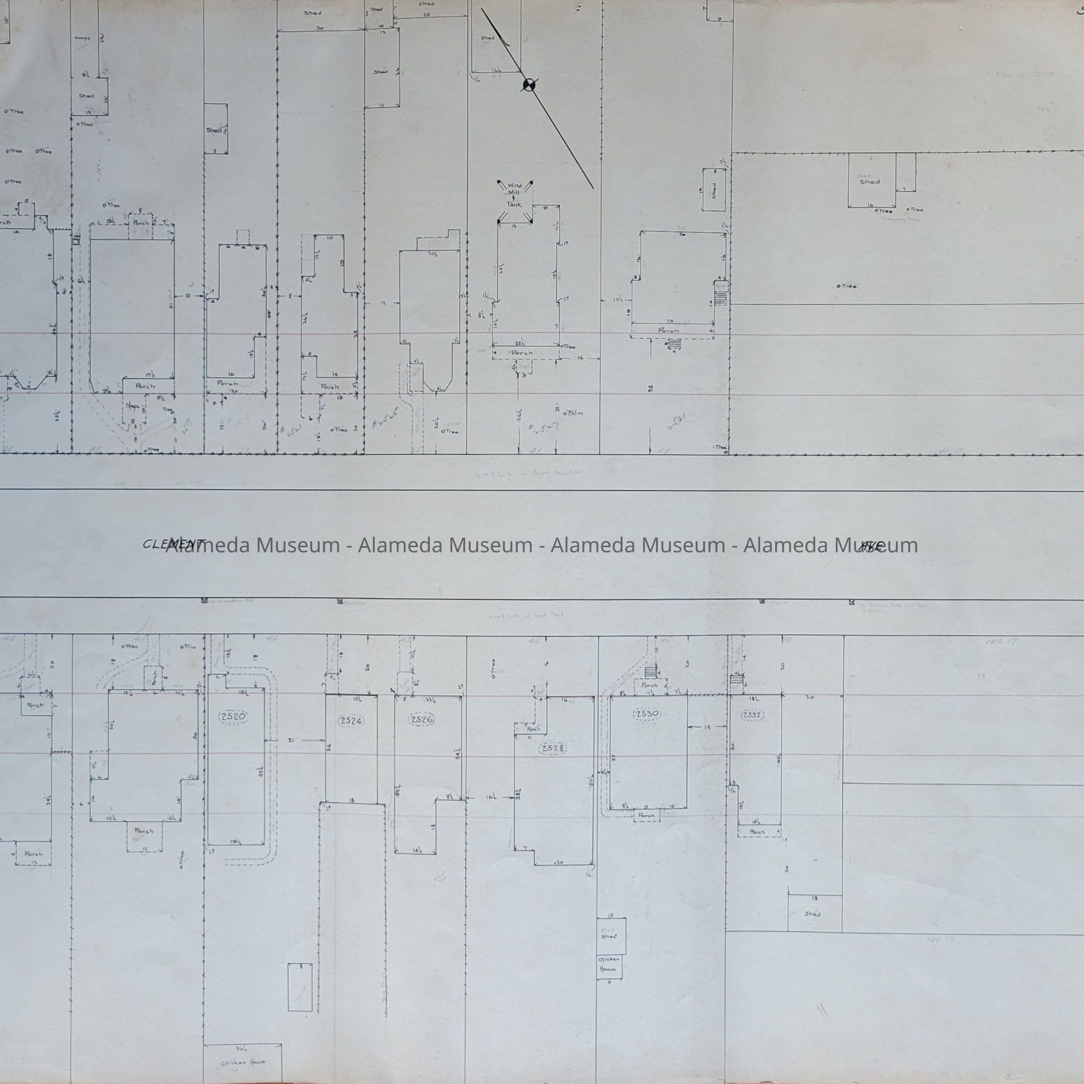
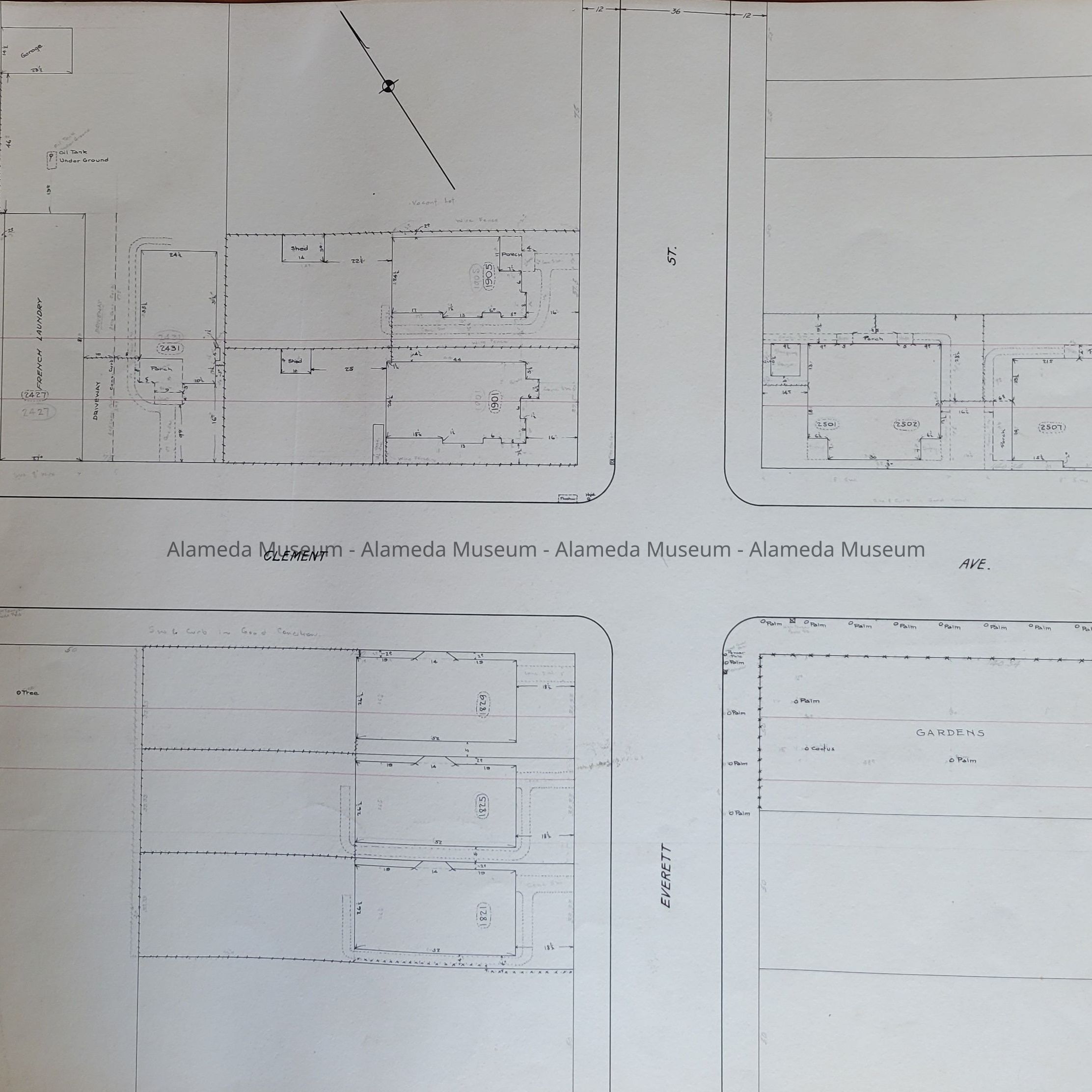
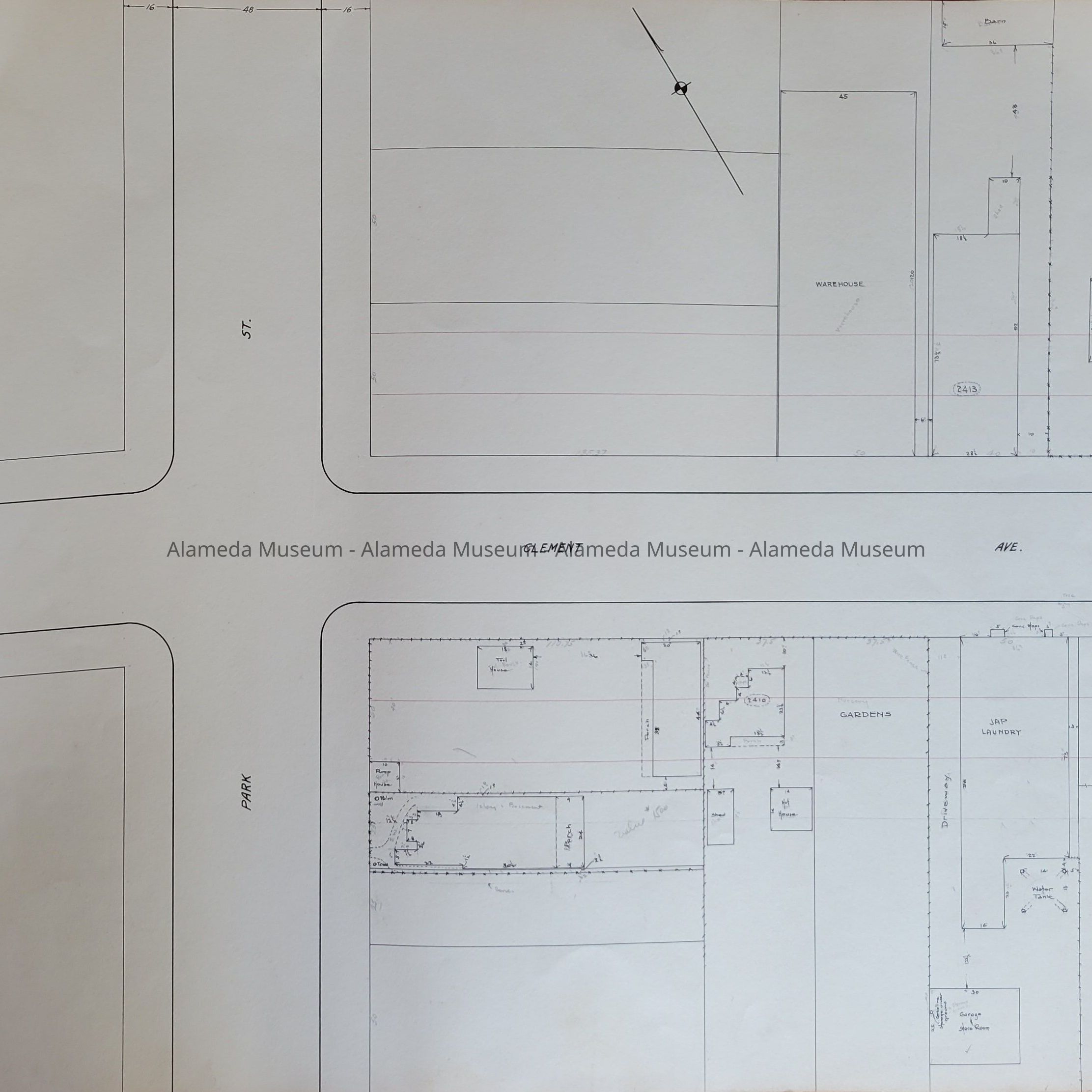
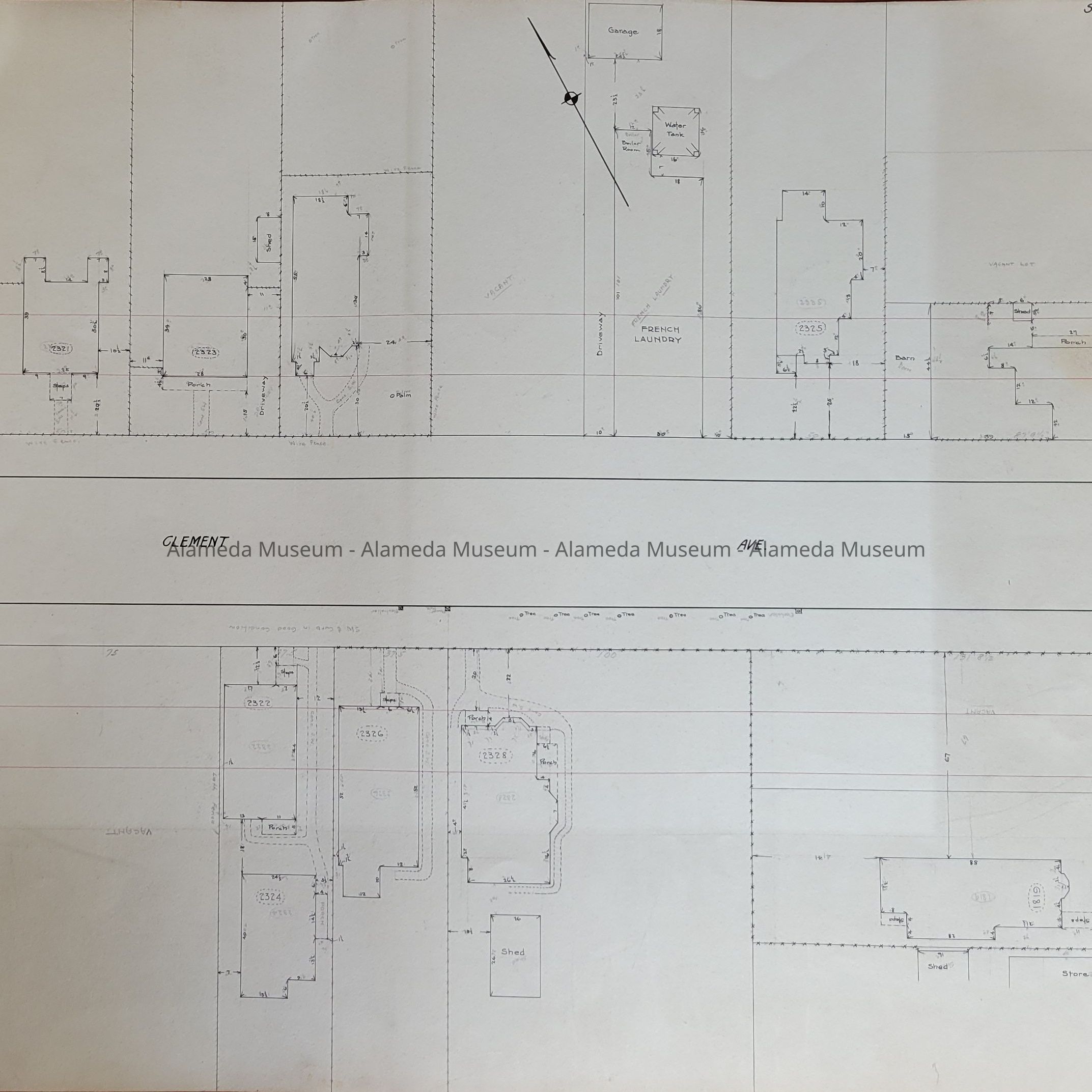
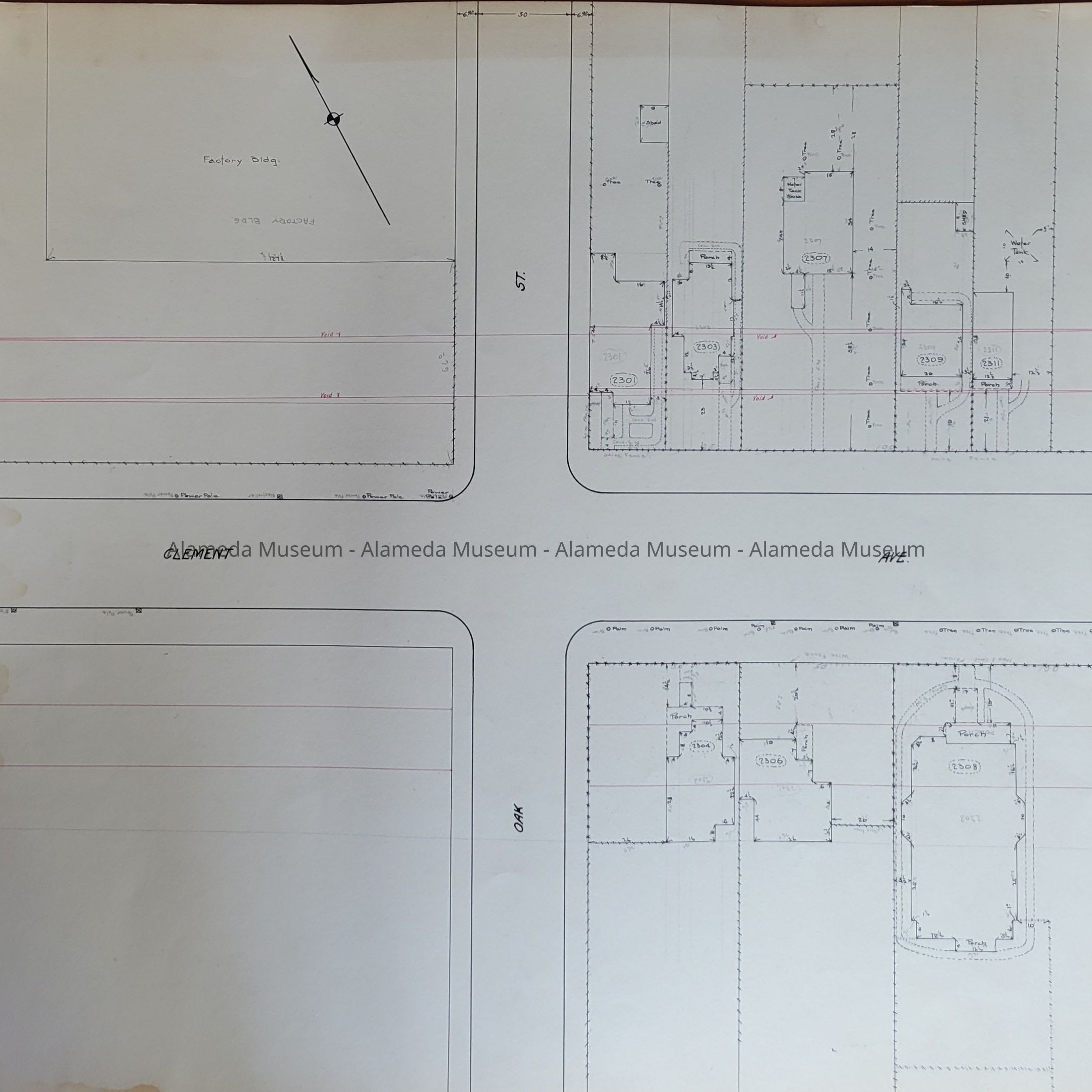
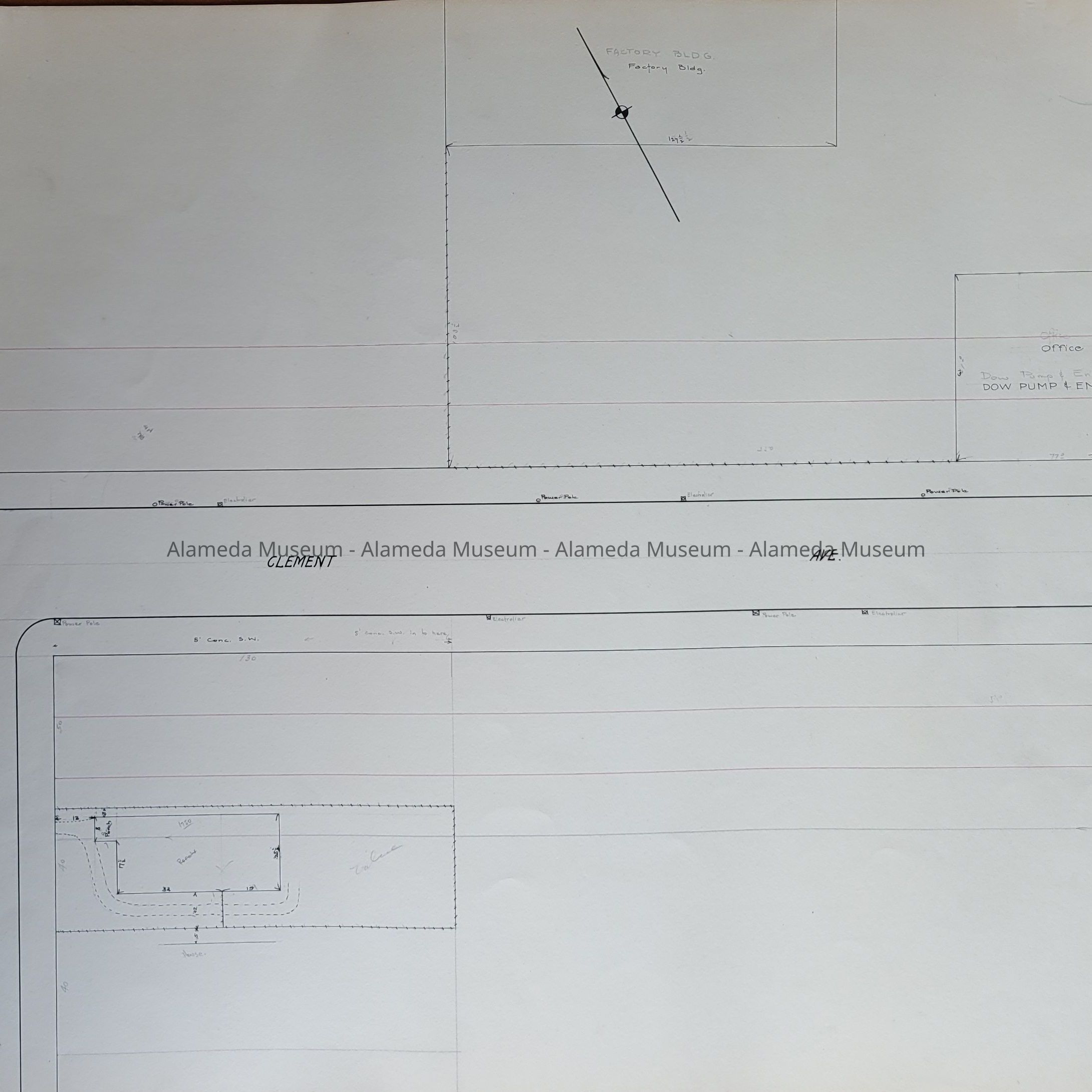
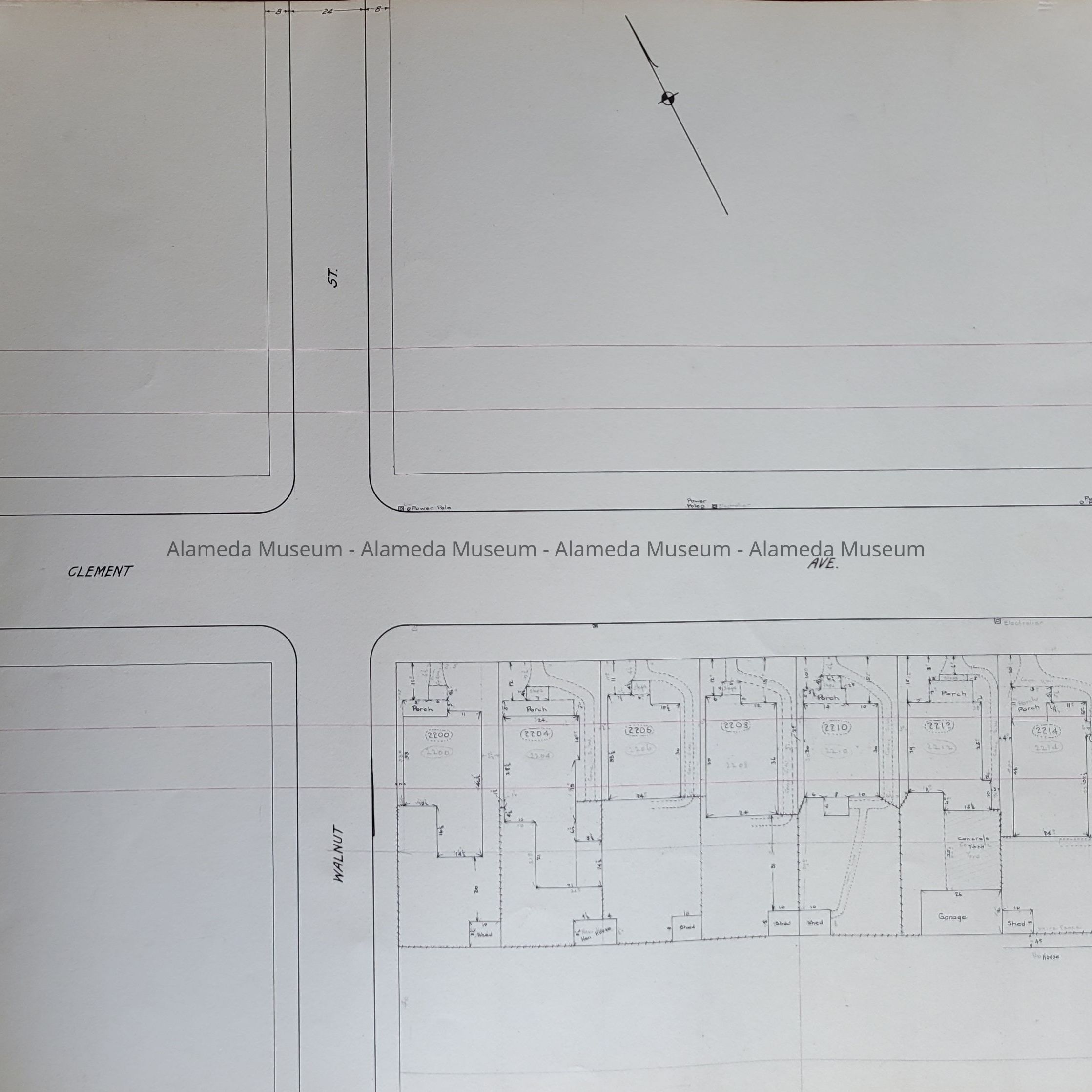
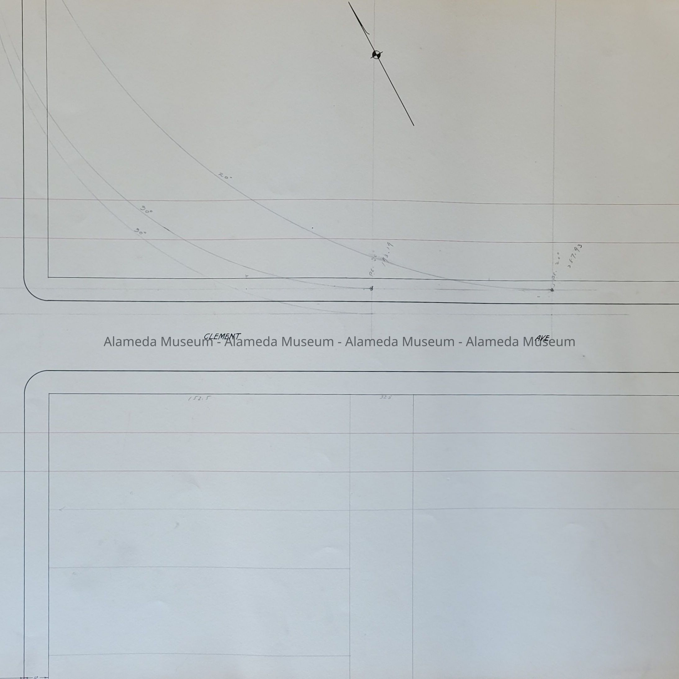
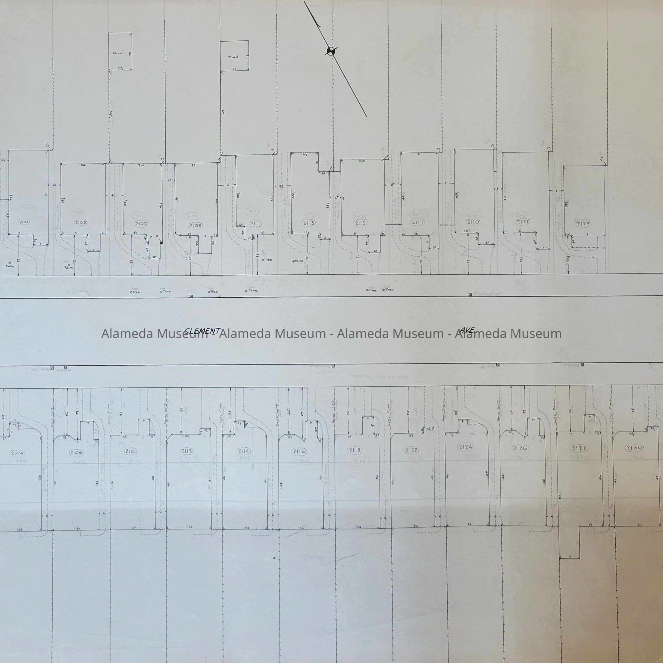
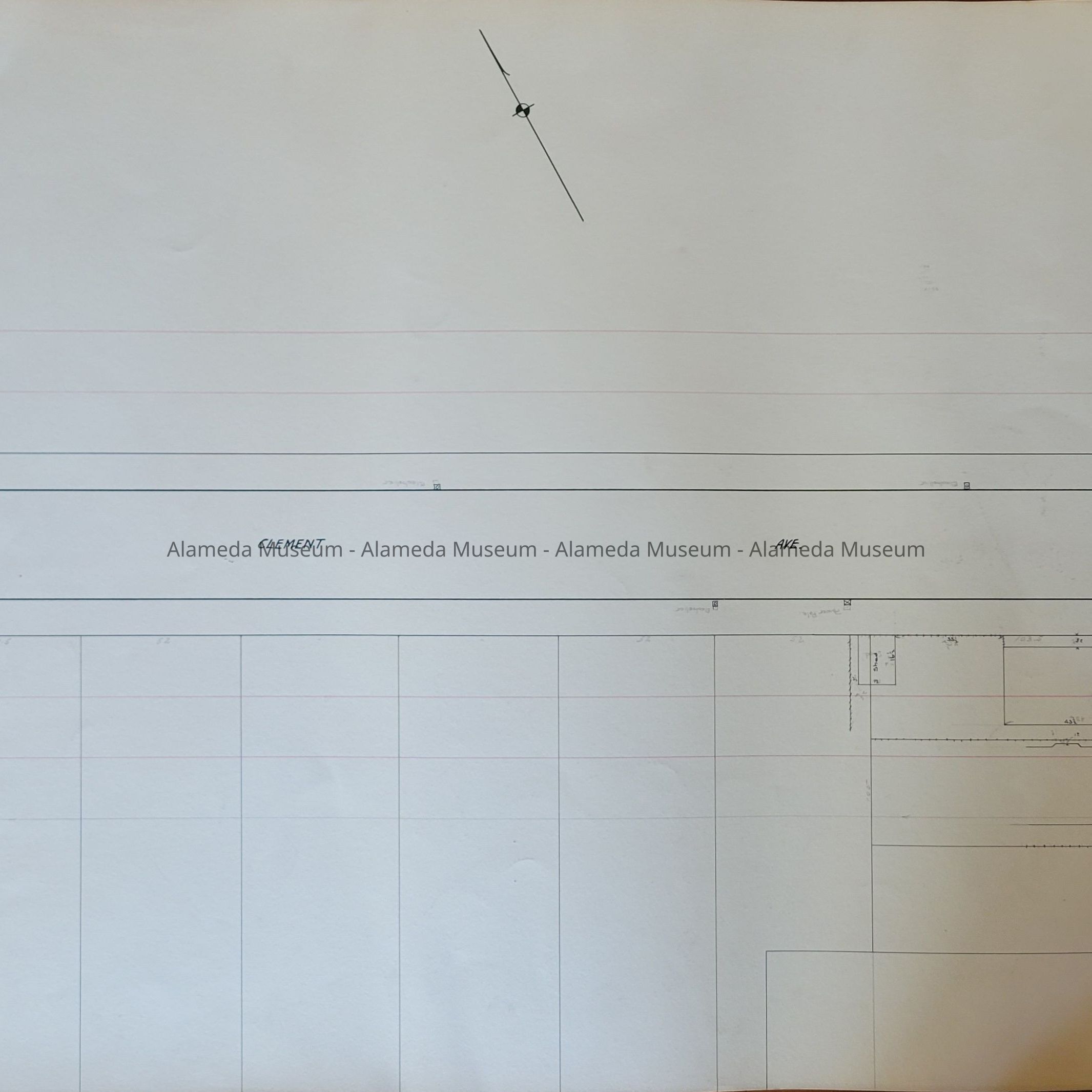
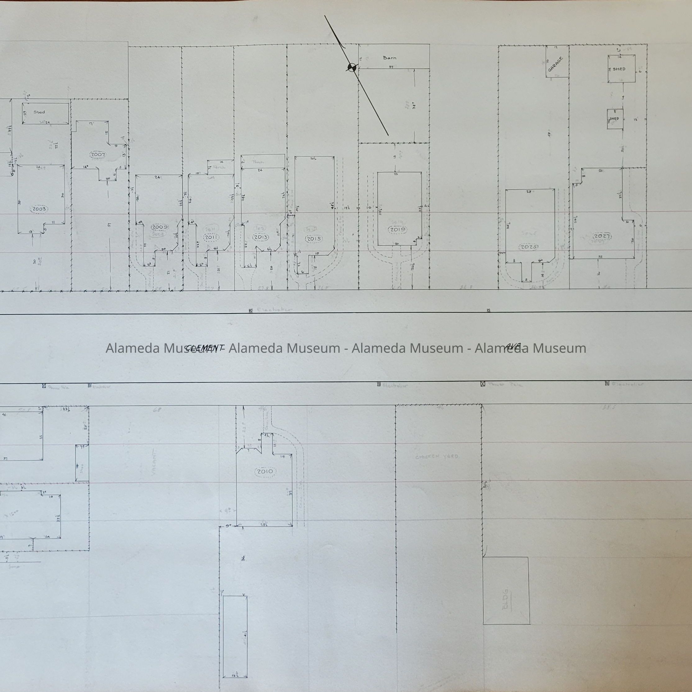
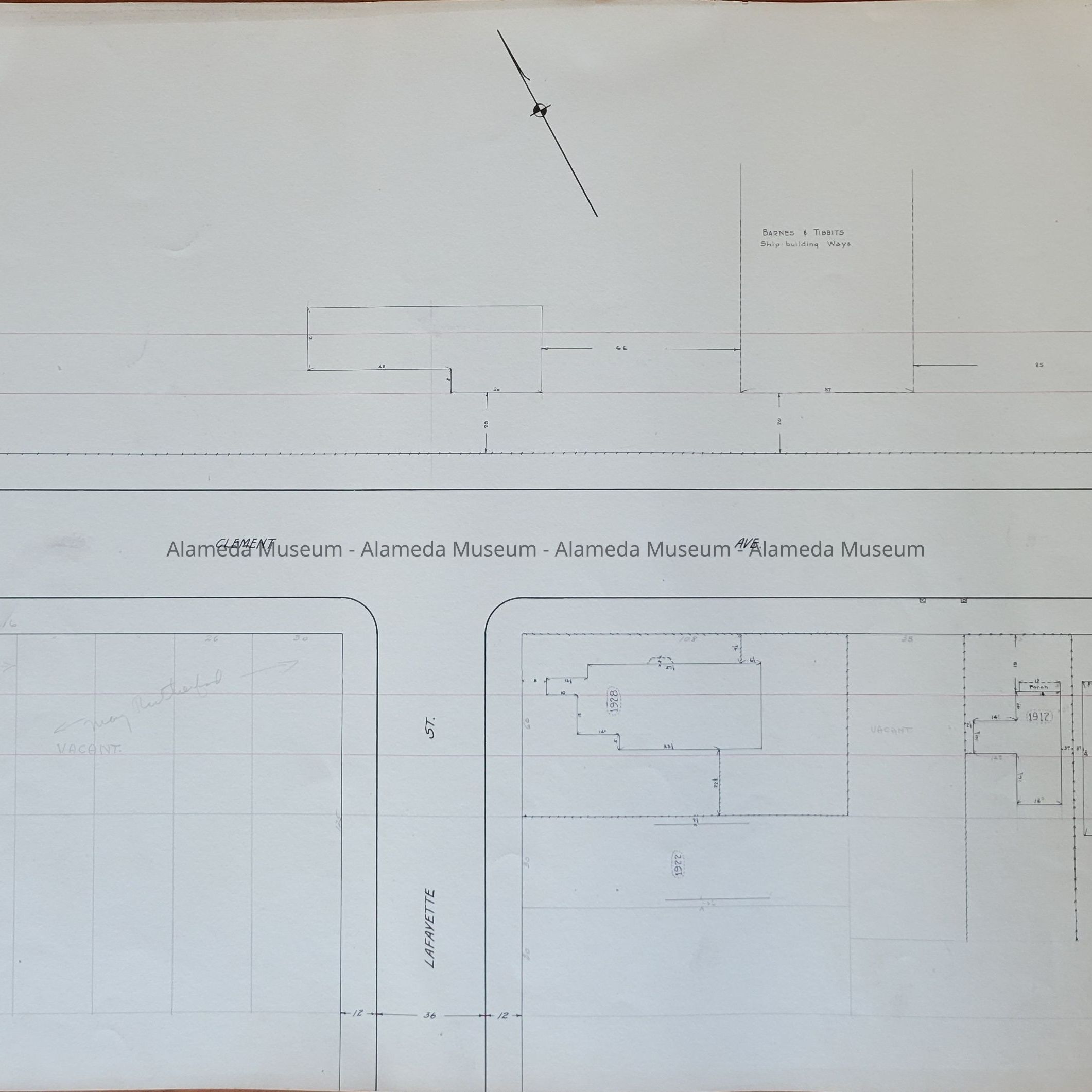
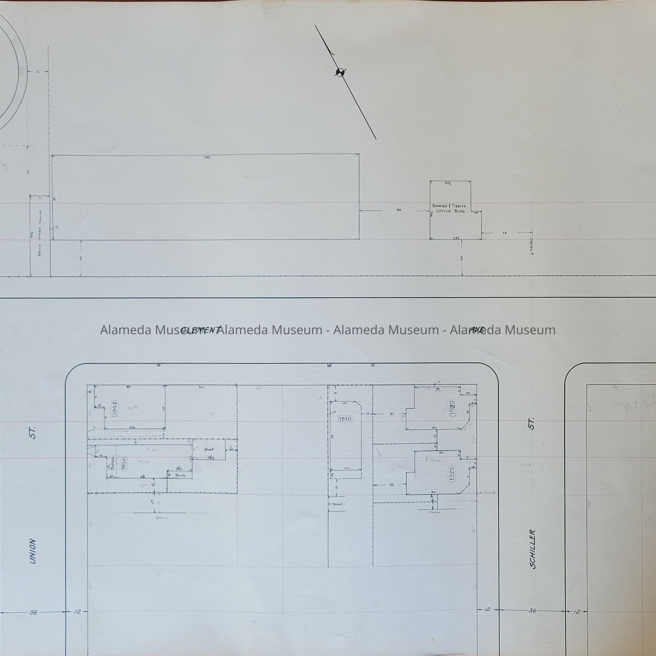
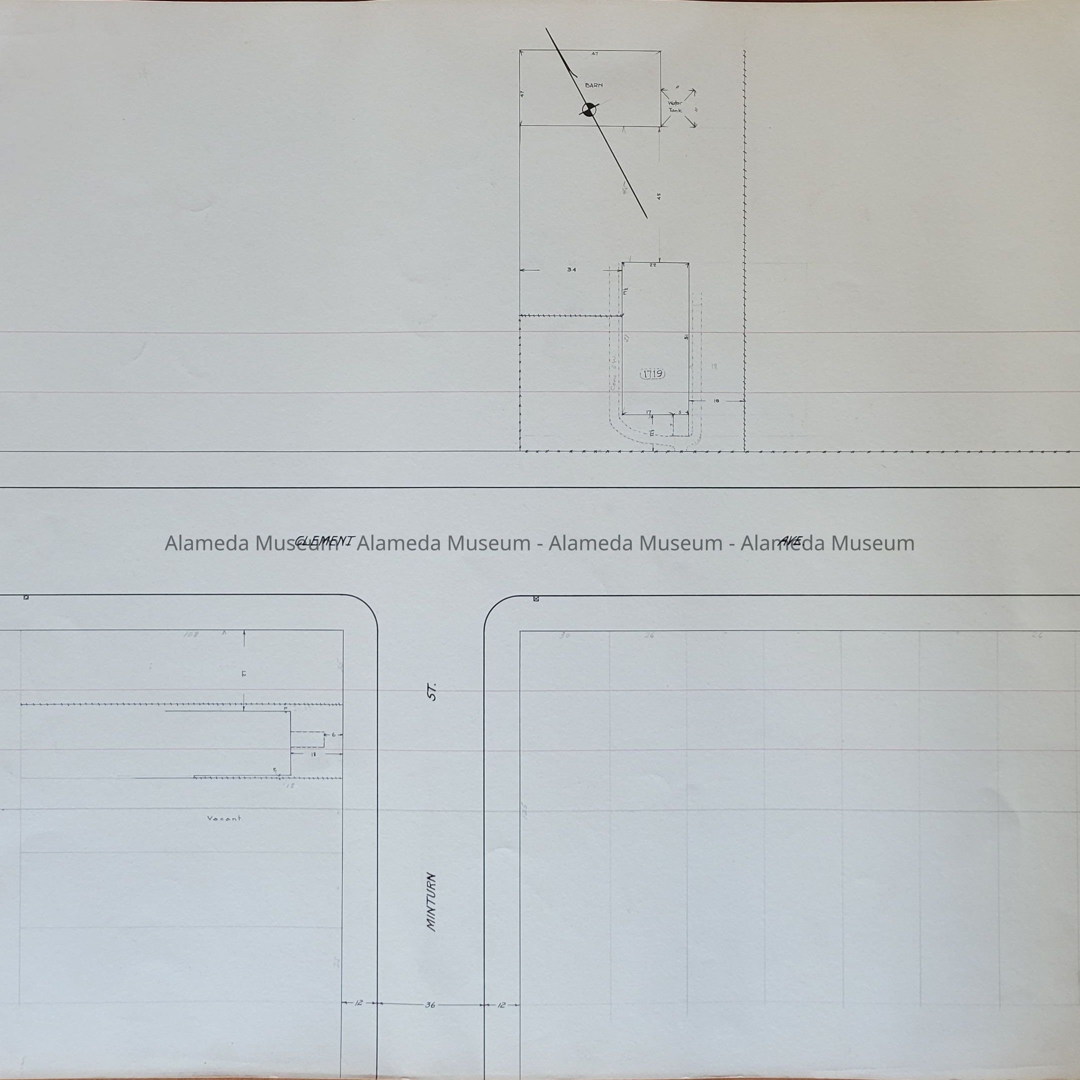
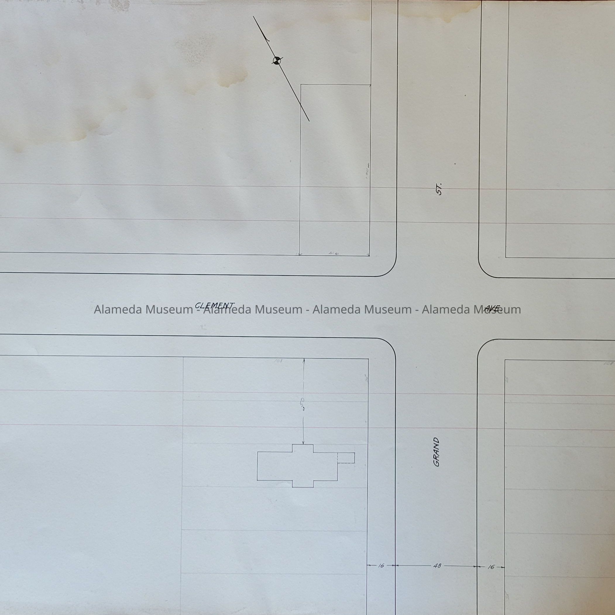
Description: 16 maps, hand-drawn on heavy-stock paper in black ink, showing properties on both sides of Clinton Ave., between Broadway and Grand Street. Buildings are shown with a Sandborn level of detail. Sometimes the location and types of trees are indicated. Pinholes in the corners indicate that these maps combined to display as a larger map.
25.80.1A shows buildings near the intersection of Broadway and Clement Ave. Sheet No. 1 is written in the upper right hand corner. This sheet is dirtier than the others.
25.80.1B is a continuation of 25.80.1A showing Clement buildings to the west, toward Everett St. Sheet No. 2 is written in the upper right hand corner.
25.80.1C is a continuation of 25.80.1B showing Clement buildings on both each side of Everett St. Sheet No. 3 is written in the upper right hand corner.
25.80.1D is a continuation of 25.80.1C showing Clement buildings on the east side of Park St. Sheet No. 4 is written in the upper right hand corner.
25.80.1E is a continuation of 25.80.1D showing Clement buildings on the west side of Park St. Sheet No. 5 is written in the upper right hand corner.
25.80.1F is a continuation of 25.80.1E showing Clement buildings on both each side of Oak St. Sheet No. 6 is written in the upper right hand corner. This sheet has staining on each side.
25.80.1G is a continuation of 25.80.1F showing Clement buildings between Oak St. and Elm St. Sheet No. 7 is written in the upper right hand corner.
25.80.1H is a continuation of 25.80.1G showing buildings along the south side of Clement Ave., up to Walnut St. Sheet No. 8 is written in the upper right hand corner.
25.80.1I is a continuation of 25.80.1H west to Mulberry St. No structures are shown on either side of the street. It is assumed that none existed. Sheet No. 9 is written in the upper right hand corner.
25.80.1J is a continuation of 25.80.1I showing houses on both side of Clement Ave., between Mulberry St. and Willow St. Sheet No. 10 is written in the upper right hand corner.
25.80.1K is a continuation of 25.80.1J between Willow St. and Stanford St. No houses are shown facing Clement Ave. Sheet No. 11 is written in the upper right hand corner.
25.80.1L is a continuation of 25.80.1J between Willow St. and Stanford St. No houses are shown facing Clement Ave. Sheet No. 12 is written in the upper right hand corner.
25.80.1M is a continuation of 25.80.1L showing Clement Ave. on each side of Lafayette St. Sheet No. 13 is written in the upper right hand corner.
25.80.1N is a continuation of 25.80.1M showing houses and businesses Clement Ave., between Schiller St. and Union St. Sheet No. 14 is written in the upper right hand corner.
25.80.1O is a continuation of 25.80.1N showing Clement Ave. on each side of Minturn St. Sheet No. 15 is written in the upper right hand corner.
25.80.1P is a continuation of 25.80.1O showing a 36 feet wide Clement Ave. extending more than 300 feet west of Grand St. Sheet No. 16 is written in the upper right hand corner. There is staining in the upper left hand corner and soiling on the entire back.
Size: L 18 " x W 22.5” All maps
History of Object: The intended use of these maps is not currently known. Their historical significance is described above. Some city utilities are called out and the condition of various sidewalks is noted.
Donor: unknown
Donation Date: unknown, found in museum storage, awaiting processing.
Catalog Date: 6/6/2025