Name/Title
Subdivision Map of McPherson St, 1890sEntry/Object ID
2025.64.49Description
Acc. No. 25.64.49
Subject Category: City of Alameda; Streets of Alameda
Date or Period: 1890's
Object: Map
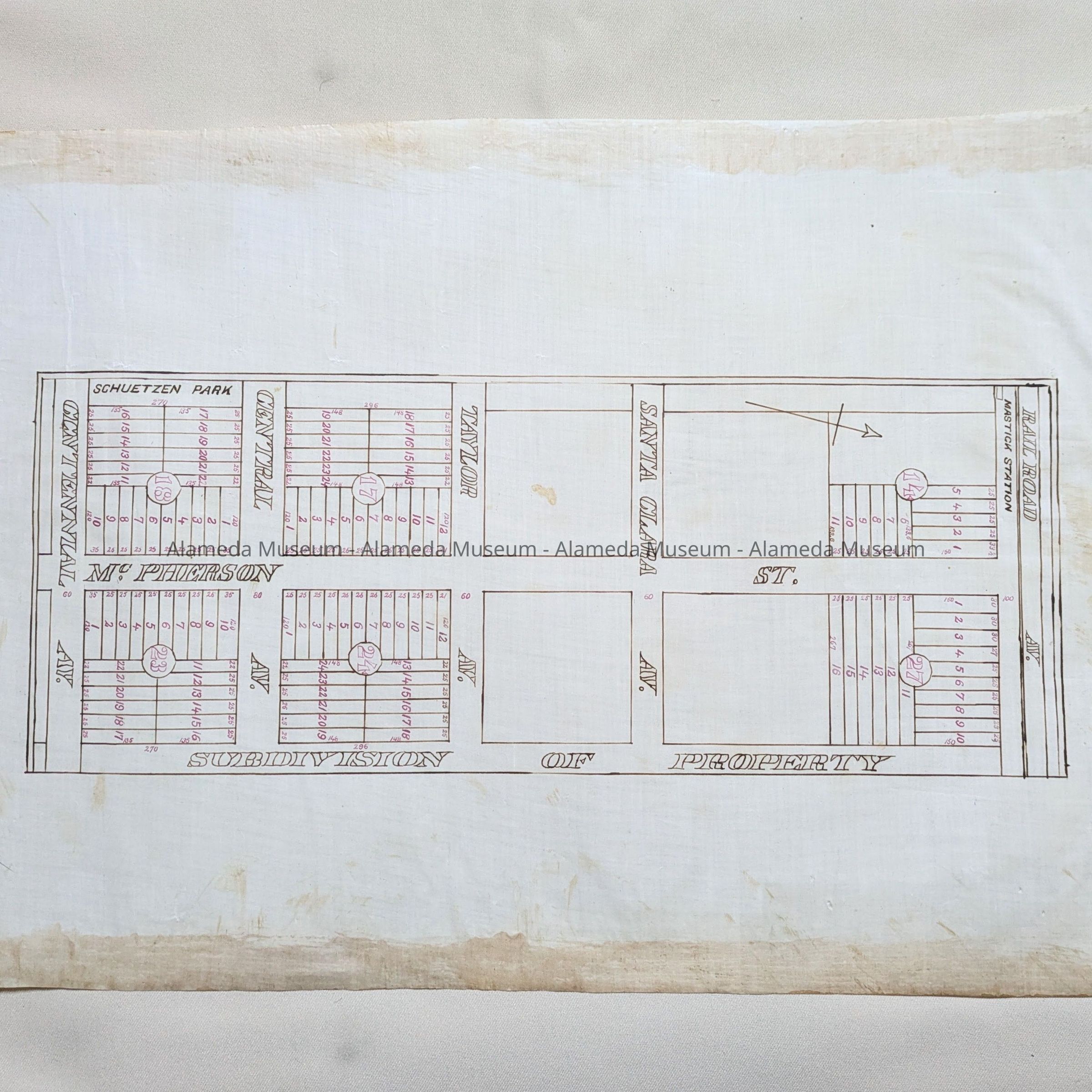
Description: A Diagram, hand-drawn on linen paper, blocks in black ink, properties numbered in red ink. Title: 'Subdivision of Property.'
Size: L 16 x W 23”
History of Object: Block map of McPherson St. (now Ninth), from Centennial Ave, through Central, Taylor, Santa Clara and Railroad Ave (now Lincoln). Shows the location of Schuetzen Park and Mastick Station.
Presumably found in the attic of City Hall in the 1990s.
Donor: City of Alameda
Donation Date: unknown
Catalog Date: 5/16/2025