Name/Title
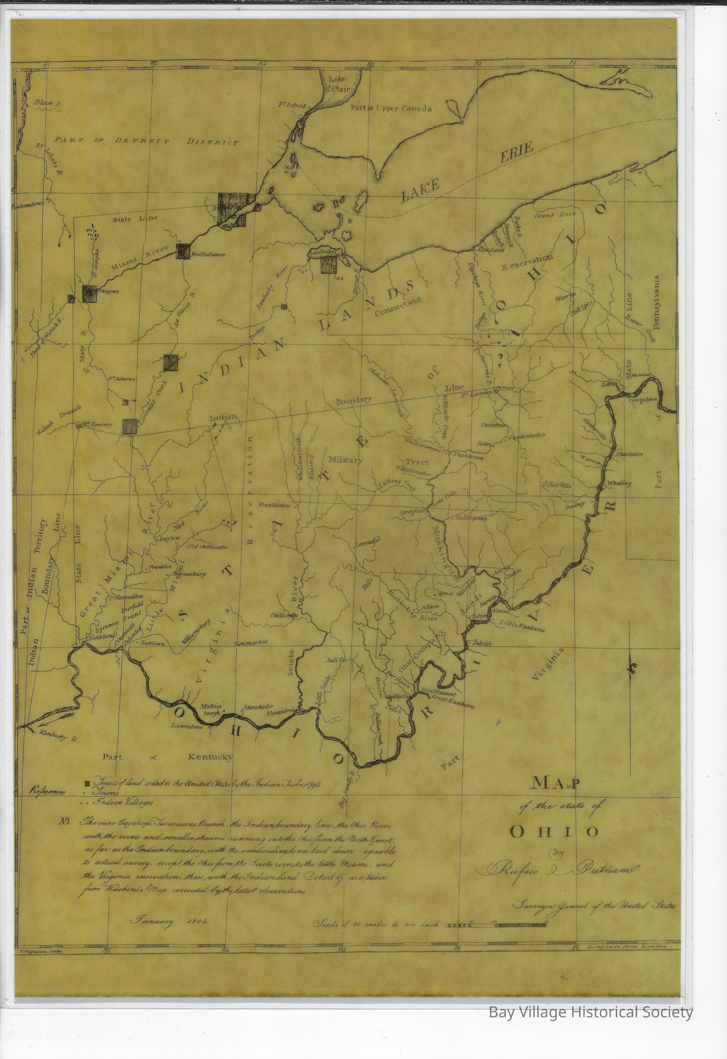
1804 Map of Ohio by Rufus PutnamEntry/Object ID
E.2023.009Description
Map of the State of Ohio by Rufus Putnam (1738-1824), Surveyor General of the United States; engraved by Thomas Wightman and adapted from a book by Thaddeus Mason Harris. Brownish color with black print. Shows longitude.
Map shows rivers and Lake Erie. Northern area says INDIAN LANDS Connecticut and below that STATE OF OHIO.
Assistance from the book: The journal is a of a tour into the territory northwest of the Alleghany Mountains : made in the spring of the year 1803 ... illustrated with original maps and views / by Thaddeus Mason Harris, A.M. https://www.loc.gov/item/90682167/
Sites and Townships Specific To This Map Are: Part of Detroit District, Lake Erie, Miami River, Sandusky Lake, Kentucky River, Grand River, Moskingum River, Fort Adams, Ohio River, White Woman's Creek.
Rufus Putnam was likely the first person to extensively map Ohio and its surrounding territories. 1 year after Ohio entered the union, this map was published by the surveyor general of these United States. His survey illustrated the states of Pennsylvania, Kentucky, Virginia, Lower Canada, Indian Territory and Illinois Territory.
The following towns are featured: Fort Defience, Fort Wayne, IN, Cleveland, Fort Recovery, Williamsburg, Hamilton, Dayton, Salem, Fort Lawrence, Charleston, Manchester, Fair Haven, Alexandria, Belville, Limestone.
https://www.geographicus.com/P/AntiqueMap/ohio-putnam-1804Dimensions
Height
16 inWidth
11-1/4 inDimension Notes
20 miles = inch.