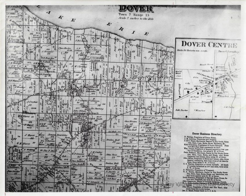
Dover Map

Dover Map: Copyright: C:\Users\BayHistoricalSociety\Desktop\P\Photo\RP.02; Origsize: 8" x 10"; Origformat: Print-Photographic; Resolution: 600 DPI
Dover Map

Copyright: C:\Users\BayHistoricalSociety\Desktop\P\Photo\RP.02; Origsize: 8" x 10"; Origformat: Print-Photographic; Resolution: 600 DPI

Name/Title

Dover Map

Entry/Object ID

RP.02.038

Description

Reference Photographs RP.02: Houses and Places Reference Photos Photocopy of a Plat map of Dover. Scale is 2": 1 mile. Shows the complete boundary of Dover and also offers a close-up of Dover Centre. The scale for Dover Center is 30 rods to an inch. Also includes a business directory to highlight businesses within the town limits.

Dimensions

Height

8 in

Width

10 in