Name/Title
Dover map 1874Entry/Object ID
D.2025.059Description
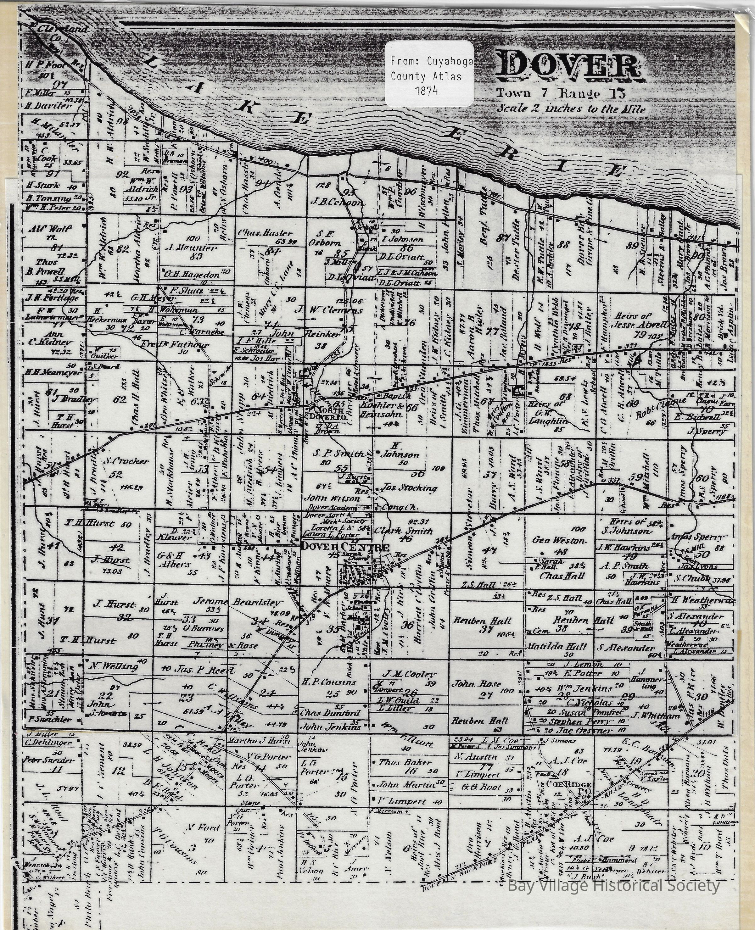
Laminated copy of Dover map, Town[ship] 7, Range 15 from the Cuyahoga County Atlas, 1874. Reduced in size and laminated.
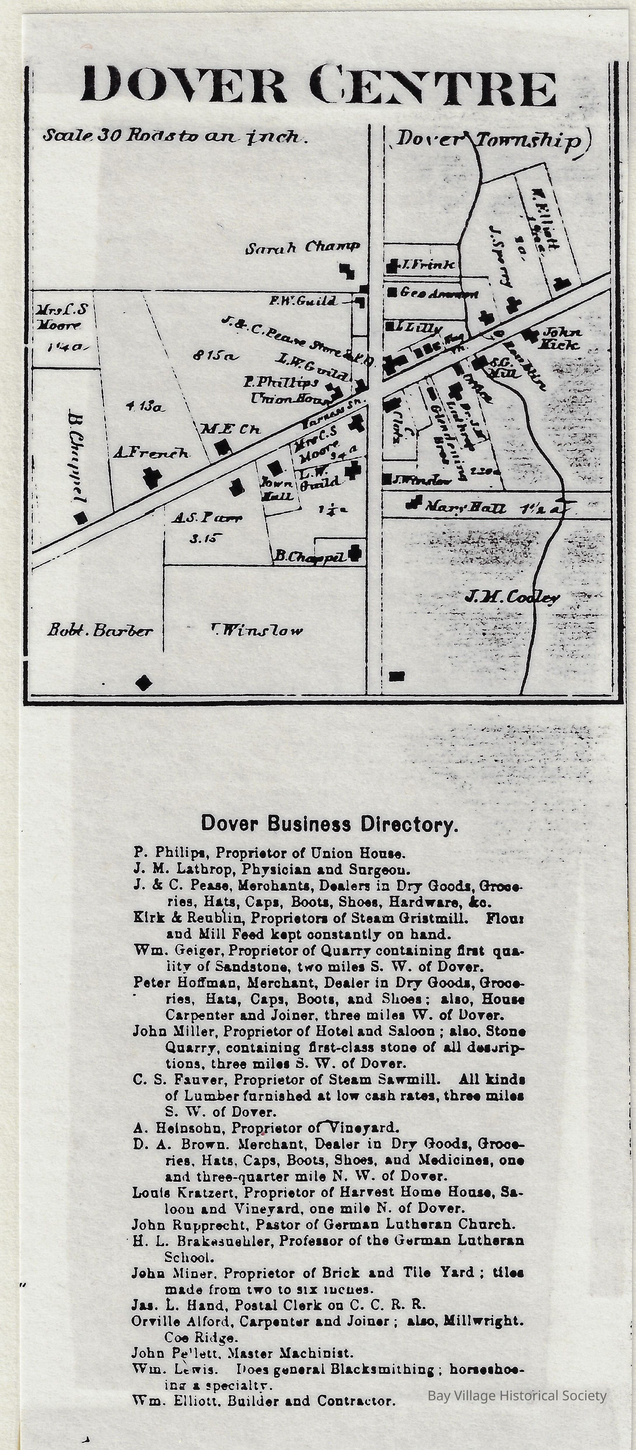
Back: Sketch showing the center of town and a Dover Business DirectoryDimensions
Height
10-1/2 inWidth
8-1/2 in