Name/Title
Dover TownshipEntry/Object ID
2018.M.FIC.004Description
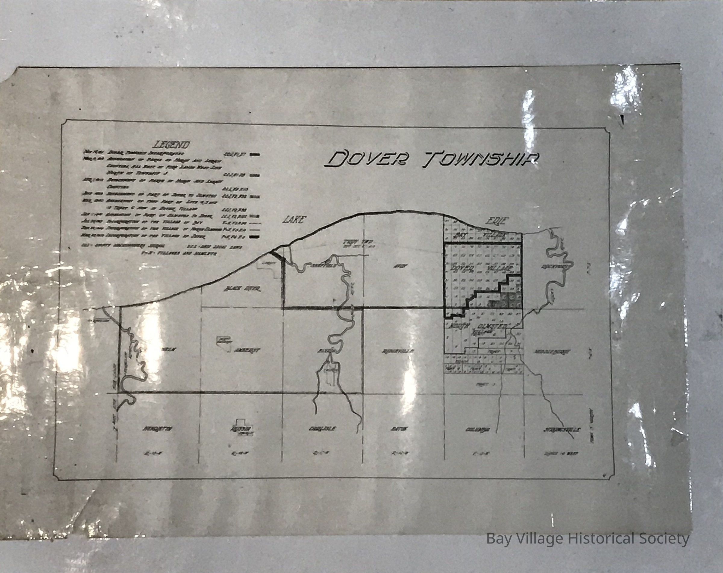
This is a copy of a map of Cuyahoga and Lorain Counties including the original Dover Township showing Bay Village, Dover Village and North Olmsted Village with lots drawn.
The overall map includes Ranges 19 (Brownhelm with the Black River and Henrietta Townships) to Range 14 (Rockport, Middleburgh and Strongsville Townships).
A legend is located on the top left side of the map listing the exact dates of incorporation and annexation of townships and counties. The dates range from November 14, 1811 to March 23, 1909. References of the County Commissioners Journal, Ohio Local Laws and Villages and Hamlets are identified with each date and borders for each change drawn.
Original map 18" x 26.4"
Additional Copy: Cream paper with brown printing. Some small tears and folds in the bottom corners. #6 and 9 written on the bottom right corner. Stored: 2nd Floor, East Room, Tube Shelving, Tube 1.Collection
Dover Township Maps