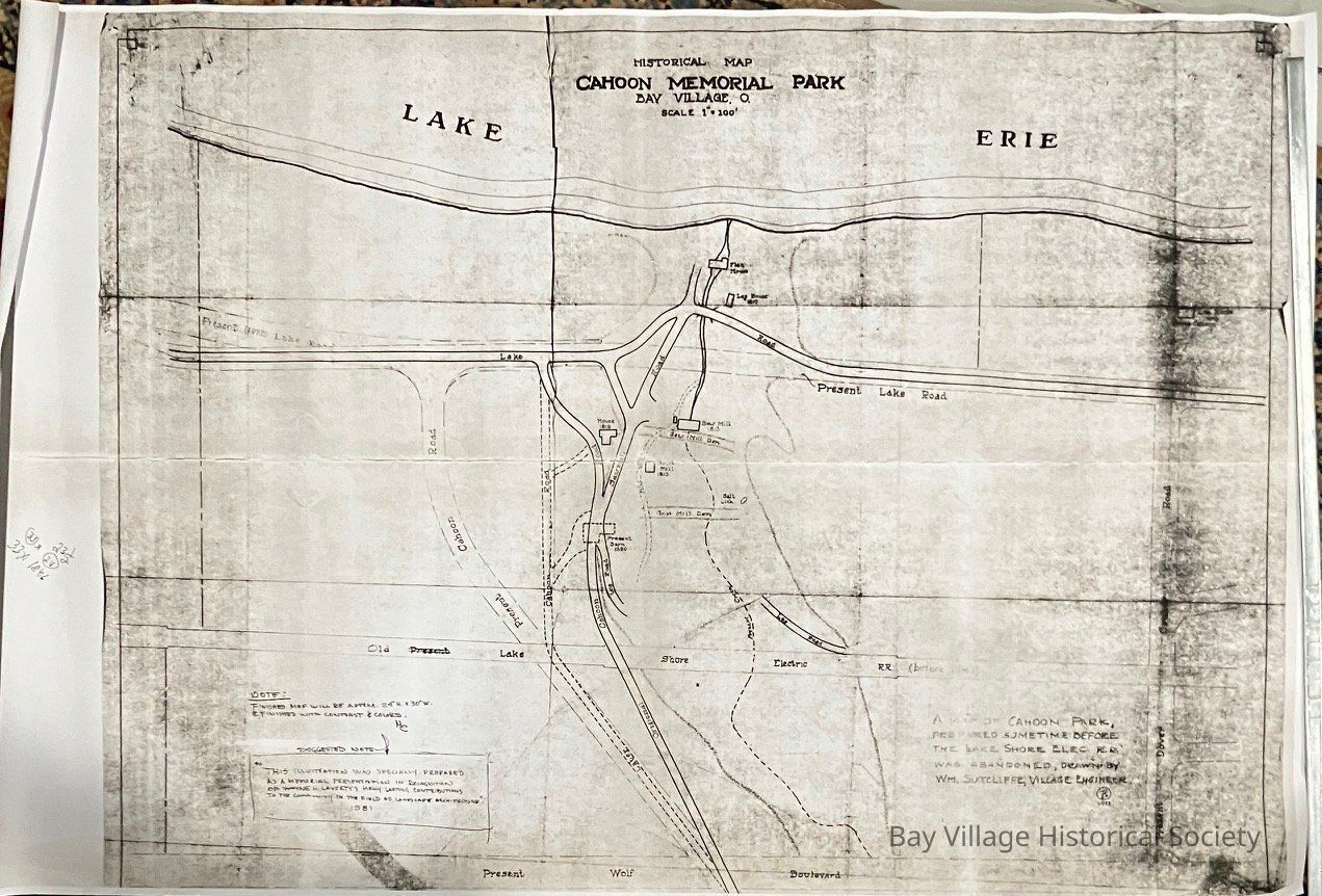
Historical Map Cahoon Memorial Park, Bay Village, O
Origsize: W 36" x H 24"; Origformat: Artifact; Resolution: 600 DPI
Name/Title
Historical Map Cahoon Memorial Park, Bay Village, O
Entry/Object ID
2020.09.01
Scope and Content
A map of Cahoon Park prepared sometime before the Lake Shore Elec. R.R. was abandoned. Drawn by Wm. Sutcliffe, Village Engineer. 1972.
Copy
Note: Finished map will be approx 24"H x30"W & finished with contrast and colors. MC
Suggested note: "This illustration was specially prepared as a memorial presentation in recognition of Wayne Laverty's many lasting contributions to the community in the field of landscape architecture". 1981
The map of Cahoon Park shows where the original structures and roads were and the buildings and roads before 1939. Prepared by Wm. Sutcliffe, C.E. in the 1930's. Prepared by Eng. Dept., City of Bay Village. Illegible seal in the bottom right corner.
Places that are identified on the map include:
Cahoon House 1818
Fish House
Grist Mill 1813
Grist Mill Damn
Lake Erie
Later Cahoon Road
Log House 1810
Log House of Amos Cahoon 1813
Log Road
Lake Shore Electric Railway
Mill Race
Original Cahoon Road
Original Lake Road
Present Barn 1880
Present Cahoon Road
Present Creek
Present Dover Center Road
Present Lake Road
Present Wolf Boulevard
Salt Lick
Saw Mill 1813
Saw Mill Dam
Saw Mill Road
Shore line of Lake Erie
Three similar copies:
2018.FIC.0051 A
2018.FIC.0051 B
2018.FIC.0082020.FIC.010
Duplicated at Office Max: 2020.FIC.010B