Name/Title
Map of Rocky River, Bay Village & Westlake, OhioEntry/Object ID
2018.FIC.0070Scope and Content
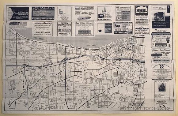
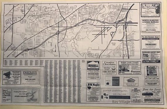
Map of Rocky River, Bay Village & Westlake, Ohio
Side 1 includes Bay Village, Fairview, Rocky River and Westlake. Street names are identified along with major routes (Rt. 6: Lake Rd., Rt. 254: Detroit Rd., Rt. 20/113: Center Ridge Rd. and Wooster Rd., Rt. 10: Lorain Rd., Rt. 252: Columbia Rd., Rt. 237: Riverside Dr.) Rocky River Reservation and Lake Erie are evident. Legend across the bottom includes 2-8 and the side is from A-F.
Side 2 includes North Olmsted and part of Brook Park. Rocky River Reservation, Cleveland Hopkins Airport and Ford Motor Company comprise sizable portions of the map. Legend across the top includes 2-8 and the side is from F-J.
Multiple ads surround the maps on both sides. The Street Index is located on side 2.Relationships
Related Places
Place
Location
Rocky River, Bay Village & Westlake, Ohio