Notes
BERKELEY HISTORICAL SOCIETY
2018.055 Berkeley, Calif. Superintendent of Streets
Records of commissioners appointed to study the opening of certain Berkeley
streets, 1906.
All sets contain a map and a list of the property to be taken and the owners of the affected
property; some sets also contain a written report of the commissioners for this project, and a clipping of
the legal public notice.
These records were found rolled up, but were originally in some kind of post binder; the
collection does not represent the entire original collection, many sheets are missing. The sheets
measure 19 x 23 inches.
A related collection is Berkeley, Calif. Street Department files, 1892-1912; 1978.055. Additional
records of street improvements can be found in the Guide to the City of Berkeley Records, 1878-1954,
BANC MSS C-A 200, The Bancroft Library
The collection has been arranged alphabetically by name of street.
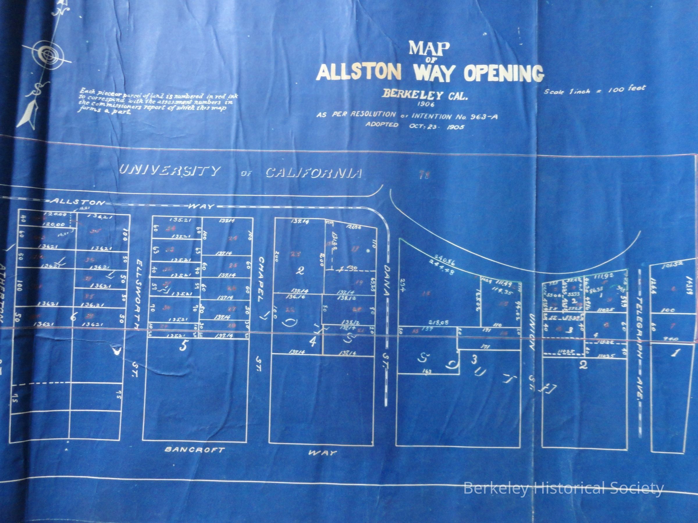
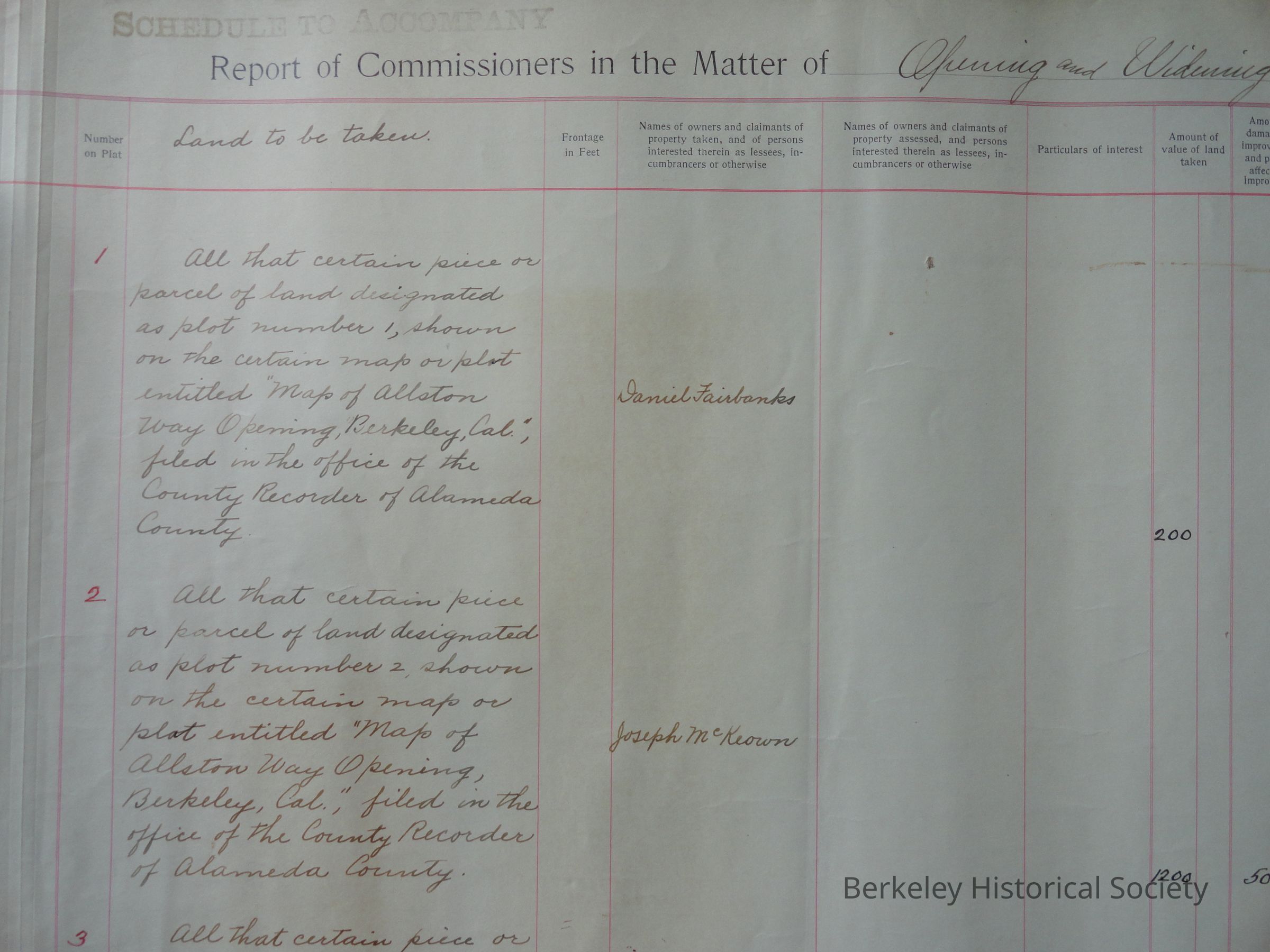
1 Allston Way from Shattuck Avenue to Telegraph Avenue. Contains pasted on report of
Commissioners, including justification and cost, legal notice (newspaper clipping), map showing streets
and lots, with lots numbered in red, 1906 (blueprint); handwritten list of lands to be taken, lists of
owners and value of land, in order by lot number. Original sheet number 224-227.
2 Benvenue Avenue from Dwight Way to Woolsey Street. Contains map showing streets and lots,
with lots numbered within each named tract (Hillegas Tract, Berry Tract, Berry-Bangs Tract, Bateman
Tract), 1907, handwritten list of lands to be taken, lists of owners and value of land, with final total cost
at end. 5 unpaginated sheets.
3 Berkeley Way from West Street to Grove Street. Contains pasted on report of Commissioners,
including justification and cost, legal notice (newspaper clipping), map showing streets and lots, with
lots numbered in red, 1906 (blueprint); Typed list of lands to be taken, lists of owners and value of land,
in order by lot number. Original sheet number 217-222.
4 Bruce Street from University Avenue to Dwight Way (now Curtis Street). Contains pasted on
report of Commissioners, including justification and cost, legal notice (newspaper clipping), map
showing streets and lots, with lots numbered in red, 1906 (blueprint); handwritten list of lands to be
taken, lists of owners and value of land, in order by lot number. Original sheet number 209-216.
5 Chestnut Street from Cedar Street to University Avenue. Contains pasted on report of
Commissioners, including justification and cost, legal notice (newspaper clipping), map showing streets
and lots, with lots numbered in red, 1906; handwritten list of lands to be taken, lists of owners and value
of land, in order by lot number. Original sheet number 1, 1-2 + 3 unpaginated sheets.
6 Derby Street from San Pablo Avenue to Adeline Street. Contains map showing streets and lots,
with lots numbered in red, 1906 (blueprint); handwritten list of lands to be taken, lists of owners and
value of land, in order by lot number. Original sheet number 129-136.
7 Piedmont Avenue from Parker Street to Webster Street. Contains pasted on report of
Commissioners, including justification and cost, legal notice (newspaper clipping), map showing streets
and lots, with lots numbered in red, 1906 (blueprint); handwritten list of lands to be taken, lists of
owners and value of land, in order by lot number. Original sheet number 228-245.
8 Prince Street from Monroe Street (Benvenue Avenue) to Claremont Avenue. Contains map
showing streets and lots, with lots numbered in red, 1906 (blueprint); typed list of lands to be taken,
lists of owners and value of land, in order by lot number, with final total cost at end. Original sheet
number 185-208.
9 Russell Street from San Pablo Avenue to Grant Street. Contains map showing streets and lots,
with lots numbered in red, 1906 (brownline); handwritten list of lands to be taken, lists of owners and
value of land, in order by lot number. Original sheet number 90-97.