Name/Title
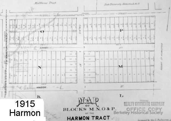
Map of blocks M, N, O & P of the Harmon Tract. 1889Entry/Object ID
1978.043.008Description
Lots bounded by Russell St, Regent Street Homestead, Ashby Ave (then called Mason St.), and Sacramento Street (Lowell Street on map).
Surveyed by Geo. L. Nusbaumer, Co. Surveyor
Filed March 4, 1889. Book 11, page 67.
Blueline. On verso: stamp of Oakland Blue Print Co., with date Aug 31, 1914.
Annotations in pencil.
Stamp of Realty Syndicate Company, 1915.Lexicon
Nomenclature 4.0
Nomenclature Secondary Object Term
MapNomenclature Primary Object Term
CartographNomenclature Sub-Class
Graphic DocumentsNomenclature Class
Documentary ObjectsNomenclature Category
Category 08: Communication ObjectsSearch Terms
Harmon Tract, Realty Syndicate Company, Real propertyMap Details
Maker or Creator
Nusbaumer, George LDate Published
1889Dimensions
Dimension Notes
12 1/2 x 17"Location
Other
Drawer FB-5a, Folder 5ag