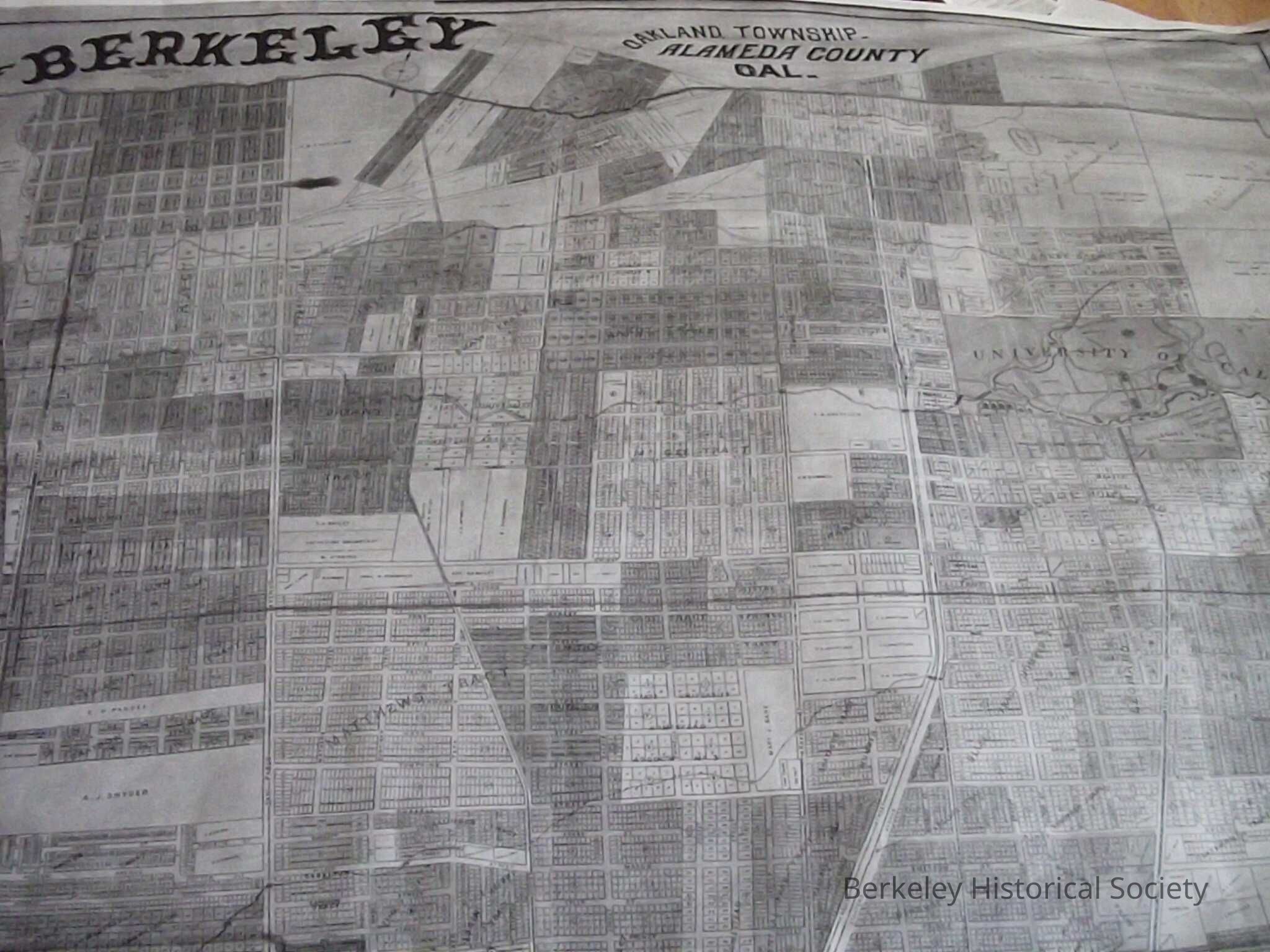
Map of Berkeley, Oakland Township, Alameda County, Cal., 1892

1892 William Raymond Map Rolled
Name/Title
Map of Berkeley, Oakland Township, Alameda County, Cal., 1892Entry/Object ID
1978.043.029Description
Rolled map. Smaller black & white reproduction in drawer Shows entire city, with ownership of some larger parcels. Compiled and published by William G. Raymond, town engineer, and James L. Bay. Photo lith. by Britton & Rey, SF. Smaller copy is in drawer, larger colored map is rolled. The Berkeley Central Library has a copy hung on the wall in the old entry hall. Extent: 1 map (rolled) ; 65 x 54 inchesLexicon
Nomenclature 4.0
Nomenclature Secondary Object Term
MapNomenclature Primary Object Term
CartographNomenclature Sub-Class
Graphic DocumentsNomenclature Class
Documentary ObjectsNomenclature Category
Category 08: Communication ObjectsSearch Terms
Oakland Township, Real PropertyMap Details
Maker or Creator
Raymond, William GPlace Published
* Untyped Place Published
BerkeleyDate Published
1892Dimensions
Height
65 inWidth
54 inLocation
Rolled Map Slot 5
Drawer FB-3, Folder 3d