Name/Title
Map of Berkeley, 1880, Carnall & EyreEntry/Object ID
1978.043.071Description
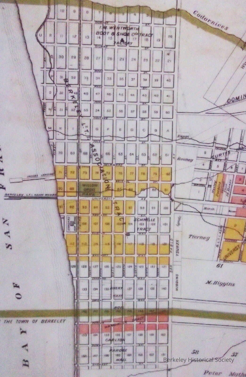
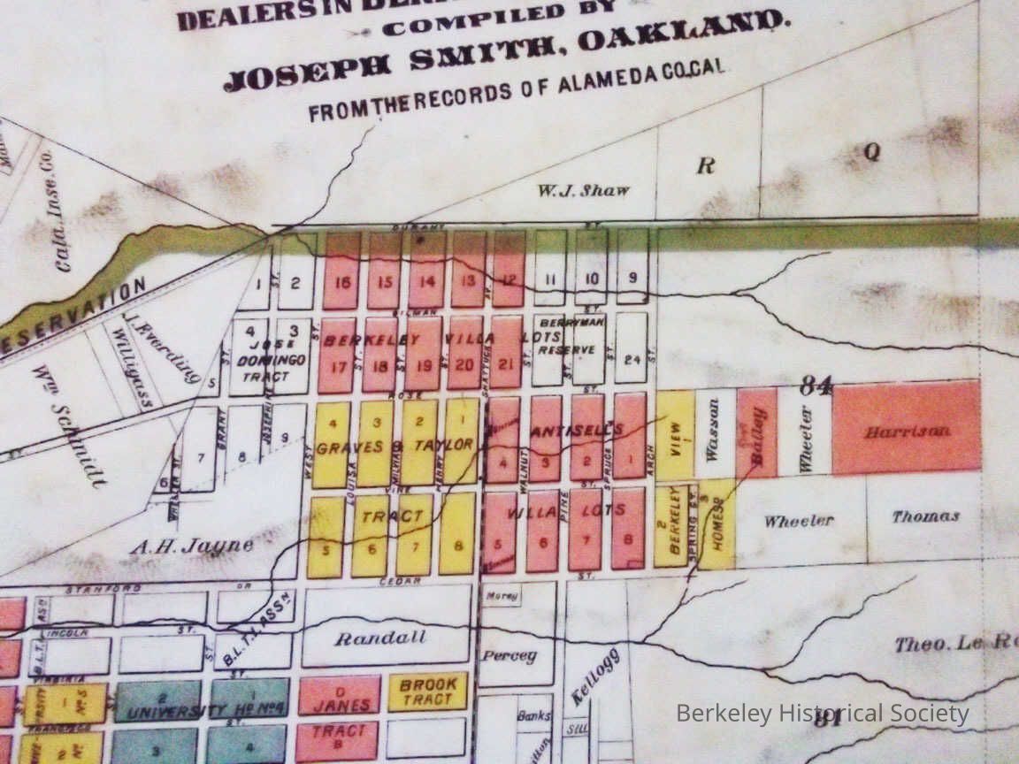
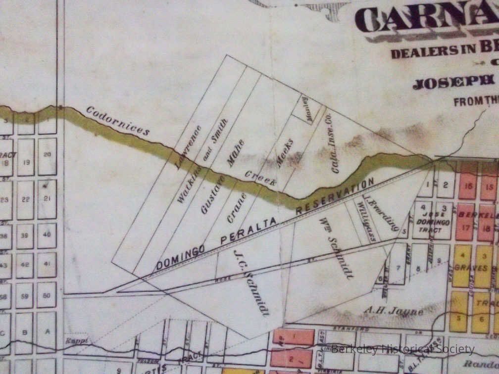
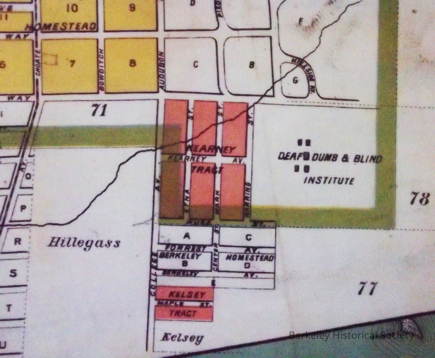
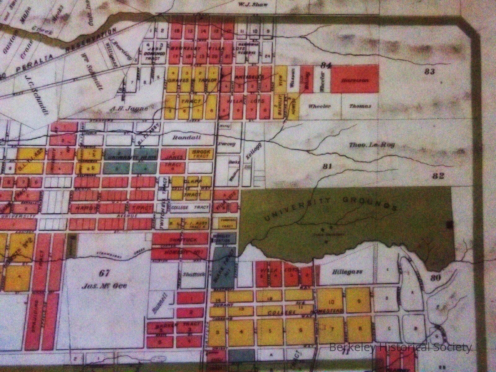
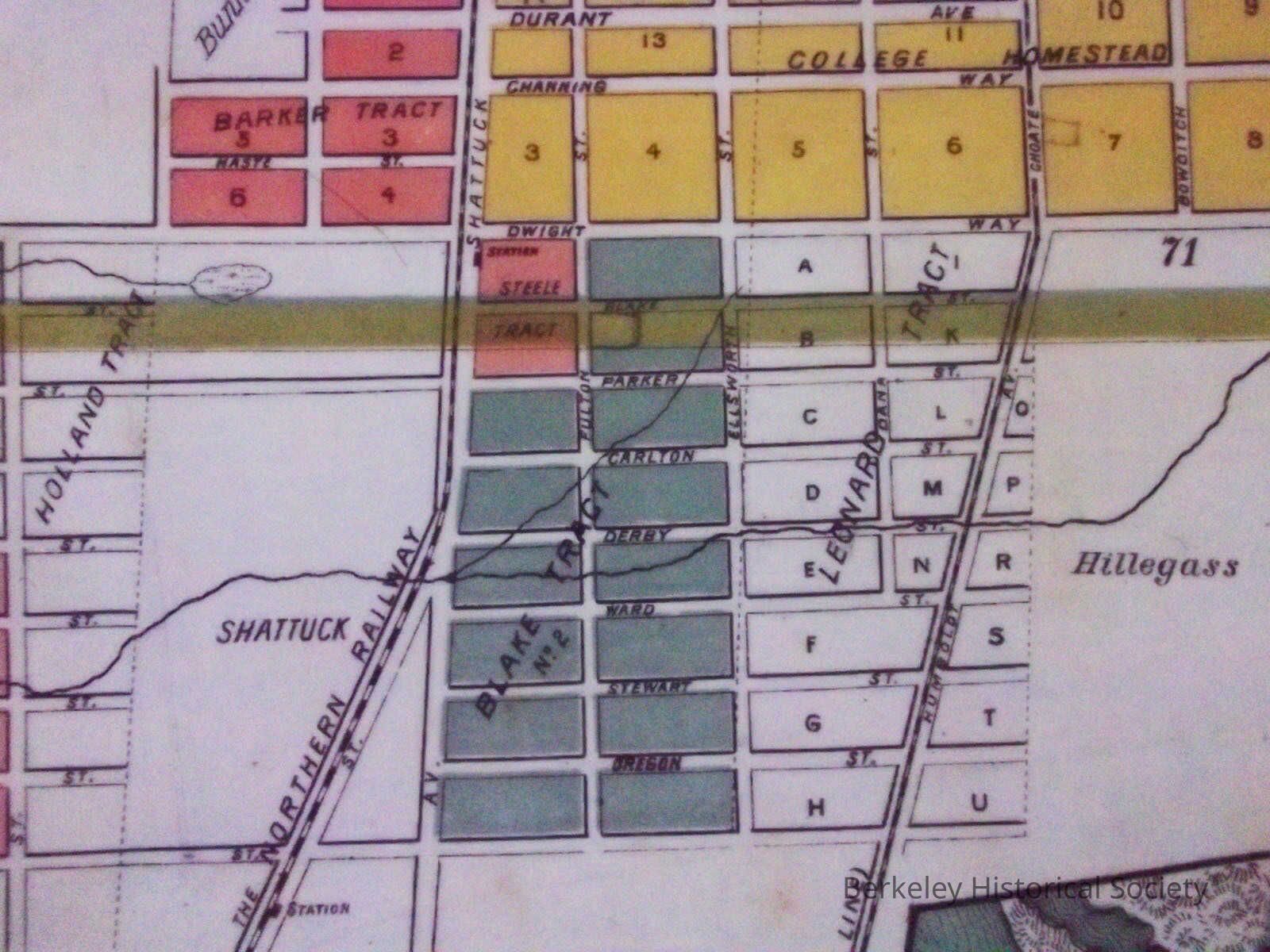
Large map of Berkeley, subdivision as of date of map 1880.
Map Berkeley , Carnall & Eyre Dealers in Berkeley Real Estate. Map displays in dark areas those lots for sale by Carnall & Eyre. Northern Railway, and Berkeley Branch of Northern Railway show, Oakland Railroad Telegraph Ave Dummy Line. Original map had a line which noted Berkeley Charter limits
There are several copies of various sizes. one in paper
BW, Mounted on cardboard, one large colorLexicon
Nomenclature 4.0
Nomenclature Secondary Object Term
MapNomenclature Primary Object Term
CartographNomenclature Sub-Class
Graphic DocumentsNomenclature Class
Documentary ObjectsNomenclature Category
Category 08: Communication ObjectsSearch Terms
University Grounds, Villa Lots, Domingo tract, Janes tract, Antisell tract, Brooks tract, Taylor tract, Real PropertyLocation
Other
Drawer FB-1, Folder 1b