Name/Title
Berkeley, Alameda County, California, 1972Entry/Object ID
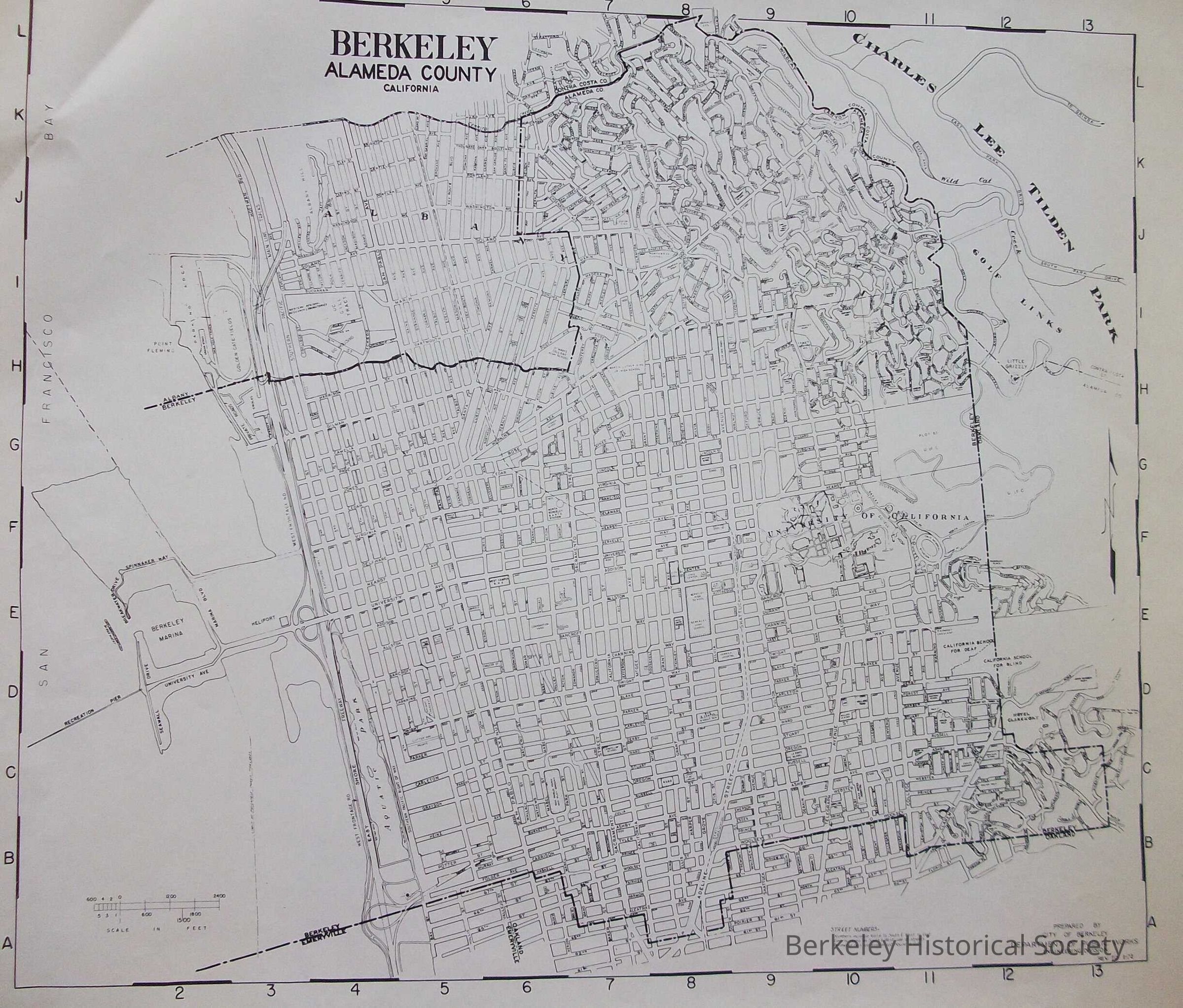
1978.043.082Description
Map of Berkeley essentially showing build out, East Shore Freeway, Southern Pacific Right of Way, BART.
Street map with streets shown as double lines.
Prepared by City of Berkeley, Department of Public Works Rev to 1-72.Lexicon
Nomenclature 4.0
Nomenclature Secondary Object Term
MapNomenclature Primary Object Term
CartographNomenclature Sub-Class
Graphic DocumentsNomenclature Class
Documentary ObjectsNomenclature Category
Category 08: Communication ObjectsSearch Terms
Berkeley, Street MapLocation
Other
Drawer FB-5a, Folder 5af