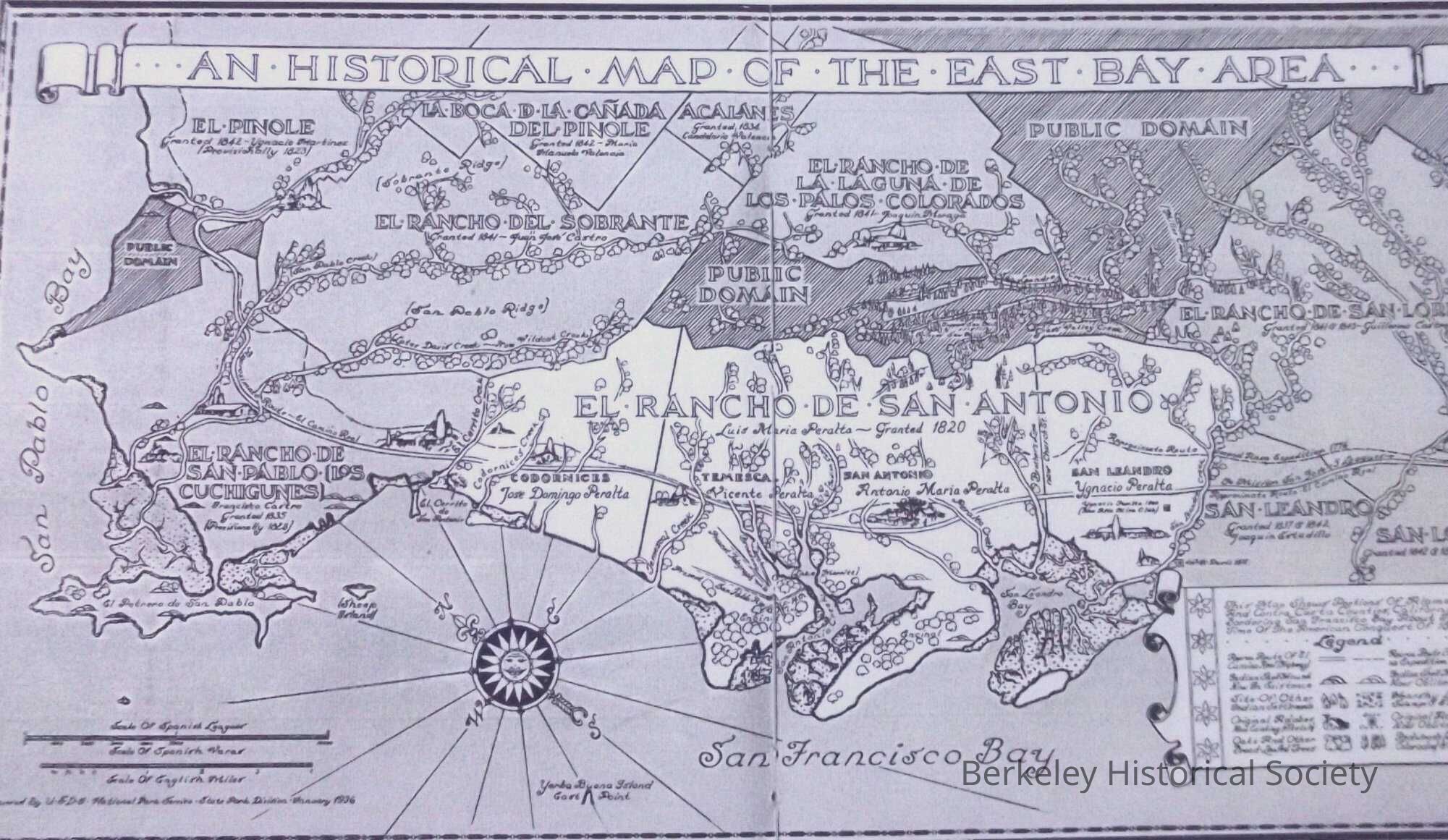
Name/Title
An historical map of the East Bay Area, 1936Entry/Object ID
1978.043.087Description
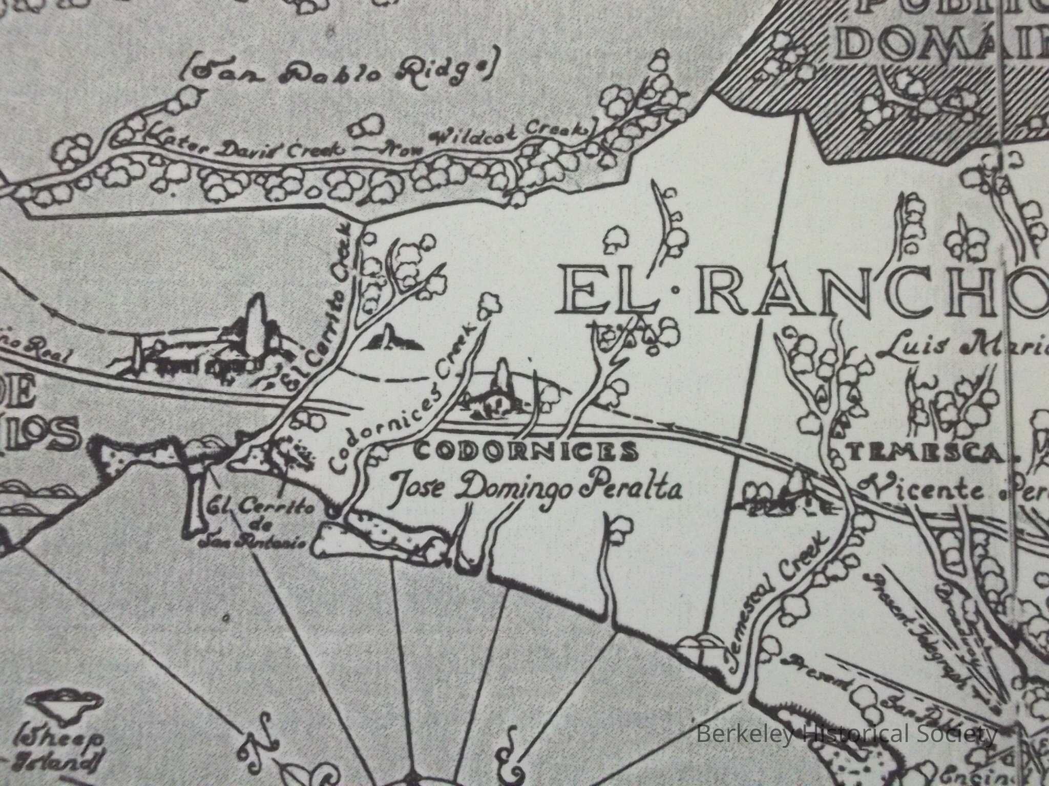
Map of land grant ranchos in Berkeley and Oakland, particularly Rancho San Antonio, granted to Luis Maria Peralta, 1820.
Reproduction of hand drawn map prepared by State Parks division of the National Park Service, 1936Lexicon
Nomenclature 4.0
Nomenclature Secondary Object Term
MapNomenclature Primary Object Term
CartographNomenclature Sub-Class
Graphic DocumentsNomenclature Class
Documentary ObjectsNomenclature Category
Category 08: Communication ObjectsSearch Terms
El Rancho de San Antonio, Codornices, RanchosLocation
Other
Drawer FB-5, Folder 5e