HUB
Collections
Classifications
About
App
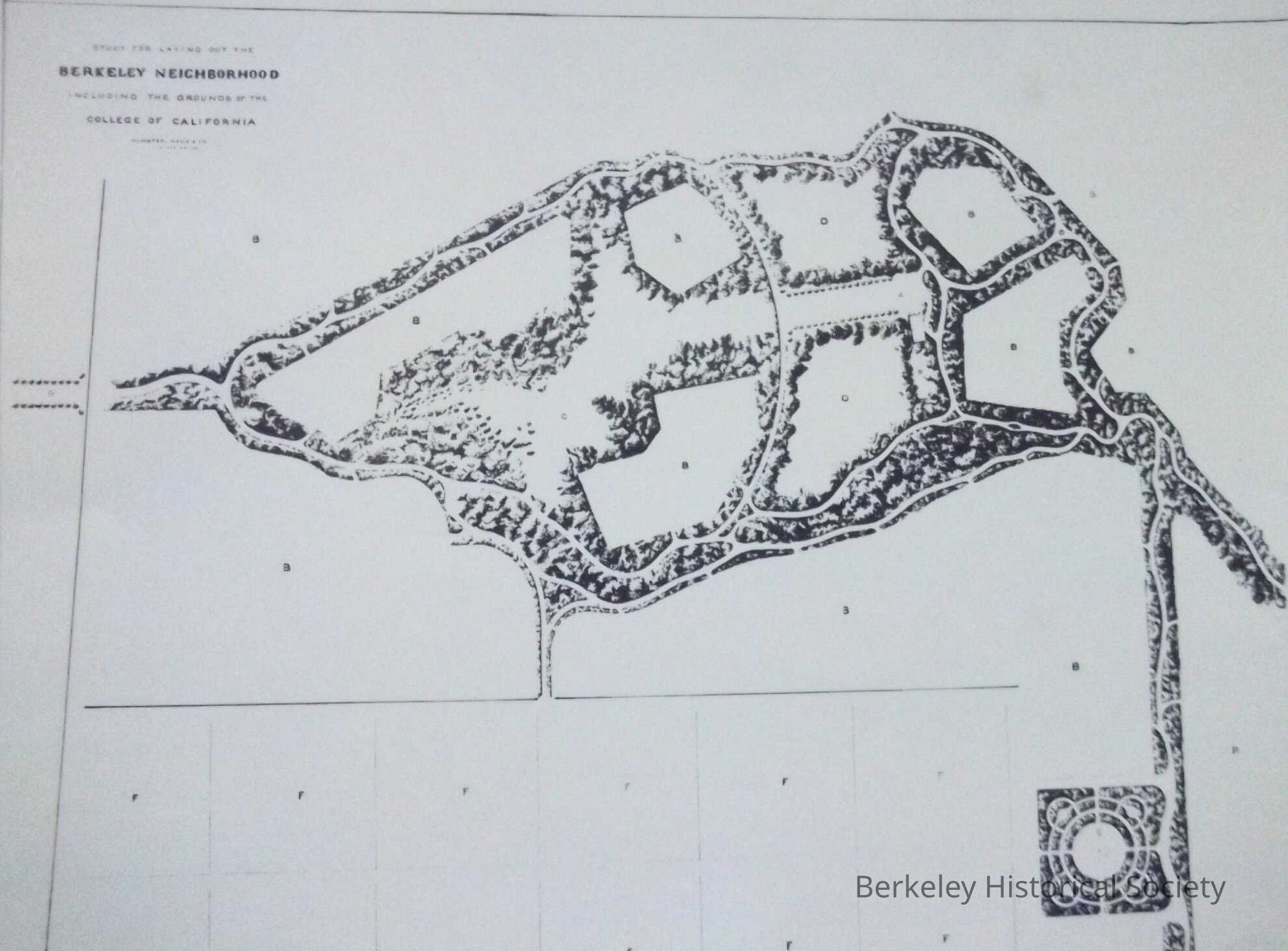
Study for laying out the College of California, 1866
Map
-
Berkeley Historical Society & Museum
1866 UC and neighborhood
Name/Title
Study for laying out the College of California, 1866
Entry/Object ID
1978.043.091
Description
Map of area around future University of California, by Olmsted, Vaux and Company. Reproduction
Lexicon
Nomenclature 4.0
Nomenclature Secondary Object Term
Map
Nomenclature Primary Object Term
Cartograph
Nomenclature Sub-Class
Graphic Documents
Nomenclature Class
Documentary Objects
Nomenclature Category
Category 08: Communication Objects
Search Terms
Berkeley Neighborhood,
College of California
Map Details
Date Published
1866
Dimensions
Height
12 in
Width
16 in
Location
Other
Drawer FB-5, Folder 5d