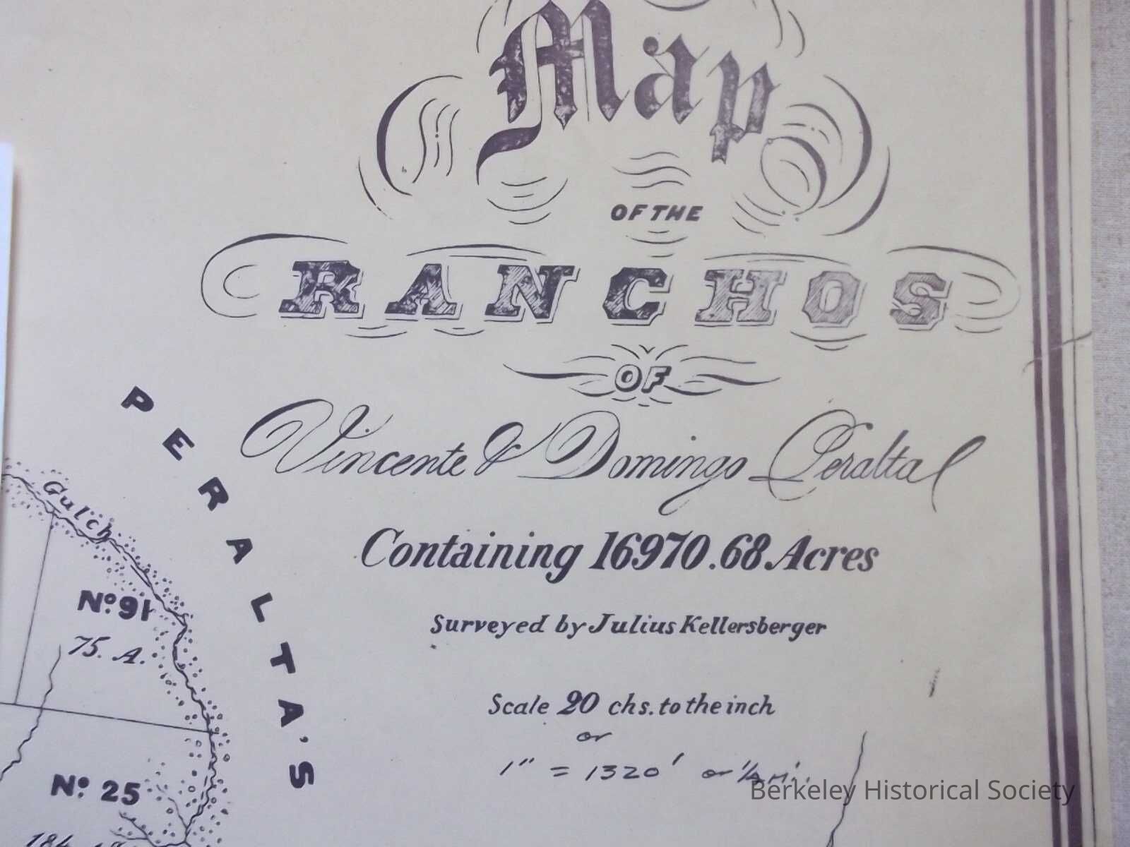
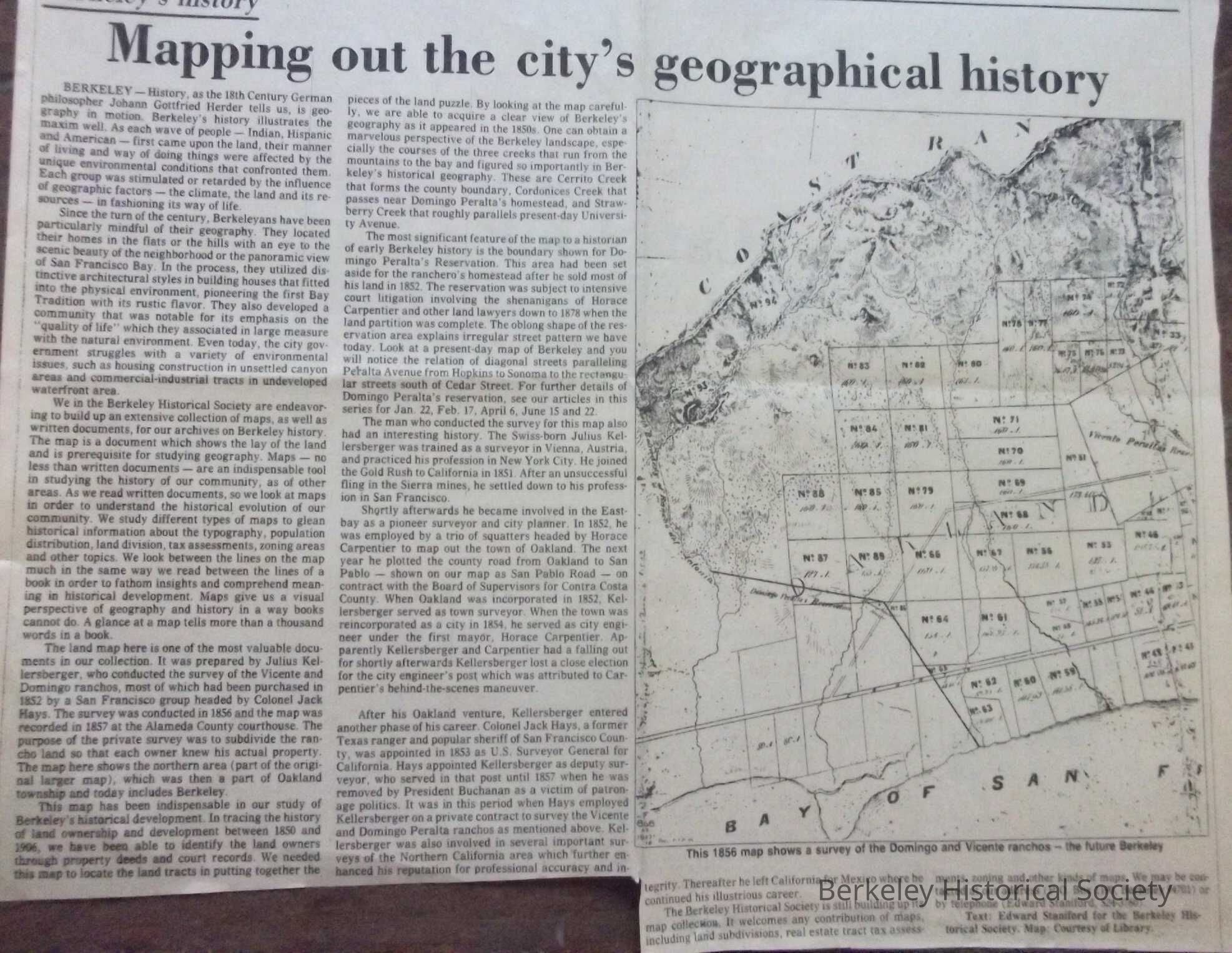
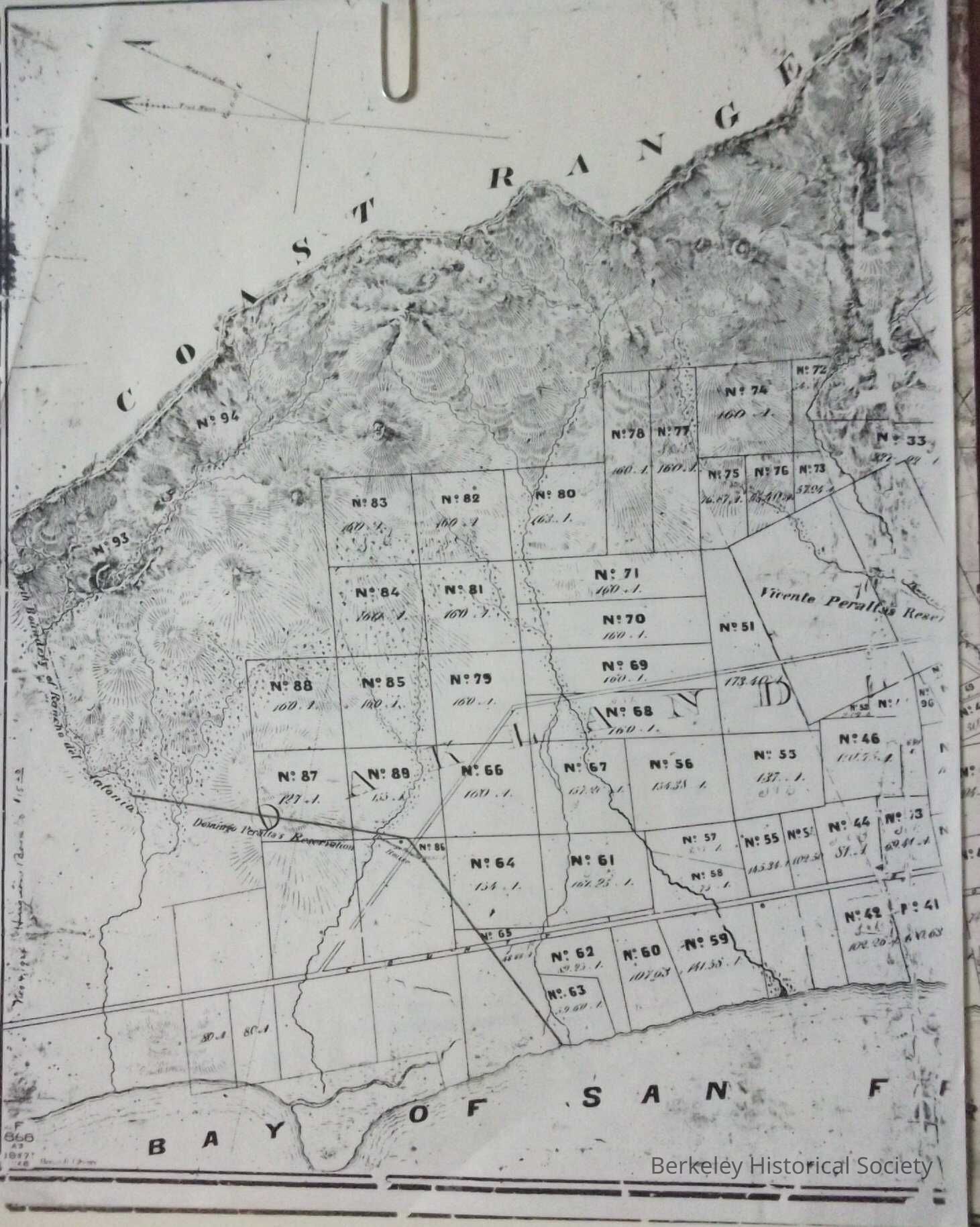
Name/Title
Kellersberger Plot Map, 1856Entry/Object ID
1978.043.092Description
Kellersberger plots maps of Oakland Berkeley
Full map showing Berkeley, Oakland,; several small sizes. Also a copy of map as printed in Berkeley Gazette July 4, 1980 which included narrative of mapping history by Edward Staniford. This document basis for all streets patterns in Berkeley, excepting the HillsLexicon
Nomenclature 4.0
Nomenclature Secondary Object Term
MapNomenclature Primary Object Term
CartographNomenclature Sub-Class
Graphic DocumentsNomenclature Class
Documentary ObjectsNomenclature Category
Category 08: Communication ObjectsSearch Terms
Kellersberger Plots, Real PropertyLocation
Other
Drawer FB-3, Folder 3b