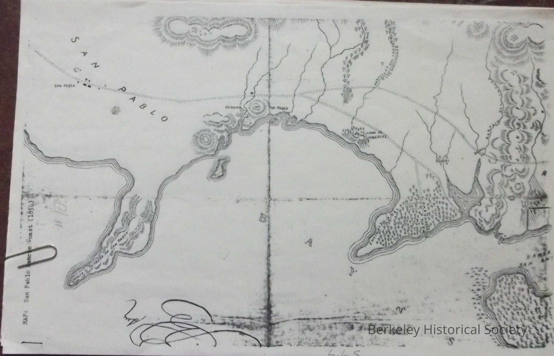
Name/Title
San Pablo Rancho Coast, 1854Entry/Object ID
1978.043.093Description
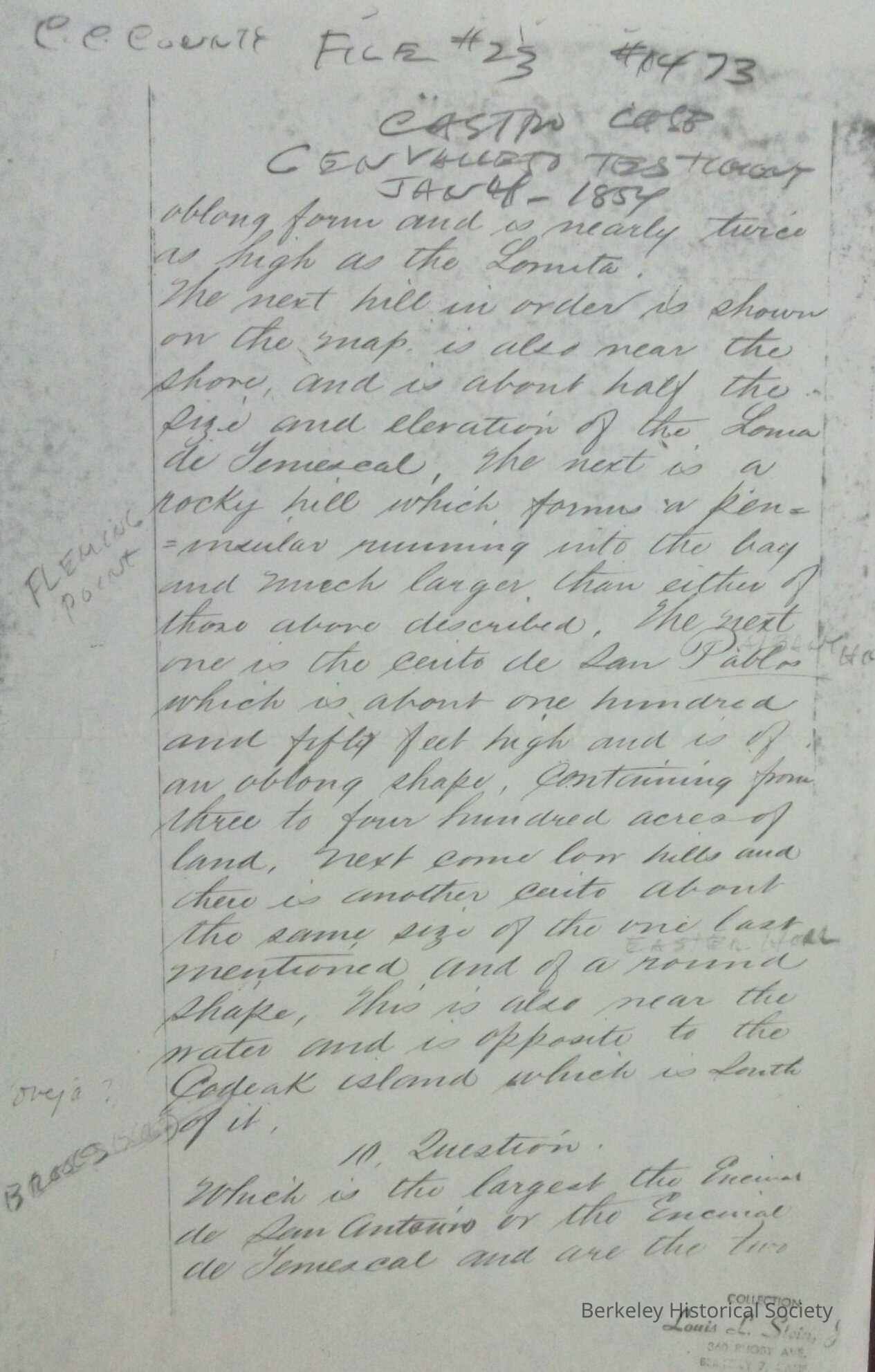
map of East Shore San Francisco Bay, north from Oakland to San Pablo. Reproduction of map used in Federal court cases (Castro dispute).
No 96, Juan Jose Castro & Victor Castro, Sobrante, Filed in the office June 11, 1854. Included is a written description of property.Lexicon
Nomenclature 4.0
Nomenclature Secondary Object Term
MapNomenclature Primary Object Term
CartographNomenclature Sub-Class
Graphic DocumentsNomenclature Class
Documentary ObjectsNomenclature Category
Category 08: Communication ObjectsLOC Thesaurus for Graphic Materials
"Maps"Search Terms
Peralta Road, San Pablo RoadLocation
Other
Drawer FB-1, Folder 1c