Name/Title
Most useful map of Berkeley, 1981Entry/Object ID
1978.043.097Description
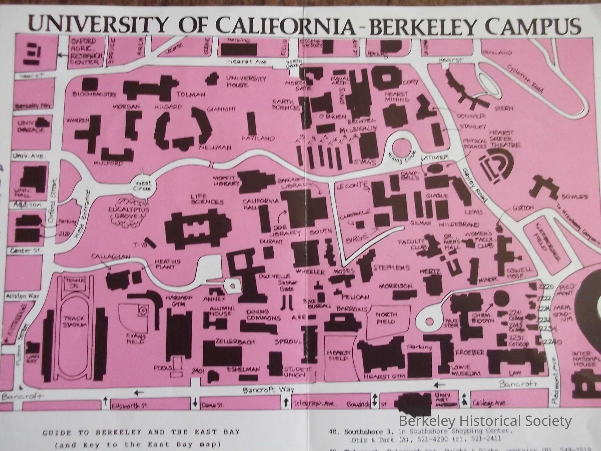
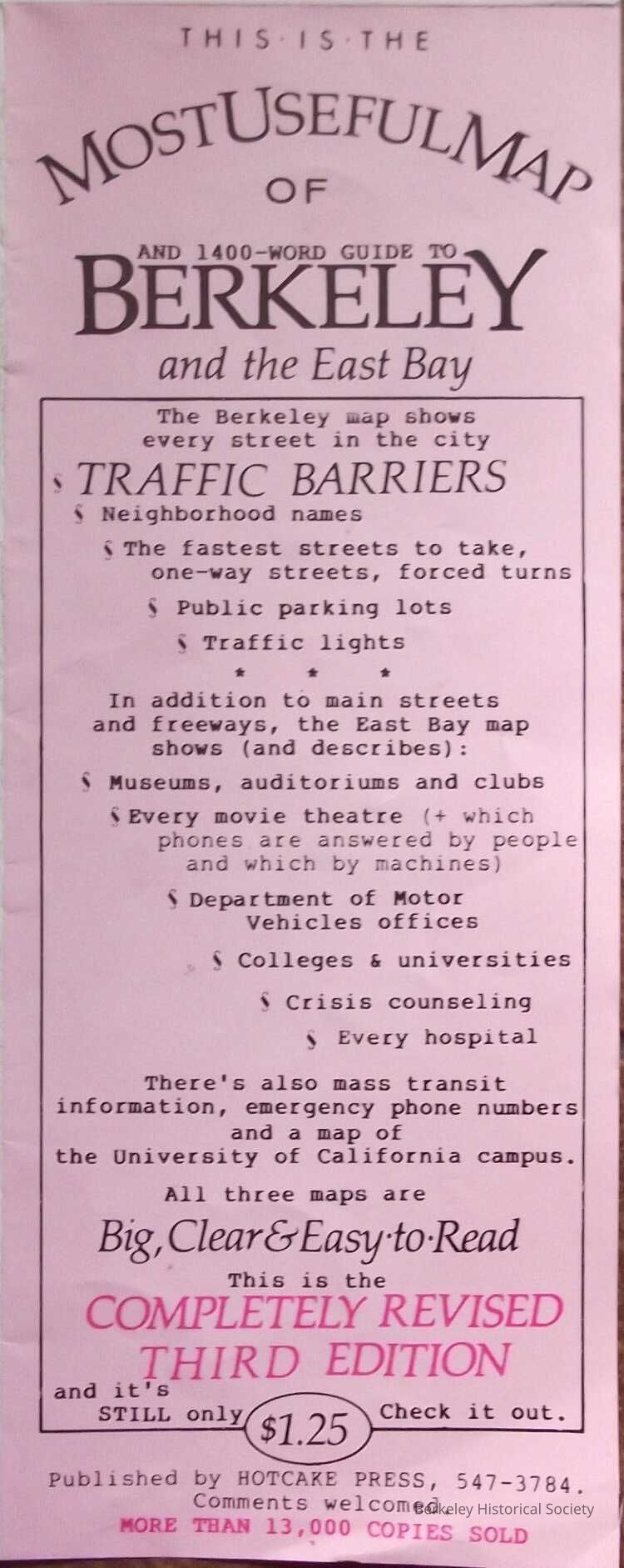
Map of Berkeley on one side with list of streets. On the reverse is text and images
This map shows in red the area of Berkeley: Oceanview, West Berkeley, Westbrae, North Berkeley, Thousand Oaks, North Berkeley Hills, Northside, Downtown, Southside, Elmwood, Claremont, Rockridge (Oakland), South BerkeleyLexicon
Nomenclature 4.0
Nomenclature Secondary Object Term
MapNomenclature Primary Object Term
CartographNomenclature Sub-Class
Graphic DocumentsNomenclature Class
Documentary ObjectsNomenclature Category
Category 08: Communication ObjectsSearch Terms
"Folded Street Map"Location
Other
Drawer FB-3, Folder 3h