HUB
Collections
Classifications
About
App
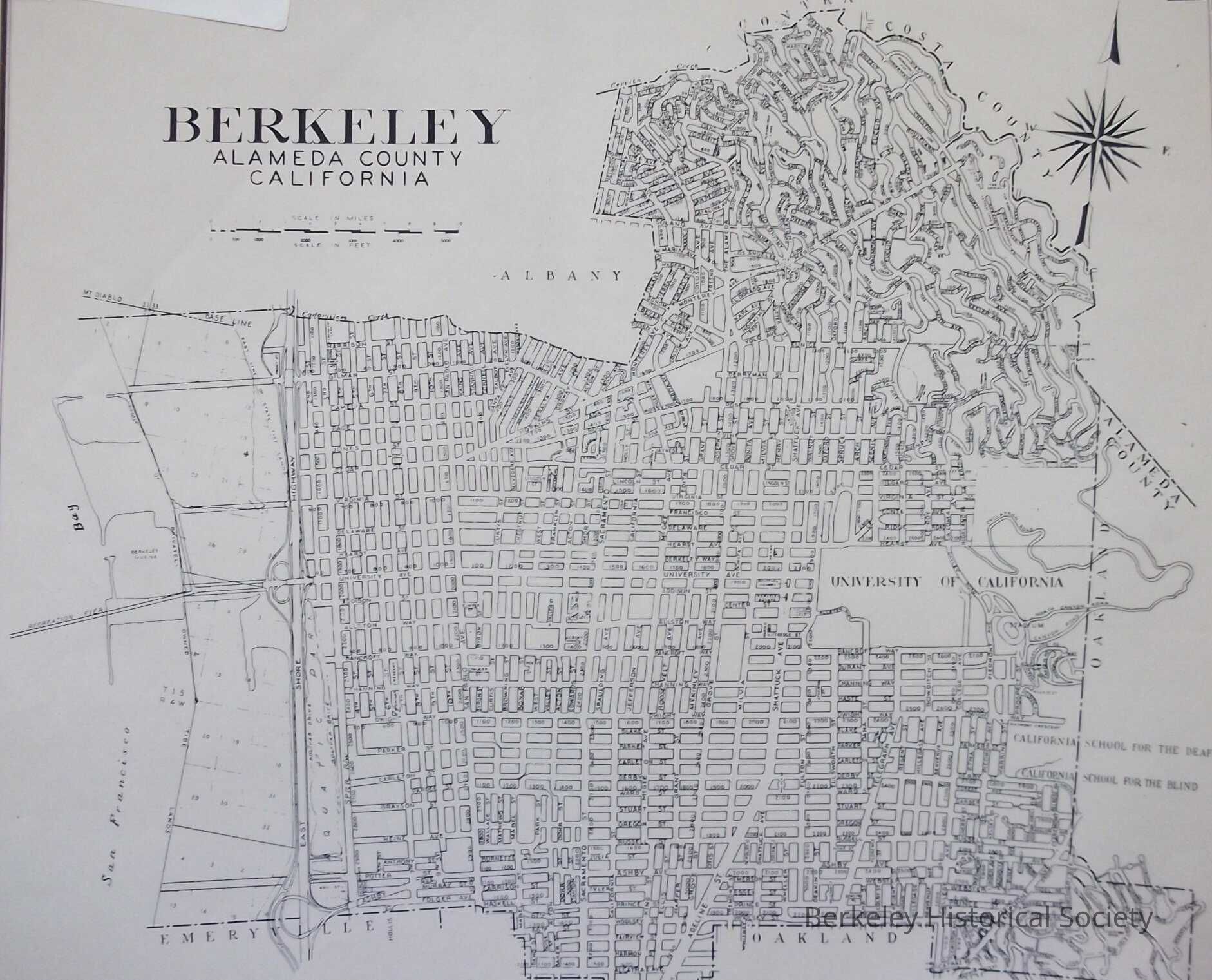
Berkeley Alameda County, California 1966
Map
-
Berkeley Historical Society & Museum
1958 Street Map
Name/Title
Berkeley Alameda County, California 1966
Entry/Object ID
1978.043.099
Description
Street Map, with address block numbers Original date 1958; revised Sept. 1963 and June 1966. At lower left: File no. 309-B-14
Lexicon
Nomenclature 4.0
Nomenclature Secondary Object Term
Map
Nomenclature Primary Object Term
Cartograph
Nomenclature Sub-Class
Graphic Documents
Nomenclature Class
Documentary Objects
Nomenclature Category
Category 08: Communication Objects
Search Terms
Berkeley,
Street Map
Map Details
Date Published
1966
Dimensions
Height
20 in
Width
18 in
Location
Other
Drawer FB-5a, Folder 5ac