Name/Title
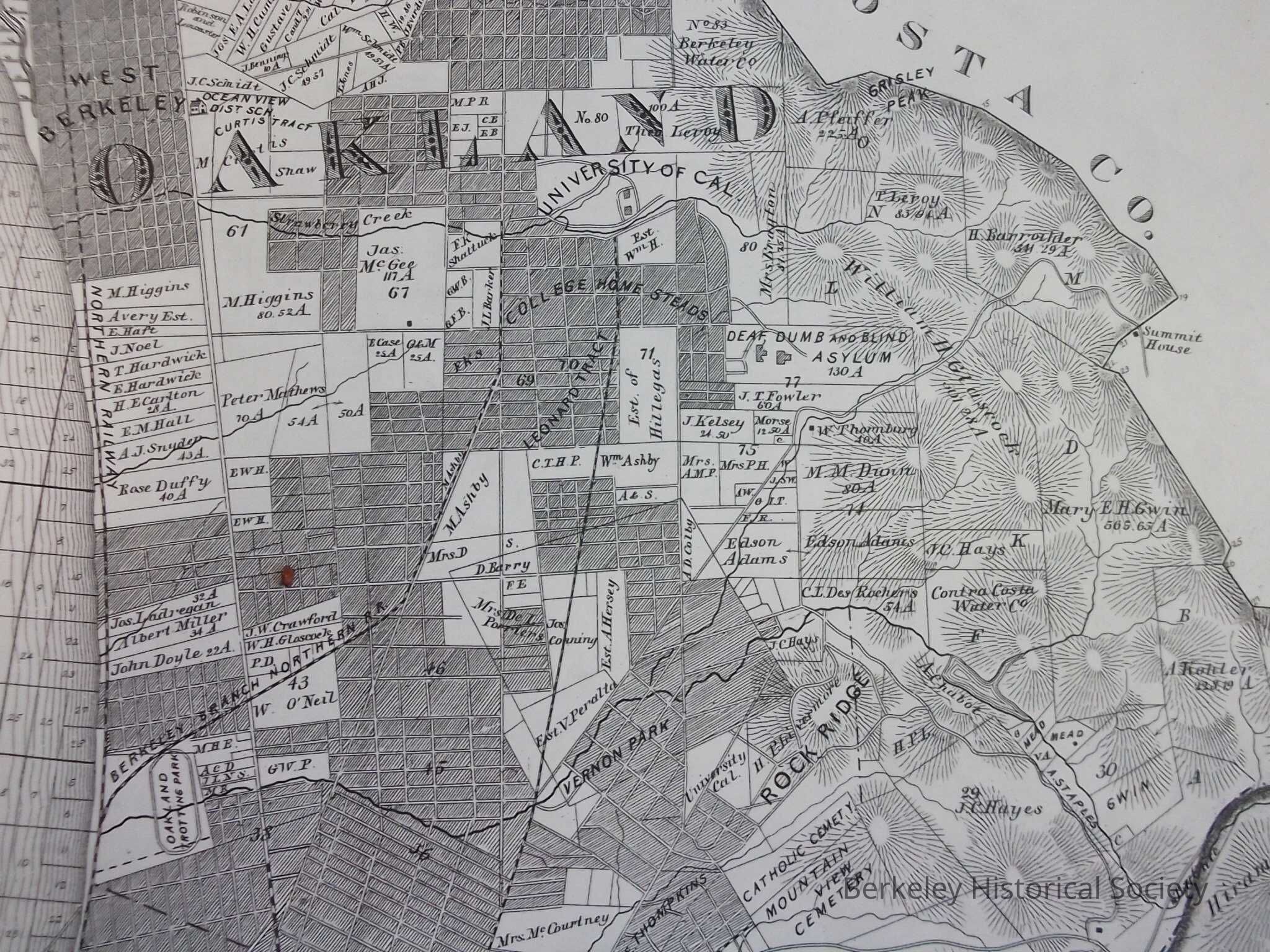
Map of Berkeley, 1878, copied from Map Number 1, Thompson & West, Historical Atlas of Alameda County, 1878.Entry/Object ID
1978.043.105Description
Title supplied
Shows north Oakland to Contra Costa County line.
Reproduction.Lexicon
Nomenclature 4.0
Nomenclature Secondary Object Term
MapNomenclature Primary Object Term
CartographNomenclature Sub-Class
Graphic DocumentsNomenclature Class
Documentary ObjectsNomenclature Category
Category 08: Communication ObjectsSearch Terms
University of California, Leonard Tract, College Homestead, West BerkeleyLocation
Other
Drawer FB-5, Folder 5f