HUB
Collections
Classifications
About
App
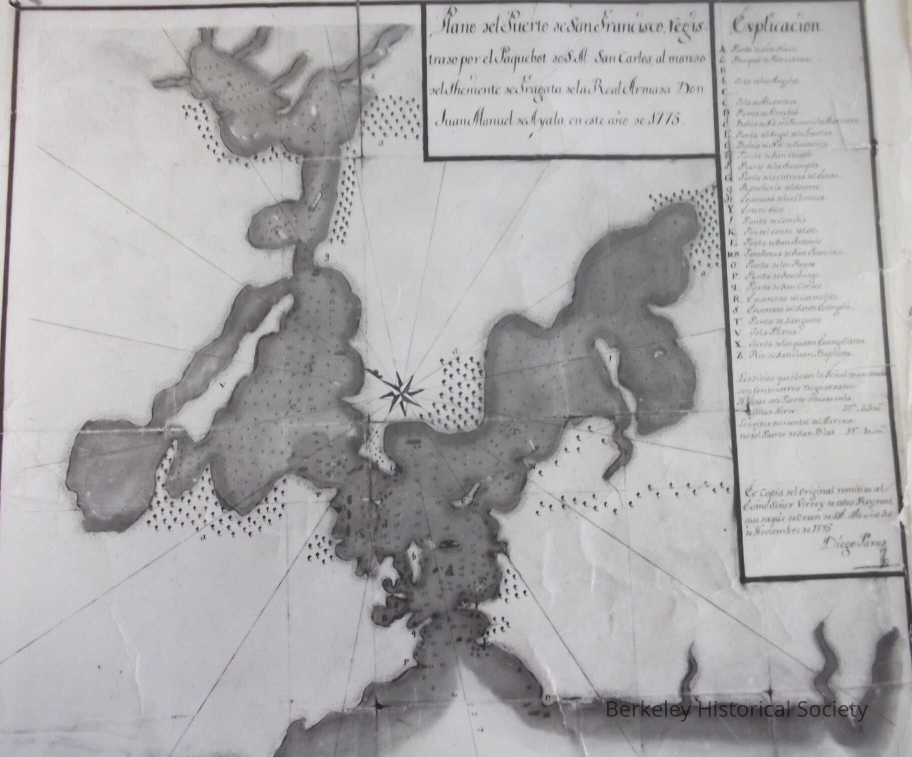
Plano del Puerto de San Francisco, 1775
Map
-
Berkeley Historical Society & Museum
1775 Puerto San Francisco Bay
Name/Title
Plano del Puerto de San Francisco, 1775
Entry/Object ID
1978.043.107
Description
Photographic copy of manuscript map. Original map in Archivo General de Indios.
Lexicon
Nomenclature 4.0
Nomenclature Secondary Object Term
Map
Nomenclature Primary Object Term
Cartograph
Nomenclature Sub-Class
Graphic Documents
Nomenclature Class
Documentary Objects
Nomenclature Category
Category 08: Communication Objects
LOC Thesaurus for Graphic Materials
"Maps"
Map Details
Date Published
1775
Dimensions
Height
9 in
Width
11 in
Location
Other
Drawer FB-5, Folder 5e