HUB
Collections
Classifications
About
App
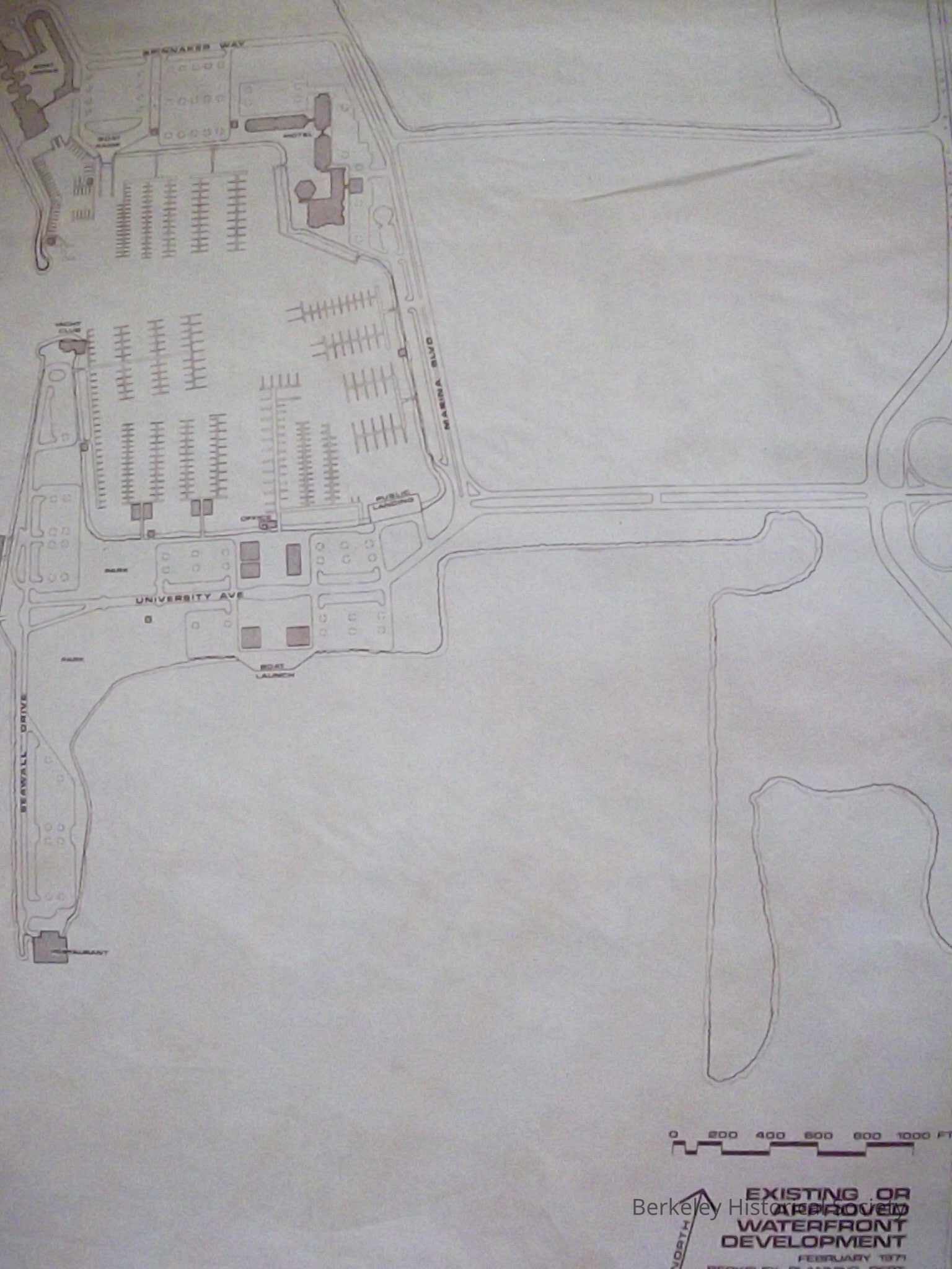
Waterfront Development, 1971
Map
-
Berkeley Historical Society & Museum
1971 Waterfront Development
Name/Title
Waterfront Development, 1971
Entry/Object ID
1978.043.127
Description
Copy of plans for waterfront. City of Berkeley Planning Department February 1971
Lexicon
Nomenclature 4.0
Nomenclature Secondary Object Term
Map
Nomenclature Primary Object Term
Cartograph
Nomenclature Sub-Class
Graphic Documents
Nomenclature Class
Documentary Objects
Nomenclature Category
Category 08: Communication Objects
Search Terms
Waterfront,
Development Map
Map Details
Date Published
1971
Dimensions
Height
24 in
Width
36 in
Location
Other
Drawer FB-2, Folder 2d