Name/Title
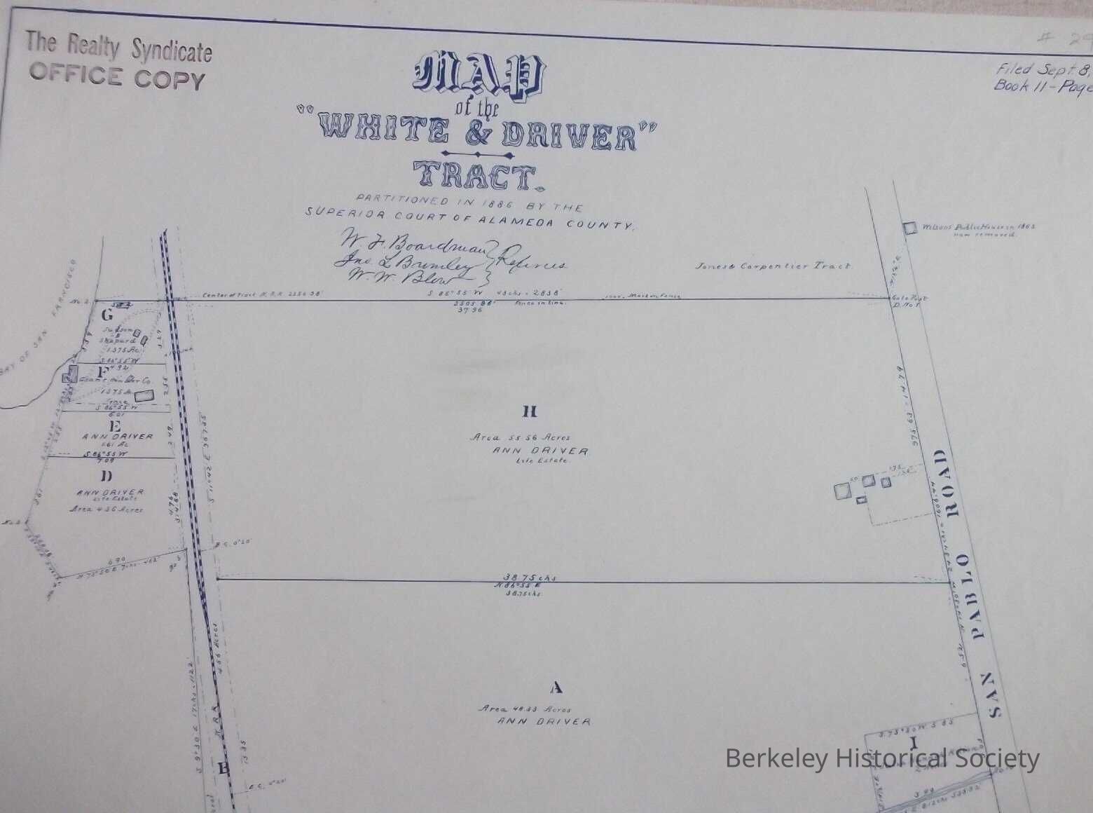
Map of the White & Driver Tract partitioned in 1886 by the Superior Court of CaliforniaEntry/Object ID
1978.043.150Description
Tract map of land just north of the Codornices River, west of San Pablo.
Filed Sept 8, 1886, Book 11, Page 30. Map partitioned By Superior Court of Alameda County.
Stamp of Realty Syndicate, Office Copy
Signatures off W. F. Boardman, Jno L. Brimley. W. W. Blew.
Most of land owned by Ann DriverLexicon
Nomenclature 4.0
Nomenclature Secondary Object Term
MapNomenclature Primary Object Term
CartographNomenclature Sub-Class
Graphic DocumentsNomenclature Class
Documentary ObjectsNomenclature Category
Category 08: Communication ObjectsSearch Terms
White & Driver, Real Property MapsLocation
Other
Drawer FB-5a, Folder 5ae