Name/Title
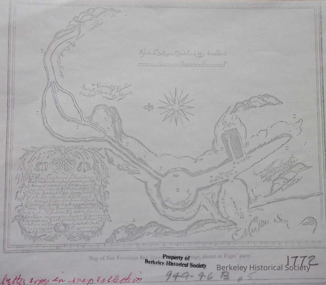
Mapa de lo substancial del famoso Puerto y Rio de San Francisco [Calif.] : explorado por tierra en el Mes y Marzo del presente año de 1772 / facado por el Diario, y observations del R.P. Fr. Juan CrespíEntry/Object ID
1978.043.152Description
map shows features of Bay Area in 1772. Very poor photocopy.
This map was probably drawn by Fages and Father Crespi in their entry into the Bay Area in 1772. The map has text in Spanish but a few words could be read: Farallones, Rio Grande de San Francisco (Carquinez Strait), There are numbers on the map that probably refer to an attached legend, that is not with the drawing. There is a note in red ink referring to a better copy in map collection; copy not found.. See 107 for a 1775 mapLexicon
Nomenclature 4.0
Nomenclature Secondary Object Term
MapNomenclature Primary Object Term
CartographNomenclature Sub-Class
Graphic DocumentsNomenclature Class
Documentary ObjectsNomenclature Category
Category 08: Communication ObjectsLOC Thesaurus for Graphic Materials
"Maps"Search Terms
"Bay Area"Location
Other
Drawer FB-5, Folder 5e