Name/Title
Map of the Jones Tract, Alameda County, CalEntry/Object ID
1978.043.154Description
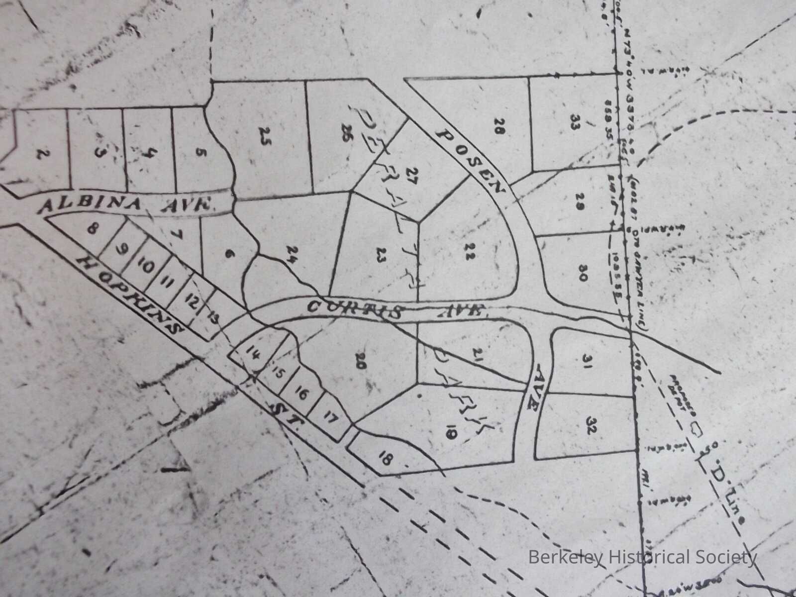
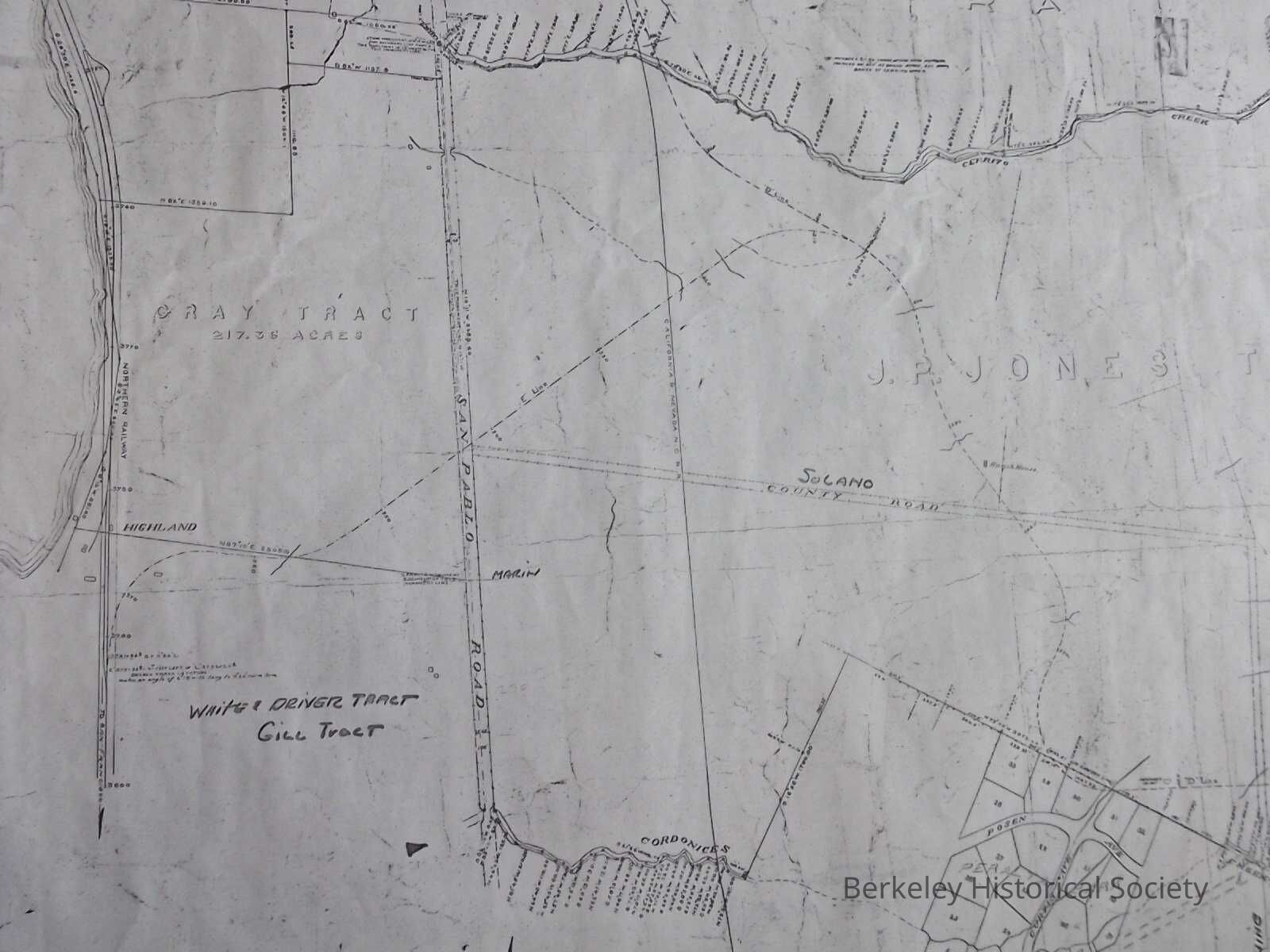
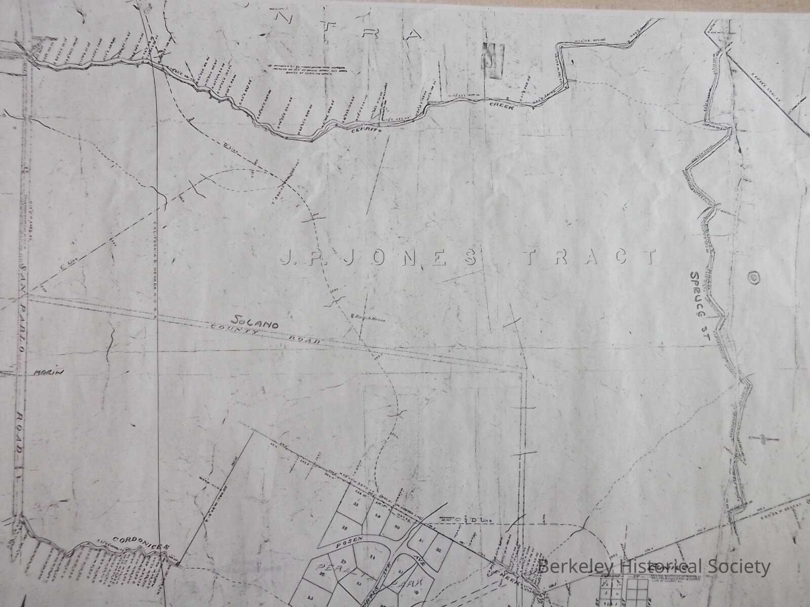
Map of Jones tract showing the proposed route of Central Pacific, now Southern Pacific to serve Peralta Park and beyond, labeled "D line."
Date in pencil, with 1907 crossed out; copy 2 has date 1895 added.
Surveyed by L. D. Norton. Some street names added by hand.
2 copies, reproductions
1887 M B Curtis buys Peralta Park in the Domingo Peralta reservation. He proposes a grand hotel with a railroad station nearby. Central Pacific surveyors laid the route which today would be in AlbanyLexicon
Nomenclature 4.0
Nomenclature Secondary Object Term
MapNomenclature Primary Object Term
CartographNomenclature Sub-Class
Graphic DocumentsNomenclature Class
Documentary ObjectsNomenclature Category
Category 08: Communication ObjectsSearch Terms
Jones Tract, Northern Railroad, Real PropertyLocation
Other
Drawer FB-2, Folder 2f