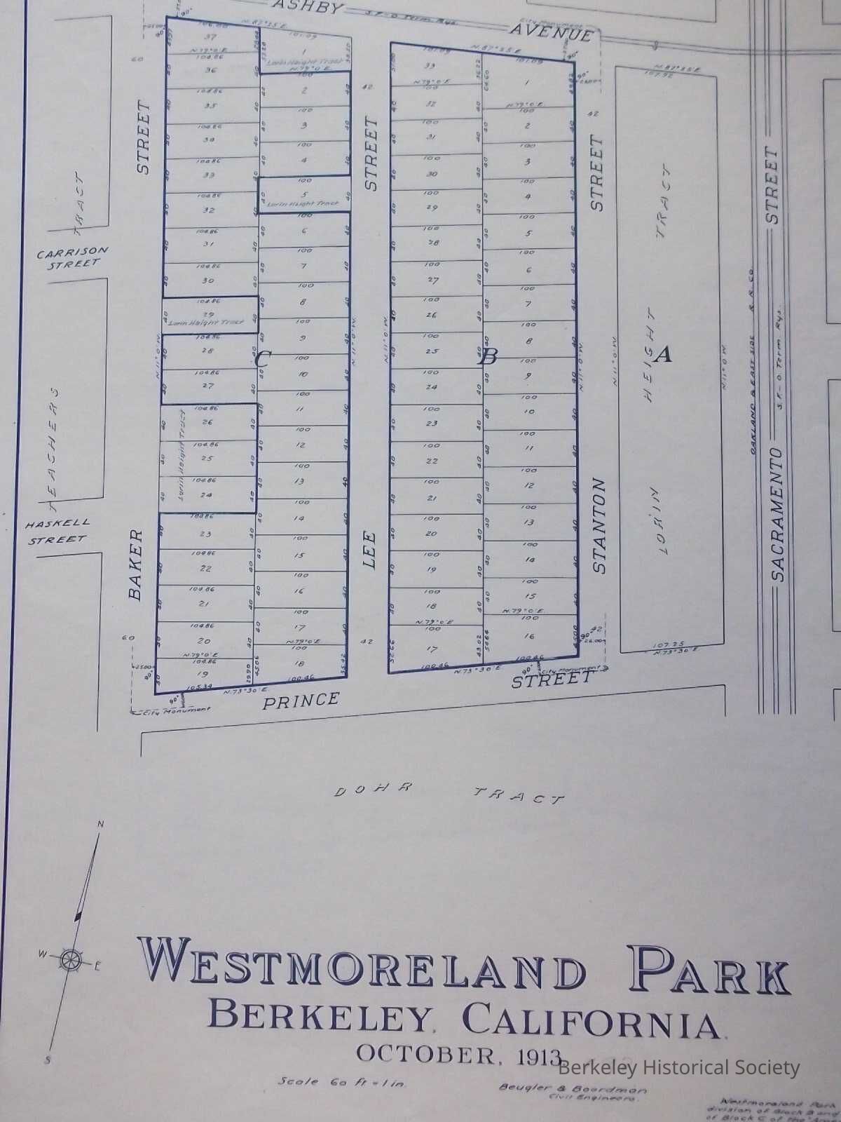
Name/Title
Westmoreland Park, Berkeley, California. October, 1913.Entry/Object ID
1978.043.157Description
2 copies.
Sheet 1 shows area bounded by Ashby Avenue, Stanton Street, Prince Street, and Baker Street.
Sheet 2 shows only Prince Street at the bottom. Above this, text by surveyors and United Home Builders (signed by president F. G. Becker), notaries, city clerks and county recorder. Feb. 27, 1914 written on map.
Tract Map. south of Ashby west of Sacramento, Adjacent to Teachers Tract, Mountain View Tract, Portion of plot 55, V&D Peralta Ranch, Lorin Heights Tract, Dohr Tract. Westmoreland Park is a resubdivision of a portion of block B and a portion of block C of the 'Amended map of the Lorin Height Tract' etc., filed Sept. 22, 1890 in the office of the Recorder of Alameda County, Cal.
Beugler & Boardman Civil EngineersLexicon
Nomenclature 4.0
Nomenclature Secondary Object Term
MapNomenclature Primary Object Term
CartographNomenclature Sub-Class
Graphic DocumentsNomenclature Class
Documentary ObjectsNomenclature Category
Category 08: Communication ObjectsSearch Terms
Westmoreland Park, Real PropertyLocation
Other
Drawer FB-4, Folder 4h