Name/Title
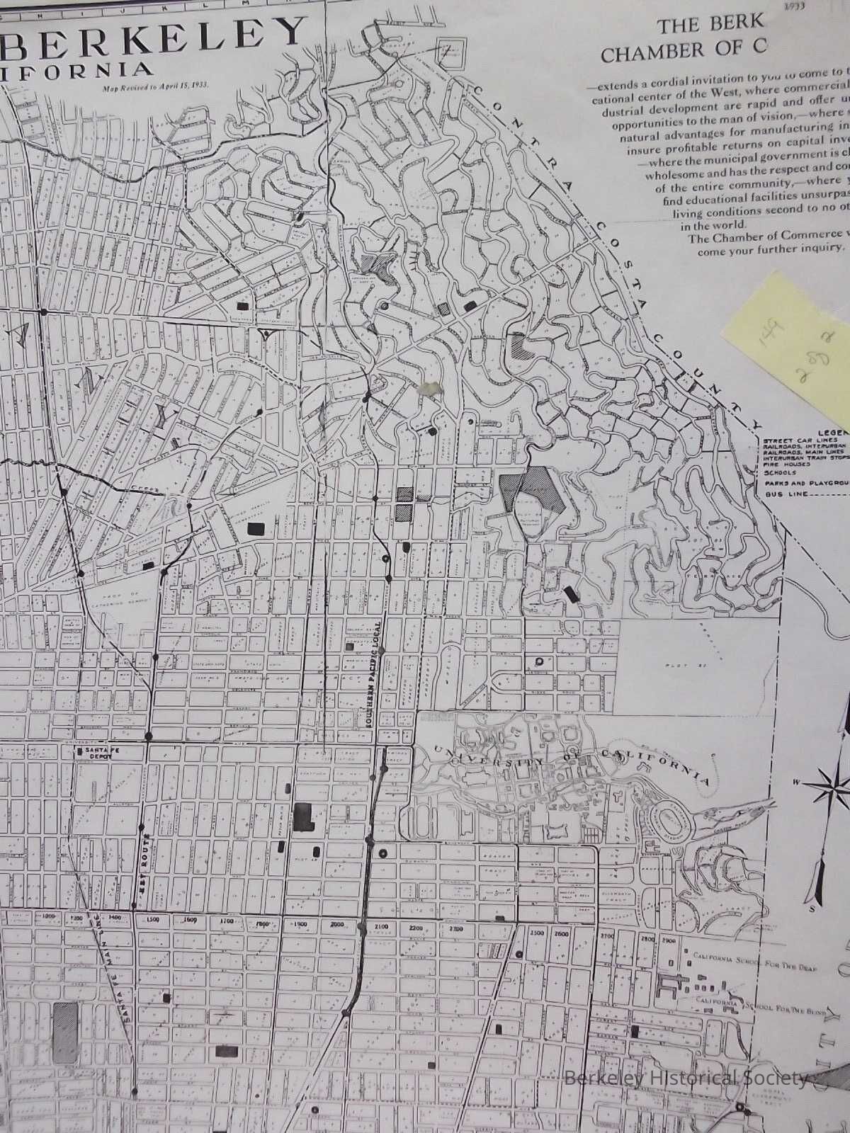
City of Bertkeley, 1933Entry/Object ID
1978.043.180Description
Street map with street index.
Map shows rail lines and Interurbnan train stops, Santa Fe Depot, S.P. Depot, Map revised to April, 15, 1933, shows tract namesLexicon
Nomenclature 4.0
Nomenclature Secondary Object Term
MapNomenclature Primary Object Term
CartographNomenclature Sub-Class
Graphic DocumentsNomenclature Class
Documentary ObjectsNomenclature Category
Category 08: Communication ObjectsSearch Terms
Santa Fe Depot, University Avenue, street mapLocation
Other
Drawer FB-2, Folder 2a