Name/Title
Berkeley's Public TransitEntry/Object ID
1978.043.193Description
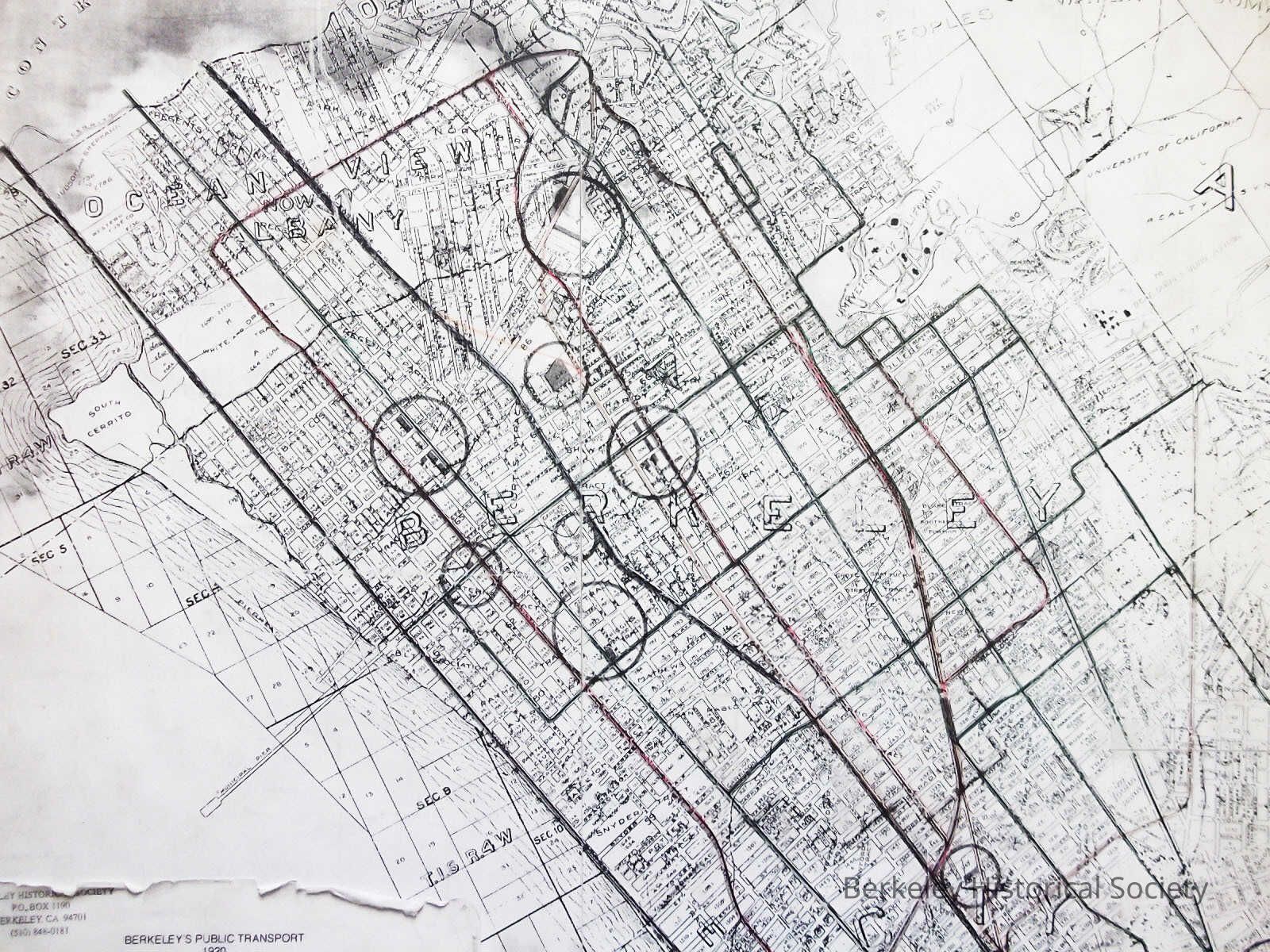
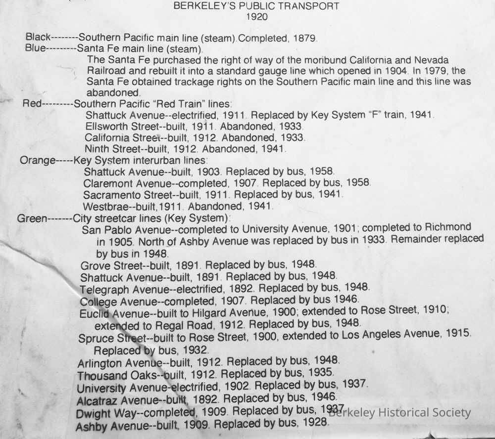
A map of Berkeley with transit lines as of 1920. A description of the carriers and lines in left bottom corner.
Unknown author. Map is BW, transit lines in color, coding explained in attached note on map. Mounted, on reverse side is standard street map of Bay AreaLexicon
Nomenclature 4.0
Nomenclature Secondary Object Term
MapNomenclature Primary Object Term
CartographNomenclature Sub-Class
Graphic DocumentsNomenclature Class
Documentary ObjectsNomenclature Category
Category 08: Communication ObjectsSearch Terms
SP, Santa Fe, Key System, Map TransitLocation
Other
Drawer FB-4, Folder 4f