Name/Title
World War II Block Warden's MapEntry/Object ID
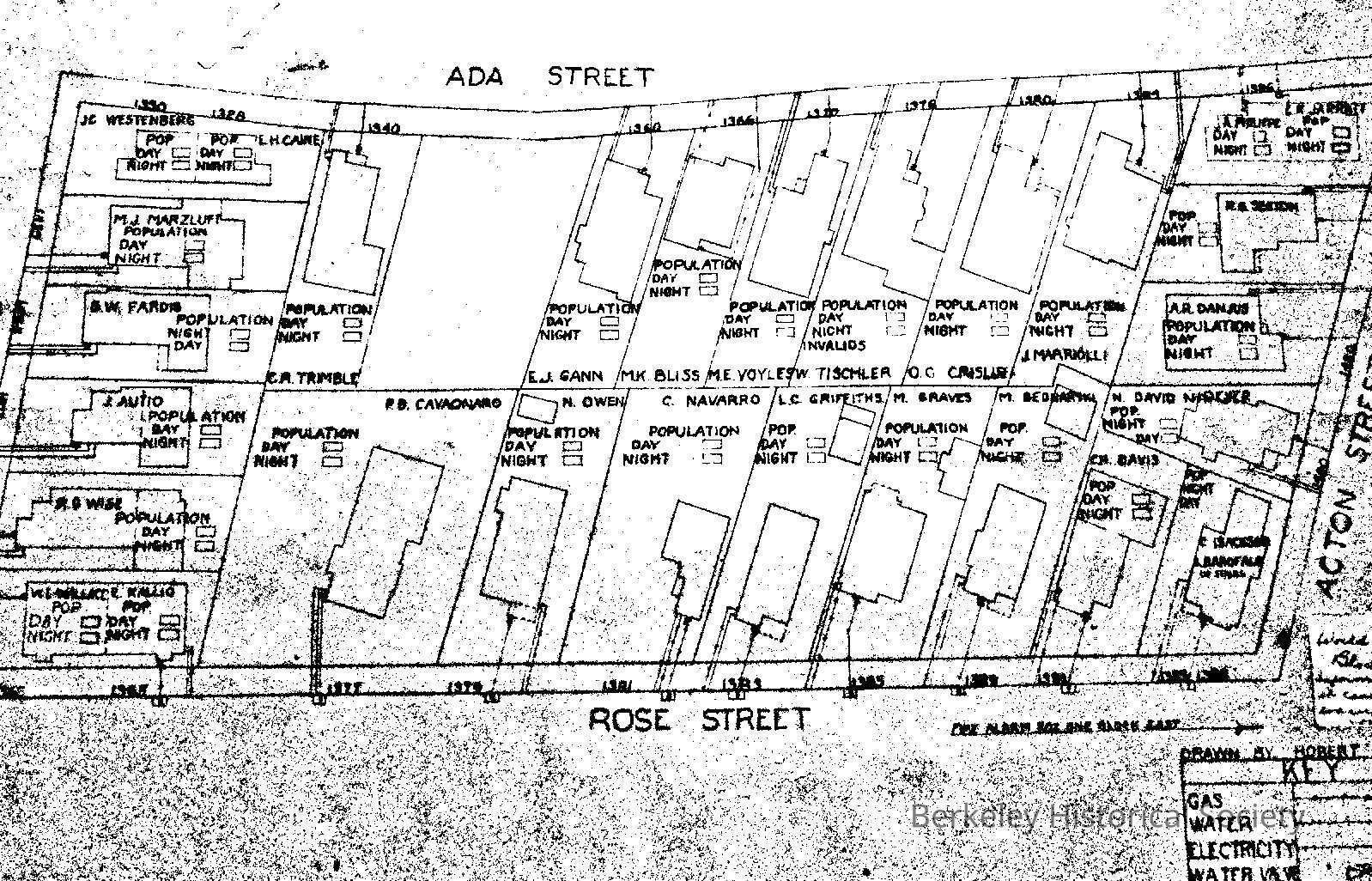
1978.043.199Description
Acton to Ordway, Rose to Ada.
Drawn by Robert Wise jr. Information required in case of possible evacuation and /or fire control. Map shows houses with residents, Gas, Water, Electricty service. It is an incomplete map as Day and Night population has not been filled in.Lexicon
Nomenclature 4.0
Nomenclature Secondary Object Term
MapNomenclature Primary Object Term
CartographNomenclature Sub-Class
Graphic DocumentsNomenclature Class
Documentary ObjectsNomenclature Category
Category 08: Communication ObjectsSearch Terms
World War II, Evacuation, Real PropertyLocation
Other
Drawer FB-2, Folder 2d