HUB
Collections
Classifications
About
App
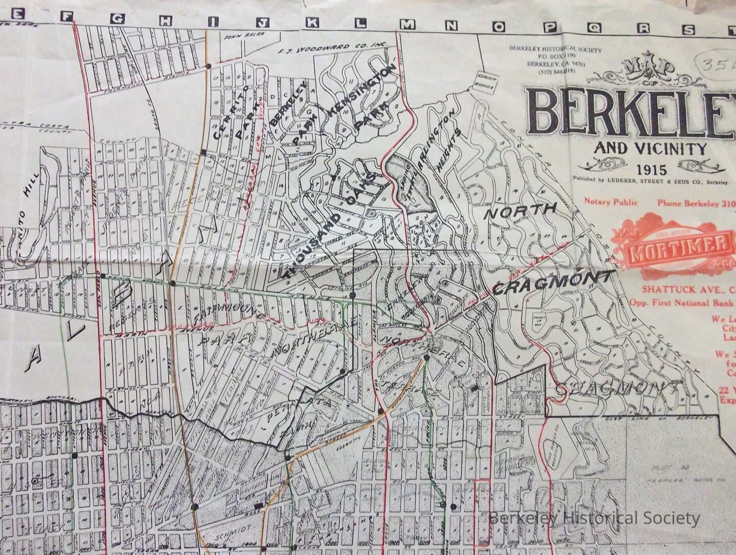
Berkeley and Vicinity, 1915
Map
-
Berkeley Historical Society & Museum
1915map
Name/Title
Berkeley and Vicinity, 1915
Entry/Object ID
1978.043.241
Description
Map showing transit and tract names, street names. Map produced by Charles Green and sold to various realtors. included on map is city's growth.
Lexicon
Nomenclature 4.0
Nomenclature Secondary Object Term
Map
Nomenclature Primary Object Term
Cartograph
Nomenclature Sub-Class
Graphic Documents
Nomenclature Class
Documentary Objects
Nomenclature Category
Category 08: Communication Objects
Search Terms
"Real Property"
Map Details
Date Published
1915
Dimensions
Height
24 in
Width
28 in
Location
Other
Drawer FB-2, Folder 2d