Name/Title
Map of Berkeley, Albany and vicinity, California.Entry/Object ID
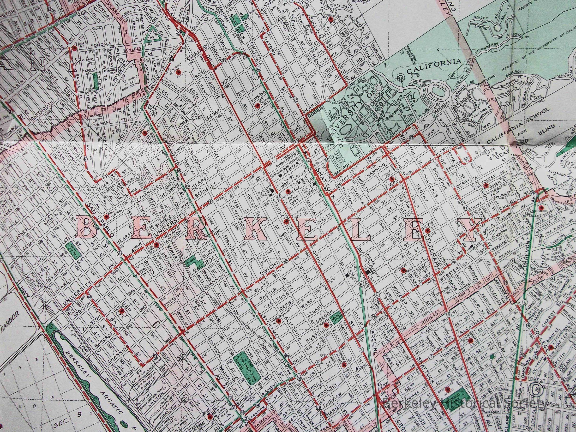
1978.043.270Description
Issued as a folded map with photos of Berkeley, "A balanced City of Residential, Educational, Commercial and Industrial Interests." Issued by the Berkeley Chamber of Commerce.
Undated; 1944 pencilled in.
One difference from probably previous maps is Ashby Avenue, above College Avenue, has been altered, but bus line still follows older route.
For earlier map, without Ashby Avenue alteration, see 1978.043.012 and 1978.043.015. For later version, see 1978.043.264.Lexicon
Nomenclature 4.0
Nomenclature Secondary Object Term
MapNomenclature Primary Object Term
CartographNomenclature Sub-Class
Graphic DocumentsNomenclature Class
Documentary ObjectsNomenclature Category
Category 08: Communication ObjectsSearch Terms
Photos, Transit Lines, Folded Street MapLocation
Other
Drawer FB-3, Folder 3f