HUB
Collections
Classifications
About
App
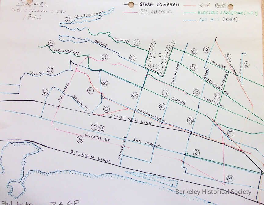
Berkeley Public Transit Lines 1940
Map
-
Berkeley Historical Society & Museum
Name/Title
Berkeley Public Transit Lines 1940
Entry/Object ID
1978.043.278
Description
Pen and ink drawing showing streets with transit lines. Shows steam lines, electric lines, etc., with route numbers.
Lexicon
Nomenclature 4.0
Nomenclature Secondary Object Term
Map
Nomenclature Primary Object Term
Cartograph
Nomenclature Sub-Class
Graphic Documents
Nomenclature Class
Documentary Objects
Nomenclature Category
Category 08: Communication Objects
Search Terms
Key System,
SOUTHERN PACIFIC,
Local transit--California--Berkeley
Map Details
Maker or Creator
Phil Gale
Date Published
1940
Dimensions
Height
8 in
Width
11 in
Location
Other
Drawer FB-5a, Folder 5ab