Name/Title
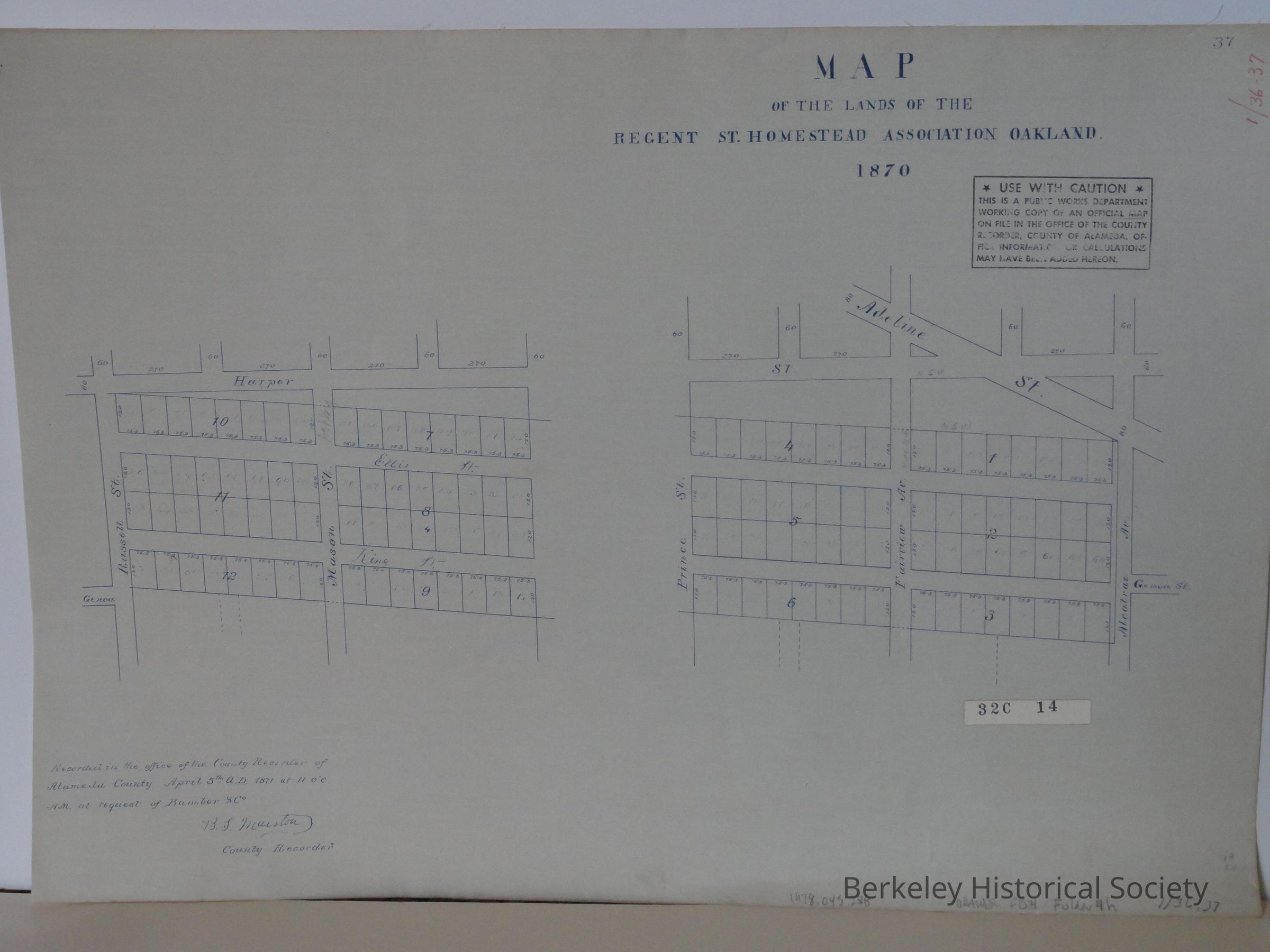
Map of the lands of the Regent St. Homestead Association, Oakland, 1870.Entry/Object ID
1978.043.288Description
Two maps on sheet: one shows Russell St., Harper St., and Mason St. (Ashby). the second map shows Prince St., Fairview Ave., and Alcatraz Ave., above Adeline St.
"Recorded ... April 5, 1871 at the request of Bamber & Co."
Reporduction of map in the Alameda County Recorder's Office.Lexicon
Nomenclature 4.0
Nomenclature Secondary Object Term
MapNomenclature Primary Object Term
CartographNomenclature Sub-Class
Graphic DocumentsNomenclature Class
Documentary ObjectsNomenclature Category
Category 08: Communication ObjectsDimensions
Dimension Notes
45 x 64 cm.Location
Other
Drawer FB-4, Folder 4h