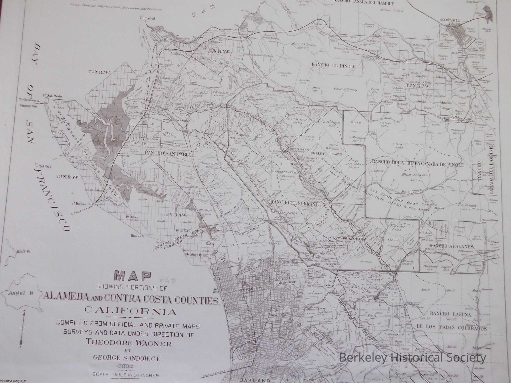
Name/Title
Portions of Alameda and Contra Costa Counties, 1894Entry/Object ID
1978.043.103Scope and Content
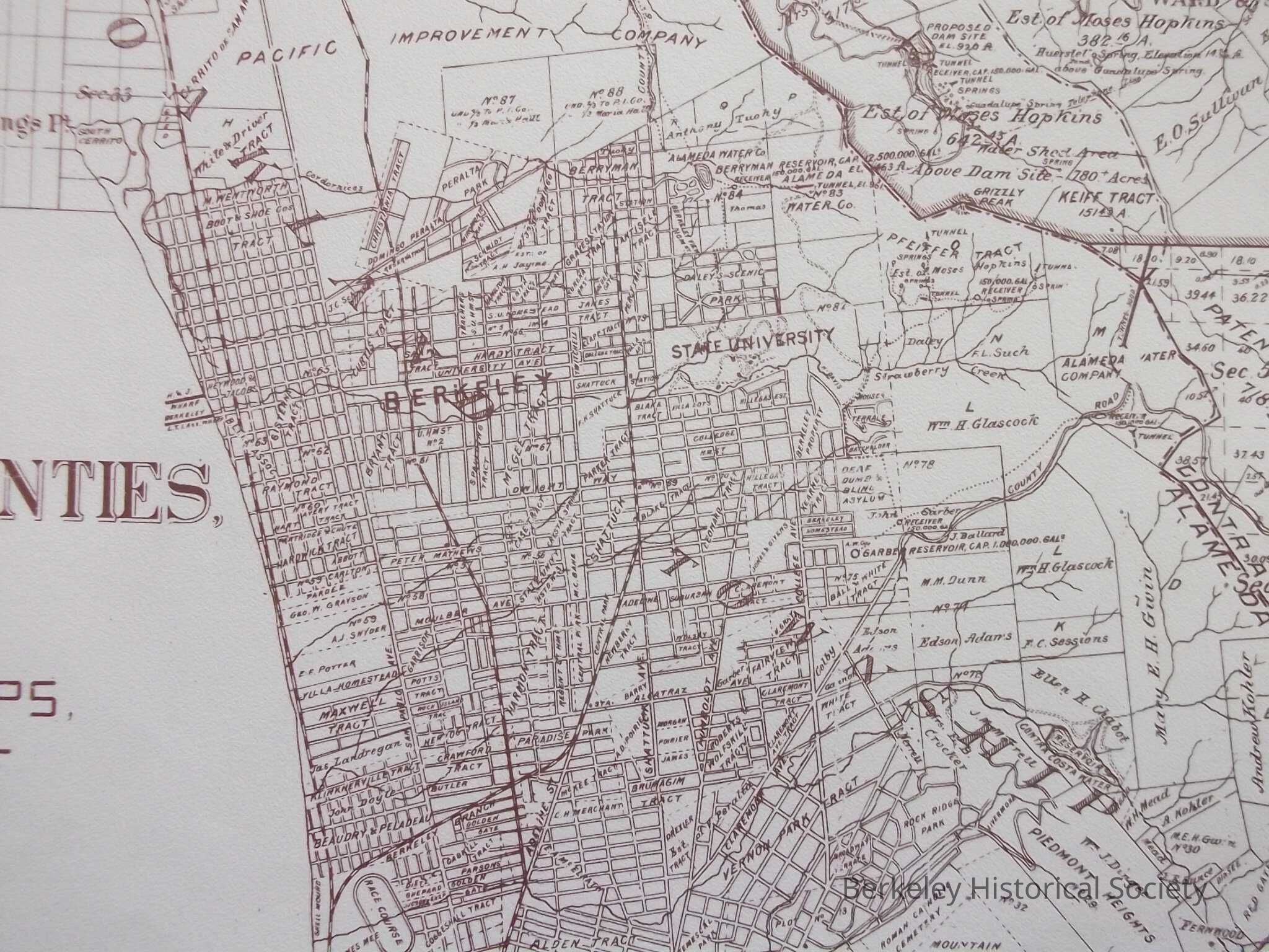
Map showing development as of 1894, show tracts.
Compiled from Official and Private Maps, Survey and Data Under Direction of Theodore Wagner by George Sandow, Map still shows Ranchos north and east of Berkeley. Cal & Nev R.R. Pier and Route, Northern Railway, S.F. & S.J R.R. Depot, Point Richmond, State University, 2 copiesLexicon
Nomenclature 4.0
Nomenclature Secondary Object Term
MapNomenclature Primary Object Term
CartographNomenclature Sub-Class
Graphic DocumentsNomenclature Class
Documentary ObjectsNomenclature Category
Category 08: Communication ObjectsSearch Terms
Development East Bay, Ranchos, Map DevelopmentArchive Details
Date(s) of Creation
1894Archive Notes
Scale: 1" = 3,500'Location
Other
Drawer FB-2, Folder 2f