Name/Title
Charter Boundaries and AnnexationsEntry/Object ID
1978.043.140Scope and Content
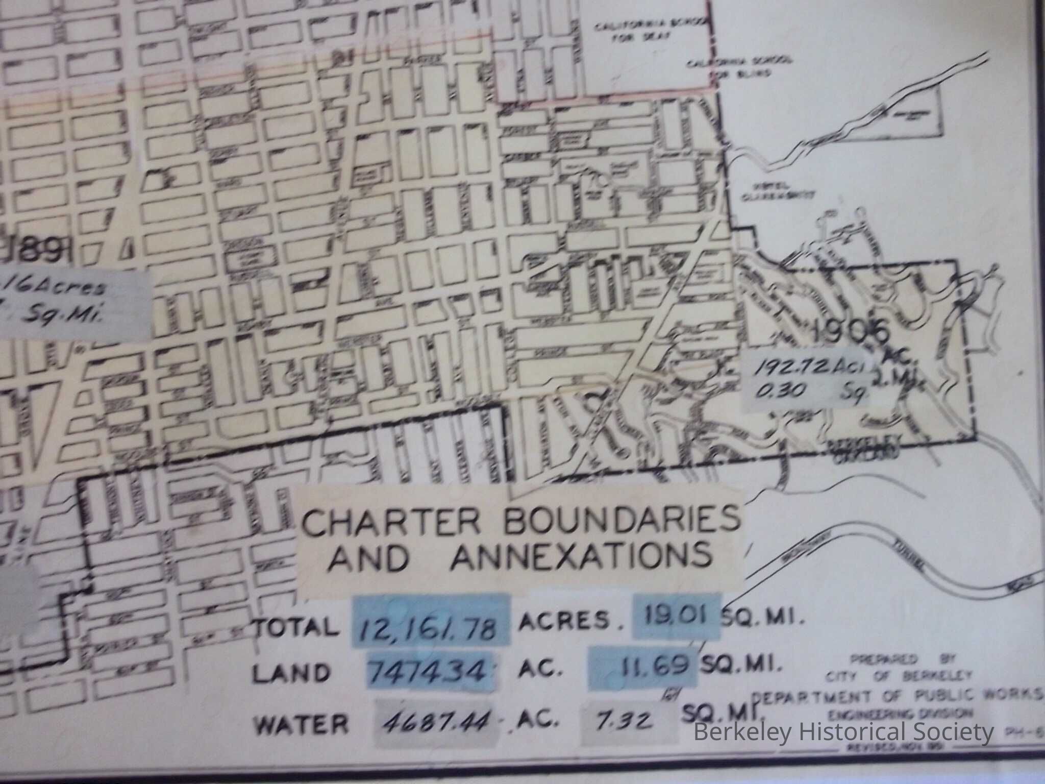
Size of area in acres and square miles for the various annexations to the city of Berkeley, with dates.
See also 1978.043.028
Map showing size of annexations
Revised November 1951
Total 12,161.78 acres, 19.01 Sq miles,
Land 7474.34 acres 11.69 Sq Miles
Water 4687.44 acres, 7.32 Sq MilesLexicon
Nomenclature 4.0
Nomenclature Secondary Object Term
MapNomenclature Primary Object Term
CartographNomenclature Sub-Class
Graphic DocumentsNomenclature Class
Documentary ObjectsNomenclature Category
Category 08: Communication ObjectsLOC Thesaurus for Graphic Materials
"Maps"Search Terms
"Charter Boundaries"Archive Details
Creator
Berkeley, Calif. Department of Public WorksDate(s) of Creation
1951Location
Other
Drawer FB-3, Folder 3c