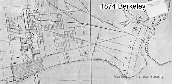
Map of Berkeley showing the property of the Berkeley L.T.I Association.
Entry/Object ID
1978.043.024
Description
Berkeley Land and Town Association.
Shows highlighted property west of San Pablo Avenue, from approximately Bancroft Way north to Codornices Creek.
Coverage of map extends south to Estuary of San Antonio, City of Oakland, but with only a few streets indicated.
Shows location of Haywood & Jacobs Wharf.
3 copies: original torn at fold and damaged at top; two reproductions, one mounted on board