Name/Title
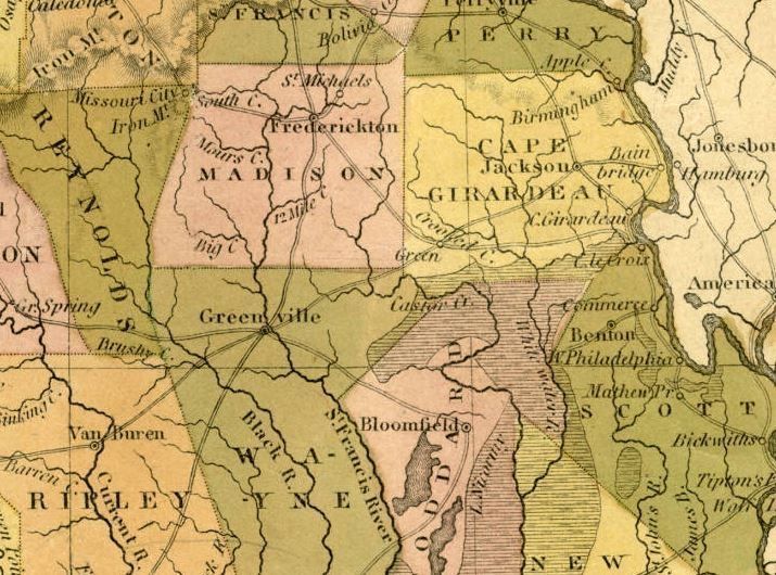
Section of Burr Postal Map (Pre-Bollinger County Map)Description
Section of 1834 Missouri map showing Wayne, Cape Girardeau, Stoddard counties--parts of which would later form Bollinger County--and Madison. The historic towns of Frederickton, Jackson, and Greenville. Greene is marked (listed "Green") on the route from Jackson to Greenville on this map; this is where present-day Marble Hill is located.Acquisition
Accession
BCL-TOT-B-00028Source (if not Accessioned)
Library of Congress (online)