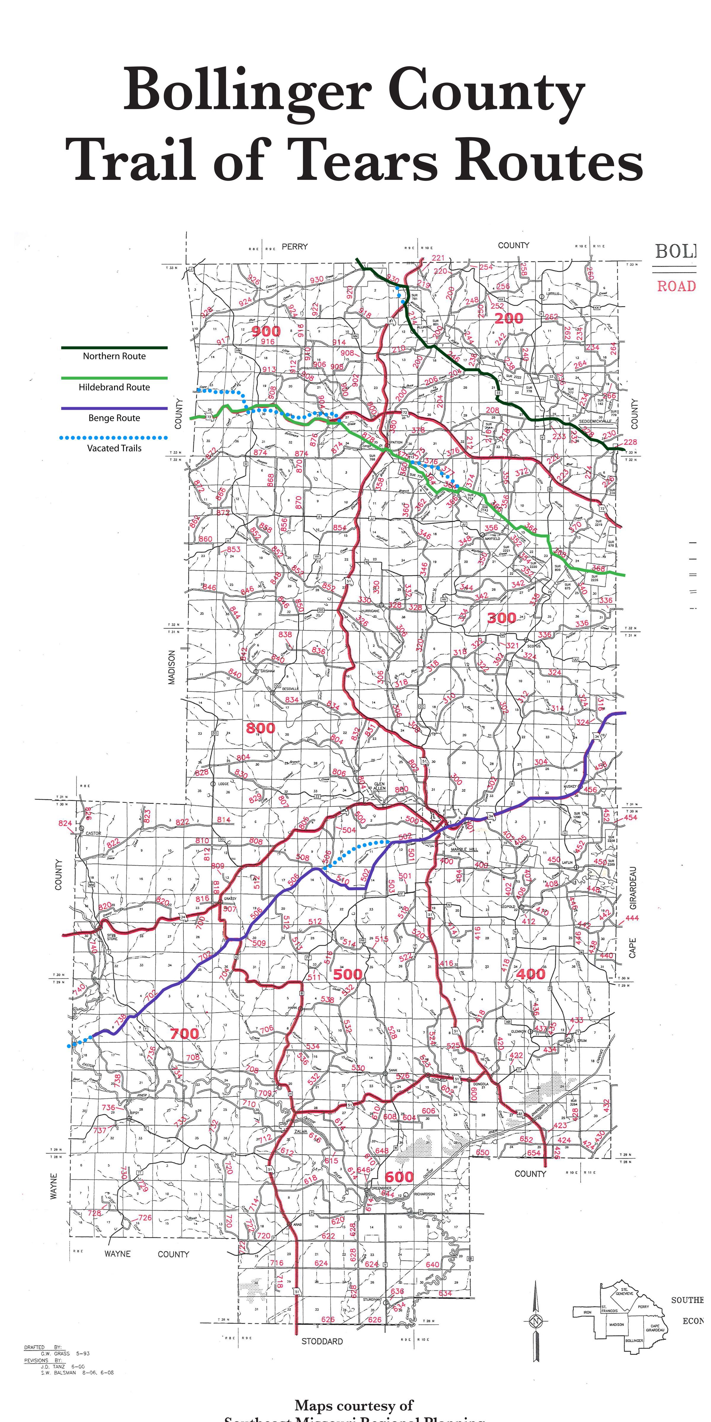
Name/Title
Bollinger County Trail of Tears MapTags
Benge Route, Northern Route, Hilderbrand RouteDescription
Map of the Bollinger County Trail of Tears Routes, showing the Northern (Dark Green), Hildebrand (Bright Green), and Benge (Purple) routes and vacated trails (blue dots) as they passed through the region.Acquisition
Accession
BCL-TOT-B-00042Source (if not Accessioned)
Southeast Missouri Regional PlanningNotes
This shows all three trails. Important to this section for its portrayal of the Northern route as understood through the aformentioned research and documentation in this archive.