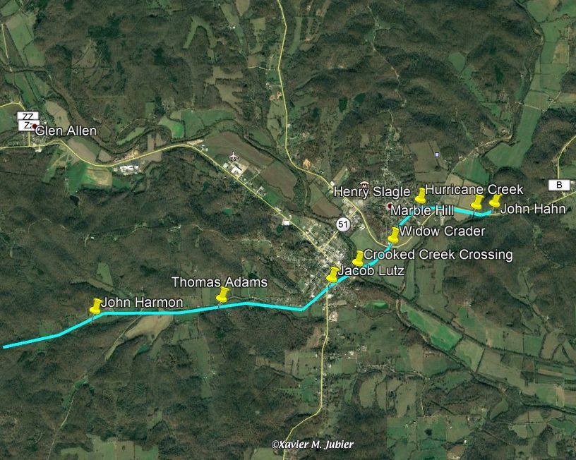
Present Marble Hill map (via Google Earth) with Benge route marked in green by Rusty Weisman. Shows Crooked Creek crossing and Lutes property (shows earlies settlers when they went through with the survey).
Acquisition
Accession
BCL-TOT-B-00010
Source (if not Accessioned)
Google Earth
Notes
Shows Crooked Creek crossing and Lutes property (shows earlies settlers when they went through with the survey).