HUB
Collections
Classifications
About
App
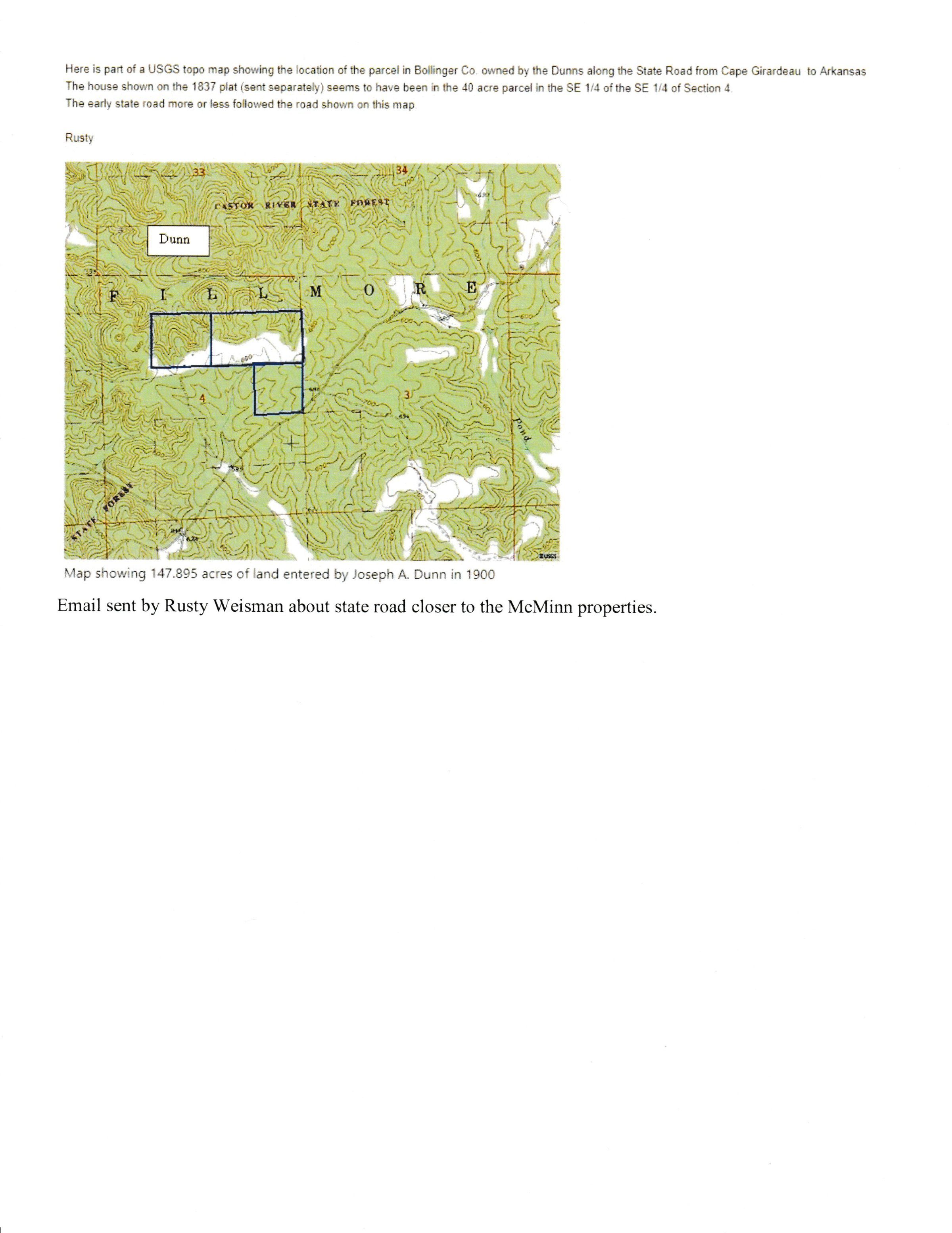
Email with 1900 Dunn Survey of McMinn Plat
Map
-
Bollinger County Collective Archives
Name/Title
Email with 1900 Dunn Survey of McMinn Plat
Description
Image of email sent by Rusty Weisman about state road closer to the McMinn properties with "Map showing 147.895 acres of land entered by Joseph A. Dunn in 1900"; Dunn Land Parcel on the 1837 survey.
Acquisition
Accession
BCL-TOT-B-00013
Source (if not Accessioned)
USGS Topo Map; Insert by Rusty Weisman