Name/Title
Blueprint of Colorado and Southern Railway Company Broomfield Station MapEntry/Object ID
1975.2.1Tags
Needs processingScope and Content
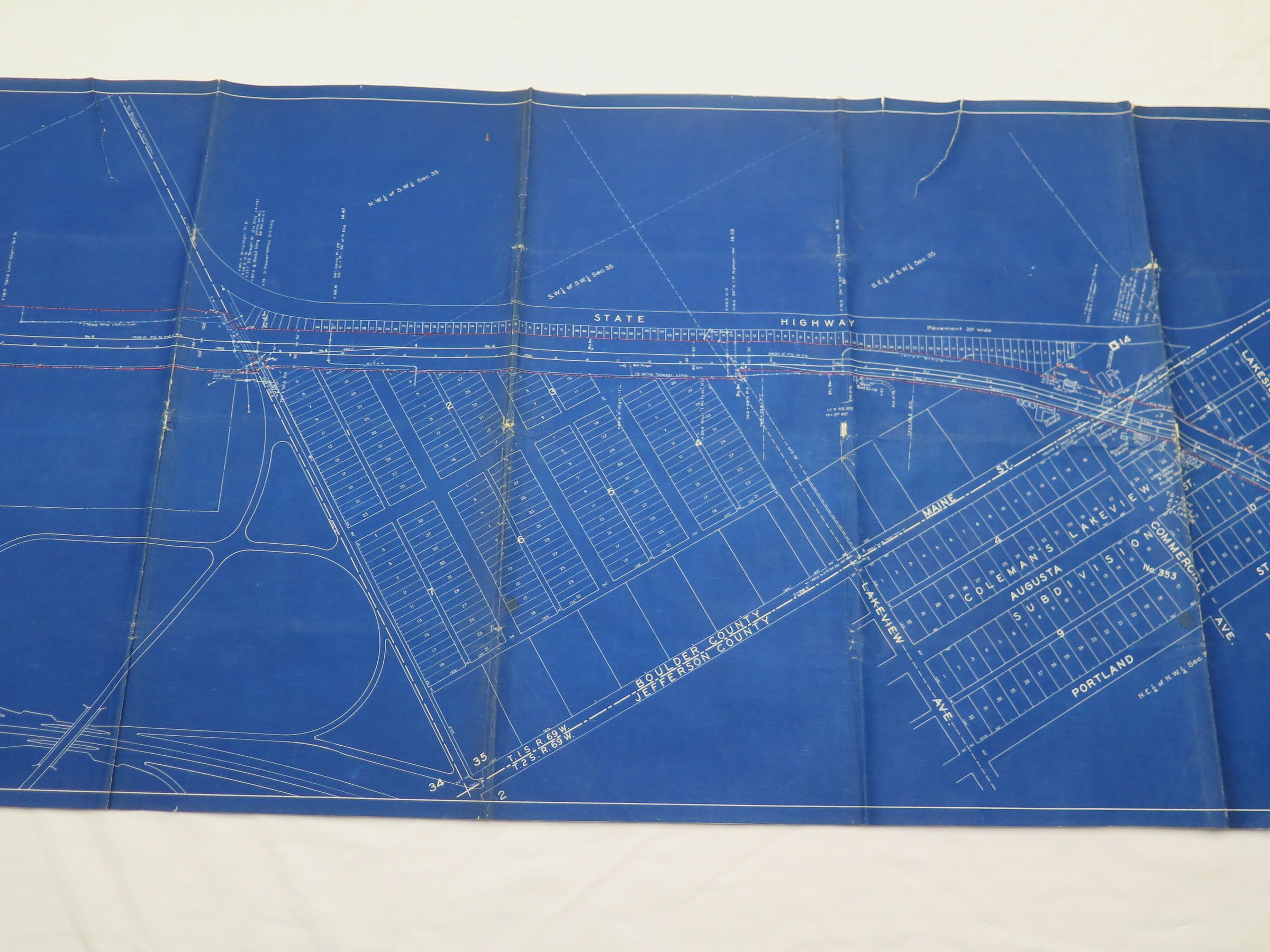
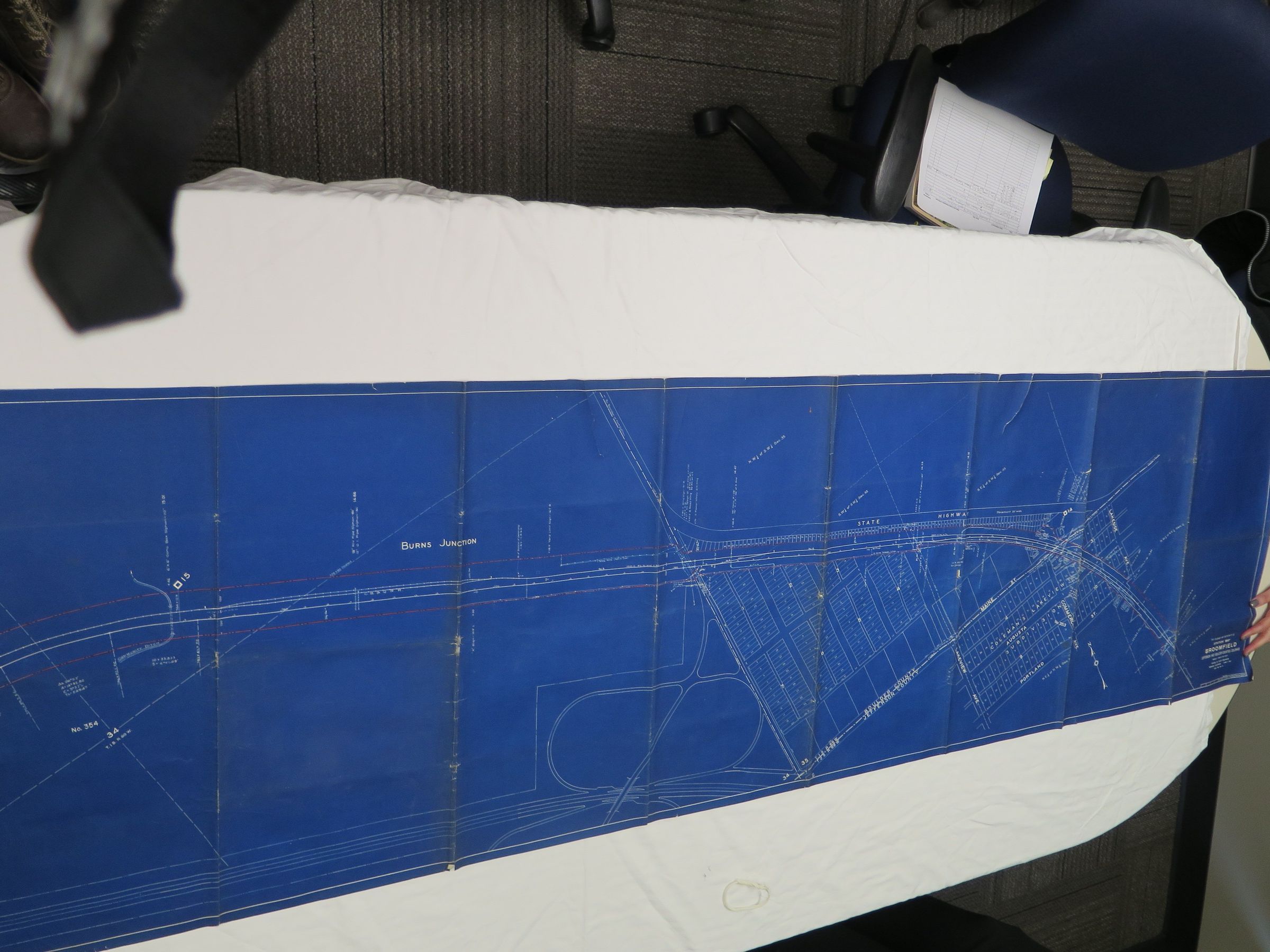
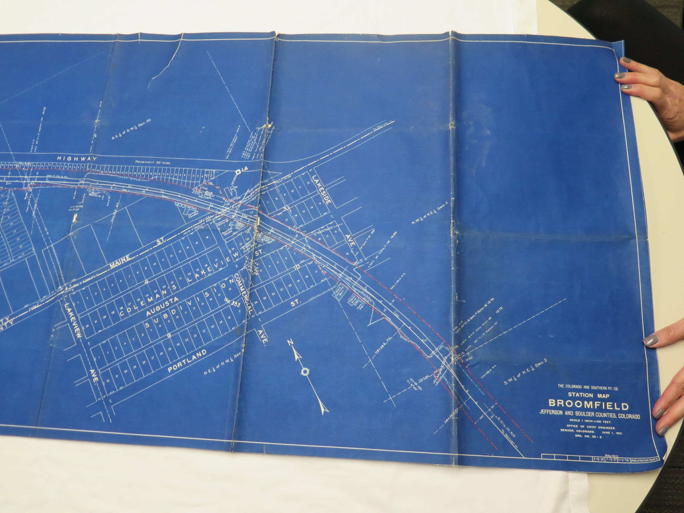
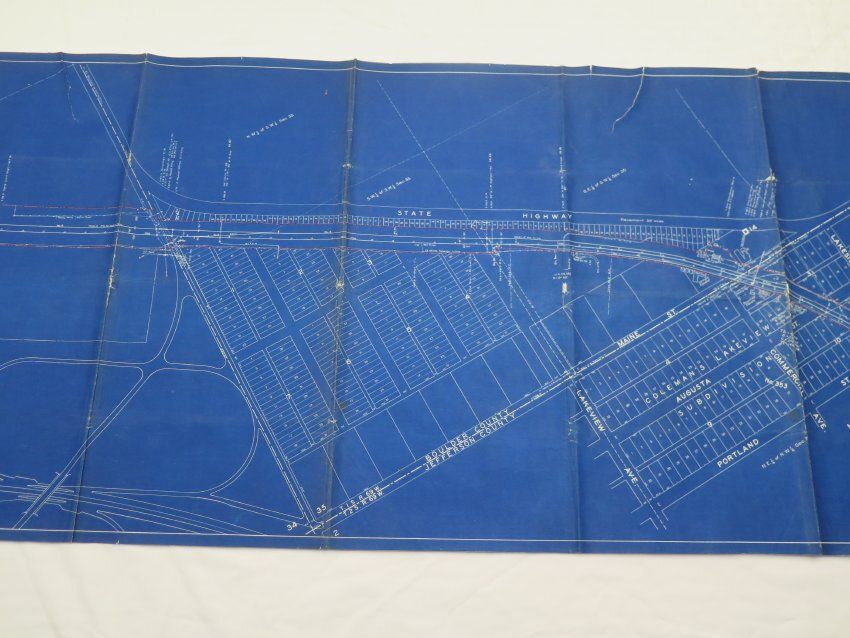
A map of the Broomfield area and railroad made by the Colorado and Southern Railway Company's Office of Chief Engineer, circa 1939. The map is 2' x 7', blueprint. The original map was created June 1, 1931. This particular copy of the map was last revised September 15, 1939, with previous revisions made January 3, 1936 and July 12, 1937. The exact date of reproduction and time of specific revisions are unknown. The scale is 1 inch = 100 feet. North is pointed at an approximate 45 degree angle to the left.
The map is labeled in the lower right corner as a "Station Map" for Broomfield within Jefferson and Boulder Counties, however it shows much of Broomfield as a whole stretching from Burns Junction in the East to Portland Street in the West. Broomfield's railroad tracks, streets, numbered blocks and lots, landmarks, and passing State Highway are also featured prominantly. Noteworthy landmarks and locations represented include the Broomfield train depot, grain elevators, dumps and loading points for crops, a local pickling factory, a Conoco station, Maine Street (later 120th), and Commercial Avenue (later Old Wadsworth). The map presents a comprehensive picture of Broomfield's layout and scale in the 1930s, and that of its passing railroad.Collection
Permanent CollectionLexicon
Nomenclature 4.0
Nomenclature Secondary Object Term
MapNomenclature Primary Object Term
CartographNomenclature Sub-Class
Graphic DocumentsNomenclature Class
Documentary ObjectsNomenclature Category
Category 08: Communication ObjectsLOC Thesaurus for Graphic Materials
Blueprints, Maps, Railroad depots, Railroad facilities, Railroad tracks, StreetsSearch Terms
Broomfield Depot, Boulder County, Colorado and Southern Railway, Jefferson CountyArchive Details
Date(s) of Creation
1939 - 1939Archive Size/Extent
One triangular rolled map tubePrimary Language
EnglishArchive Notes
Date(s) Created: Circa 1939
Date(s): 1939 circa
Medium: Blueprint
Scale: 1:1200
Copy/Orig/Other: Reproduction