Name/Title
MapEntry/Object ID
1987.15.219.28Scope and Content
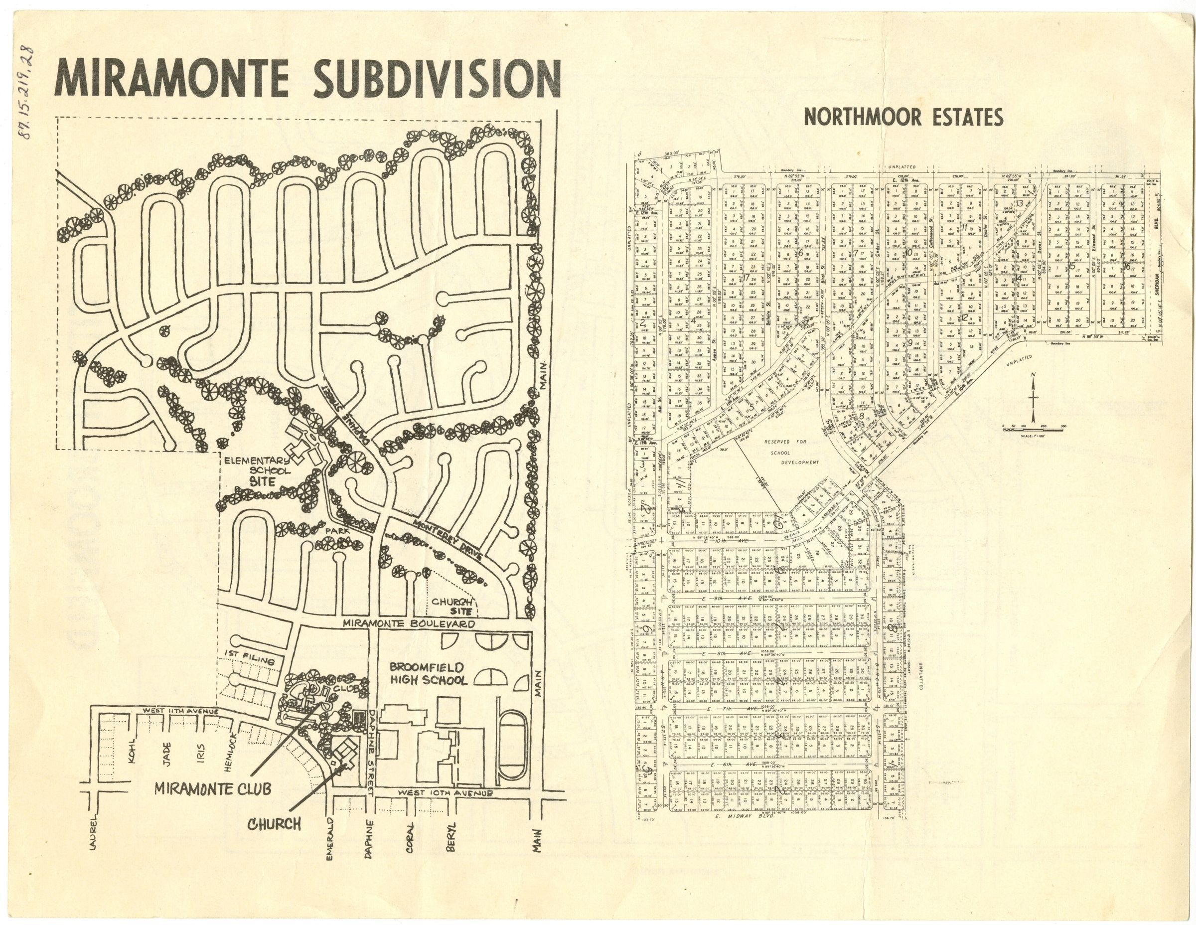
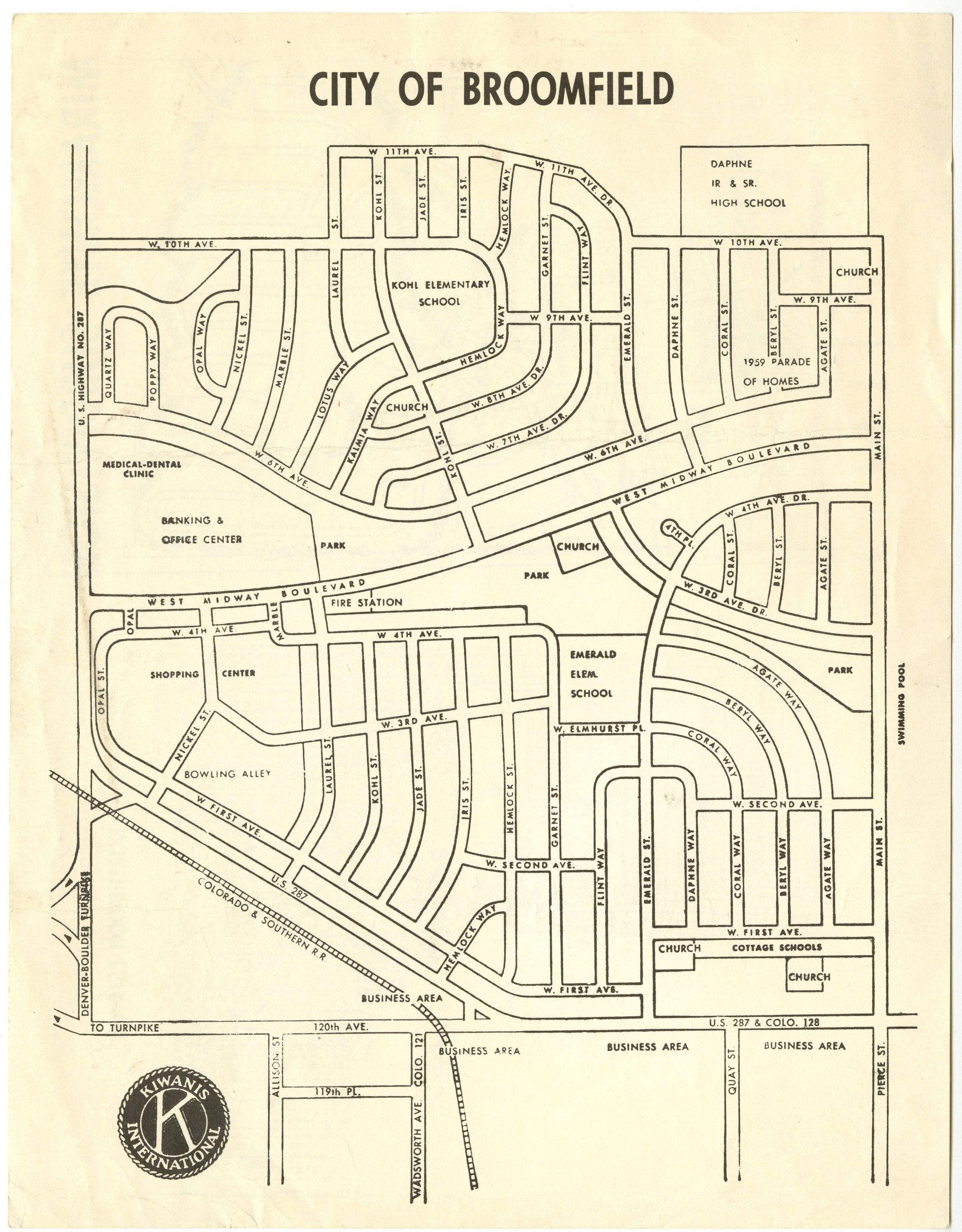
City of Broomfield map, double sided.
On front, area covering Highway 287 to Main St, and 120th Ave, to W 111th Ave. Kiwanis International stamp on bottom left.
On back, detailing the Miramonte Subdivision and Northmoore Estates.Collection
Permanent CollectionLexicon
Nomenclature 4.0
Nomenclature Secondary Object Term
MapNomenclature Primary Object Term
CartographNomenclature Sub-Class
Graphic DocumentsNomenclature Class
Documentary ObjectsNomenclature Category
Category 08: Communication Objects