Name/Title
Broomfield City Plan AlternativeEntry/Object ID
2020.0.11Scope and Content
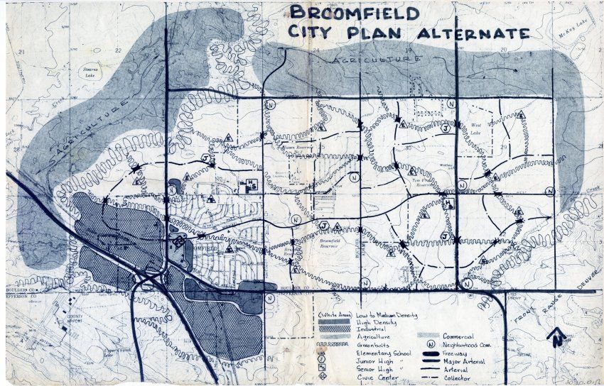
Photocopy of a map of Broomfield with handwritten in marker, "Broomfield City Plan Alternative. Found inside the cover of a 1975 telephone book (2020.0.5). Map is overlaid with different shades indicating either planned or proposed land use for low to medium density, high density, industrial, agriculture, commercial, and greenbelts. Map extends from Jeffco Airport in bottom left corner to MacKay Lake in top right corner.
Also indicated on map are the schools, freeways, civic center, major arteries, and "neighborhood com.".
Of particular interest may be the greenbelts connecting the city. Could use more research on why these were proposed.Collection
Permanent CollectionLexicon
Nomenclature 4.0
Nomenclature Secondary Object Term
MapNomenclature Primary Object Term
CartographNomenclature Sub-Class
Graphic DocumentsNomenclature Class
Documentary ObjectsNomenclature Category
Category 08: Communication ObjectsArchive Details
Date(s) of Creation
circa 1975