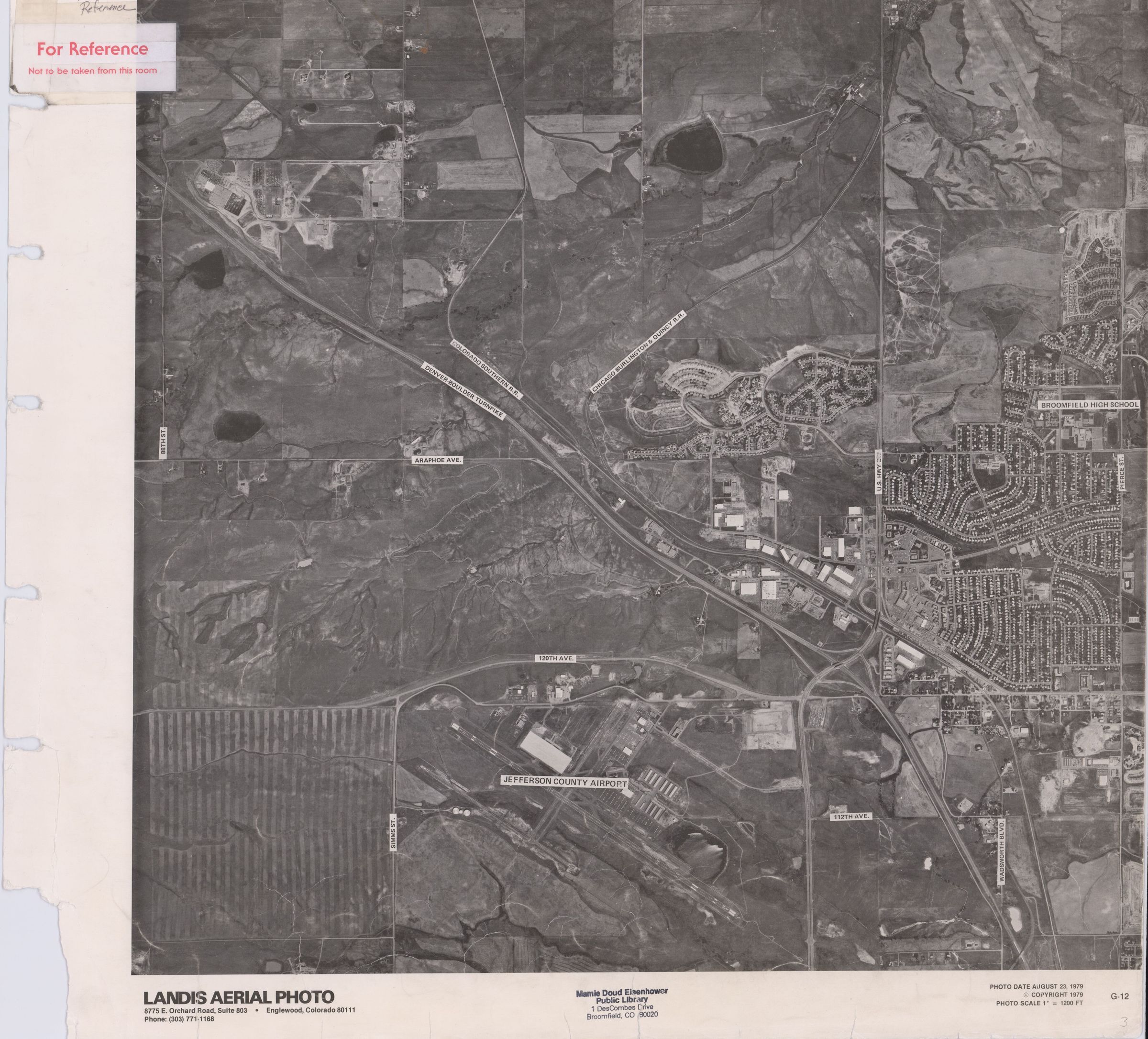
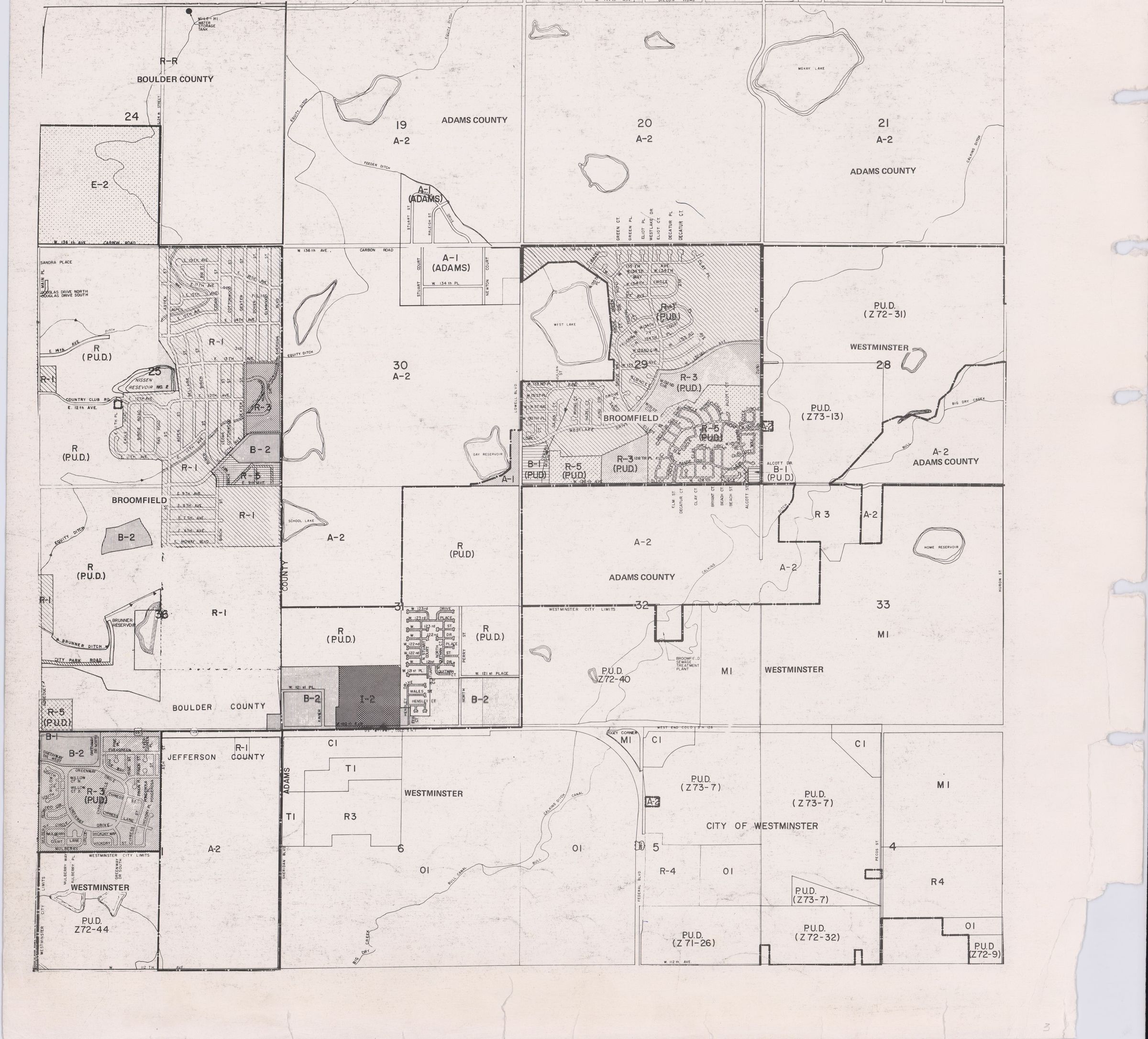
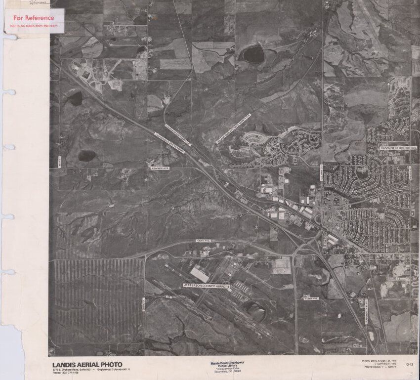
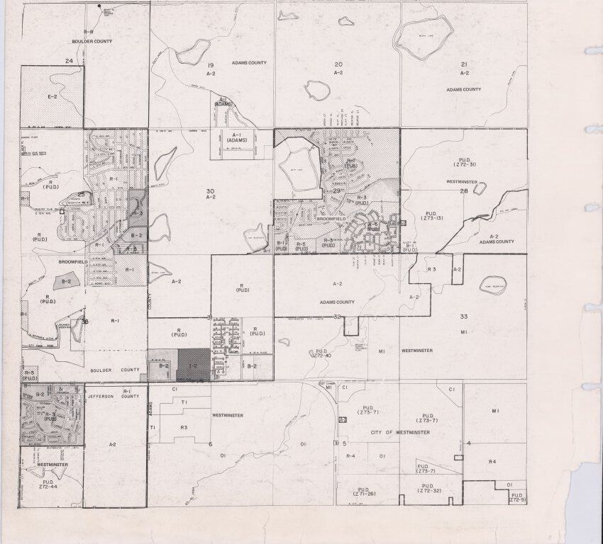
Name/Title
Landis Aerial Photo, 1979, Jeffco airport, Central BroomfieldEntry/Object ID
2019.6.3Scope and Content
Aerial Photo with a Map on the back, they are not of the exact same area.
Aerial Photo taken in 1979
Contains:
-Jeffco airport
-Wadsworth/Highway 287 through Broomfield.
-Hwy 36/Denver-Boulder Turnpike through Broomfield
-Broomfield High school
-Gate n' Green neighborhood
-Miramonte neighborhood
-Broomfield Heights neighborhood
-Railroad
-Industrial Ln
City Planning Map, likely from 1979
Contains:
-Westlake neighborhood
-Northmoor neighborhood
-McKay Lake
-Gay reservoir
-Nissen reservoir
-Greenway Park reservoir
-Northern WestminsterLexicon
Nomenclature 4.0
Nomenclature Secondary Object Term
MapNomenclature Primary Object Term
CartographNomenclature Sub-Class
Graphic DocumentsNomenclature Class
Documentary ObjectsNomenclature Category
Category 08: Communication ObjectsArchive Details
Date(s) of Creation
Aug 23, 1979