Name/Title
Landis Aerial Photo, 1980, Jeffco Airport, SuperiorEntry/Object ID
2019.6.5Scope and Content
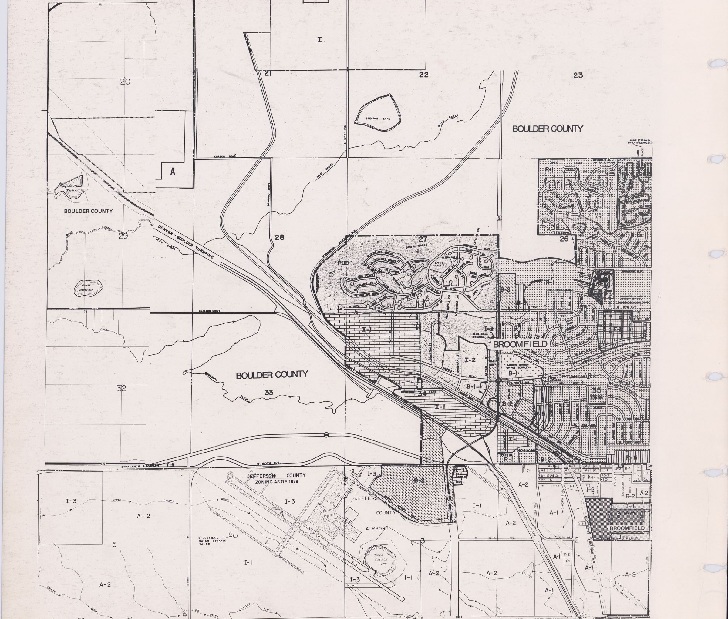
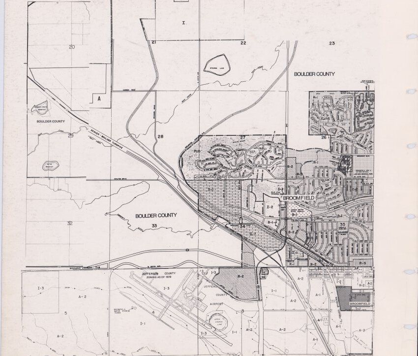
City Planning Map, likely from 1980
Contains:
-Jeffco airport
-Wadsworth/Highway 287 through Broomfield.
-Hwy 36/Denver-Boulder Turnpike through Broomfield
-Broomfield High school
-Gate n' Green neighborhood
-Miramonte neighborhood
-Broomfield Heights neighborhood
-Railroad
-Industrial Ln
-Garden Center
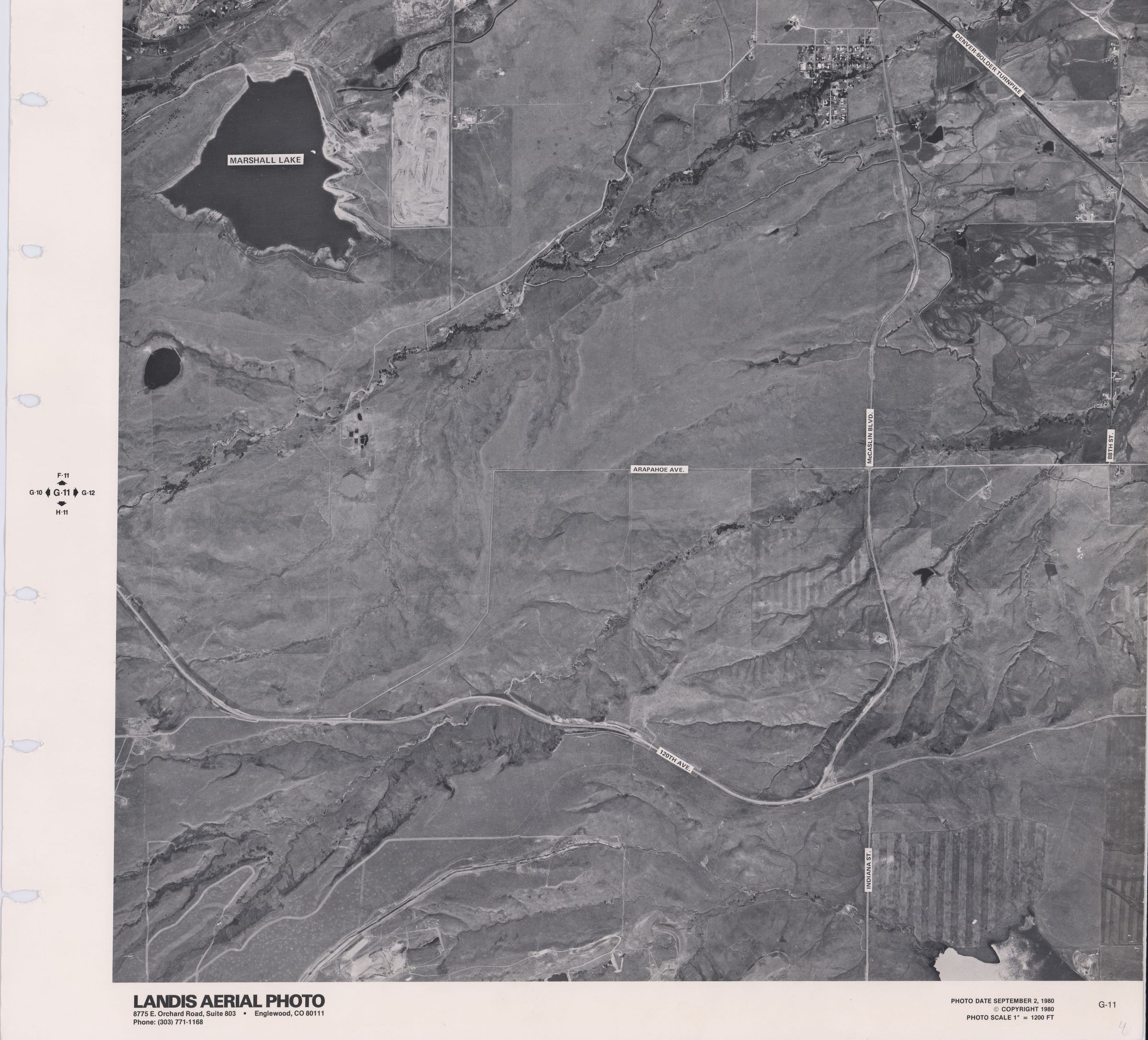
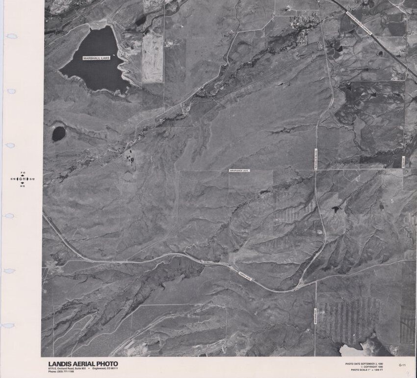
Aerial Photo, taken in 1980
Contains:
-Marshall Lake
-120th Avenue
-McCaslin Boulevard
-Hwy 36/Denver-Boulder Turnpike
-Historic Town of SuperiorLexicon
Nomenclature 4.0
Nomenclature Secondary Object Term
MapNomenclature Primary Object Term
CartographNomenclature Sub-Class
Graphic DocumentsNomenclature Class
Documentary ObjectsNomenclature Category
Category 08: Communication ObjectsArchive Details
Date(s) of Creation
Sep 2, 1980