Name/Title
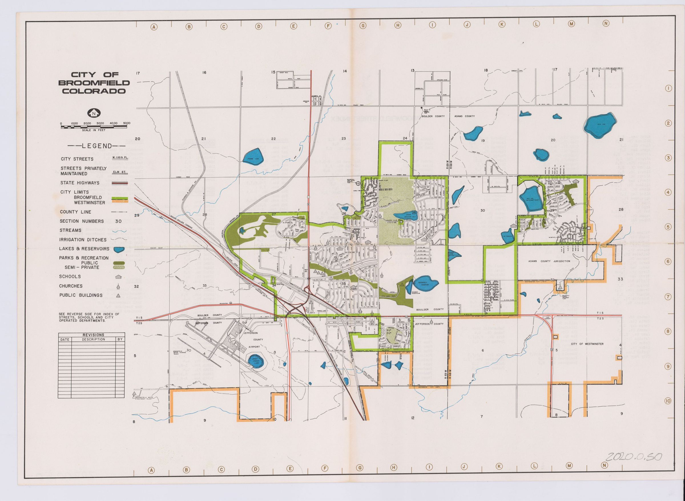
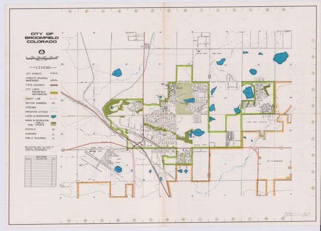
City of Broomfield, Colorado, MapEntry/Object ID
2020.0.50Scope and Content
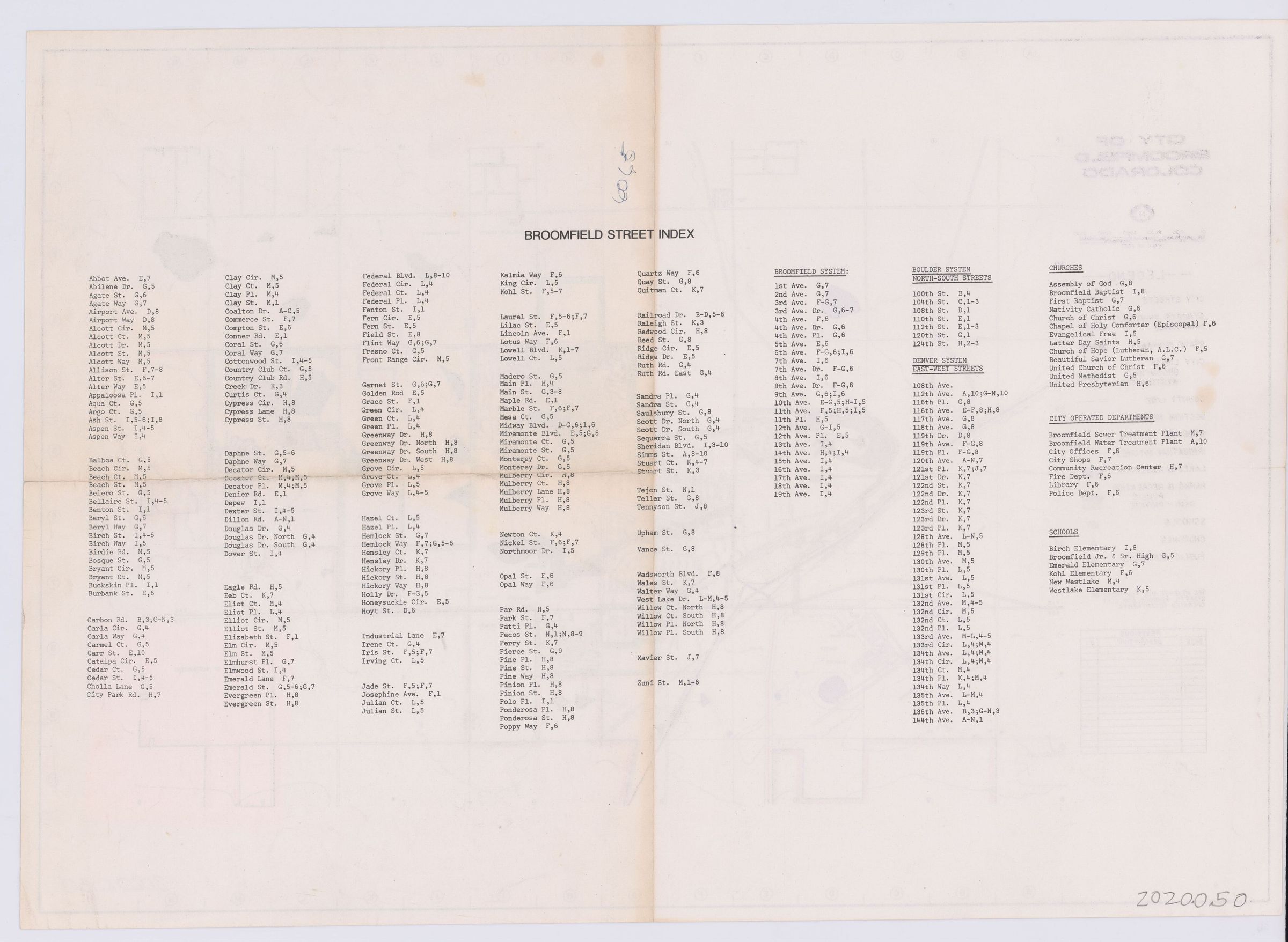
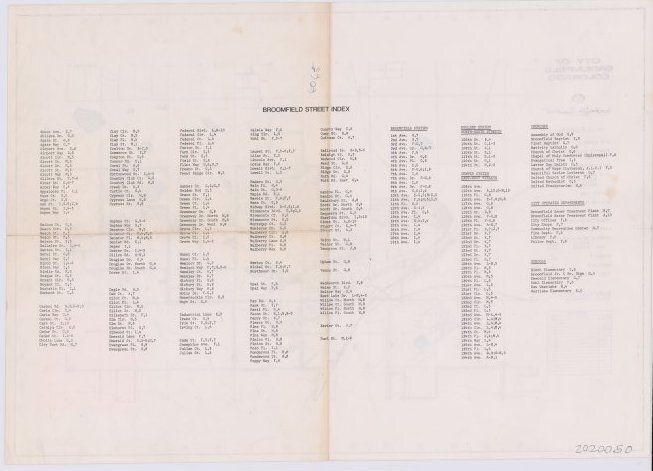
Shows streets, highways, county lines, the border between broomfield and westminister, bodies of water, parks, open spaces, and recreational zoning, as well as schools, churches, and public buildings. Street index on backLexicon
Nomenclature 4.0
Nomenclature Secondary Object Term
MapNomenclature Primary Object Term
CartographNomenclature Sub-Class
Graphic DocumentsNomenclature Class
Documentary ObjectsNomenclature Category
Category 08: Communication ObjectsArchive Details
Archive Notes
Date(s): circa 1970s