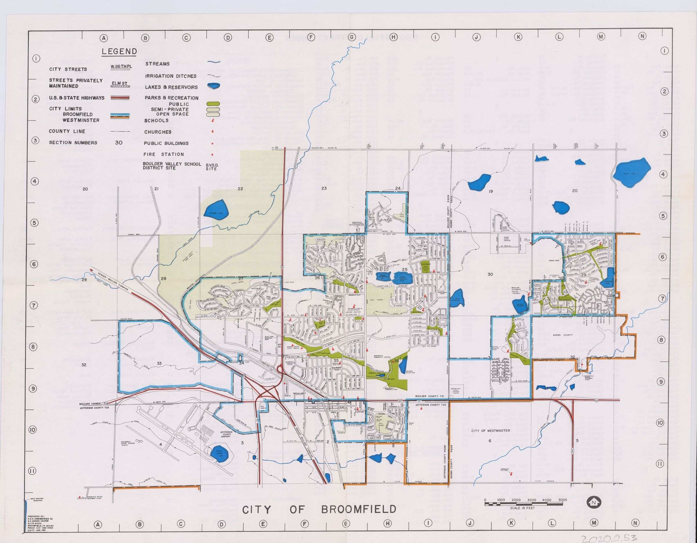
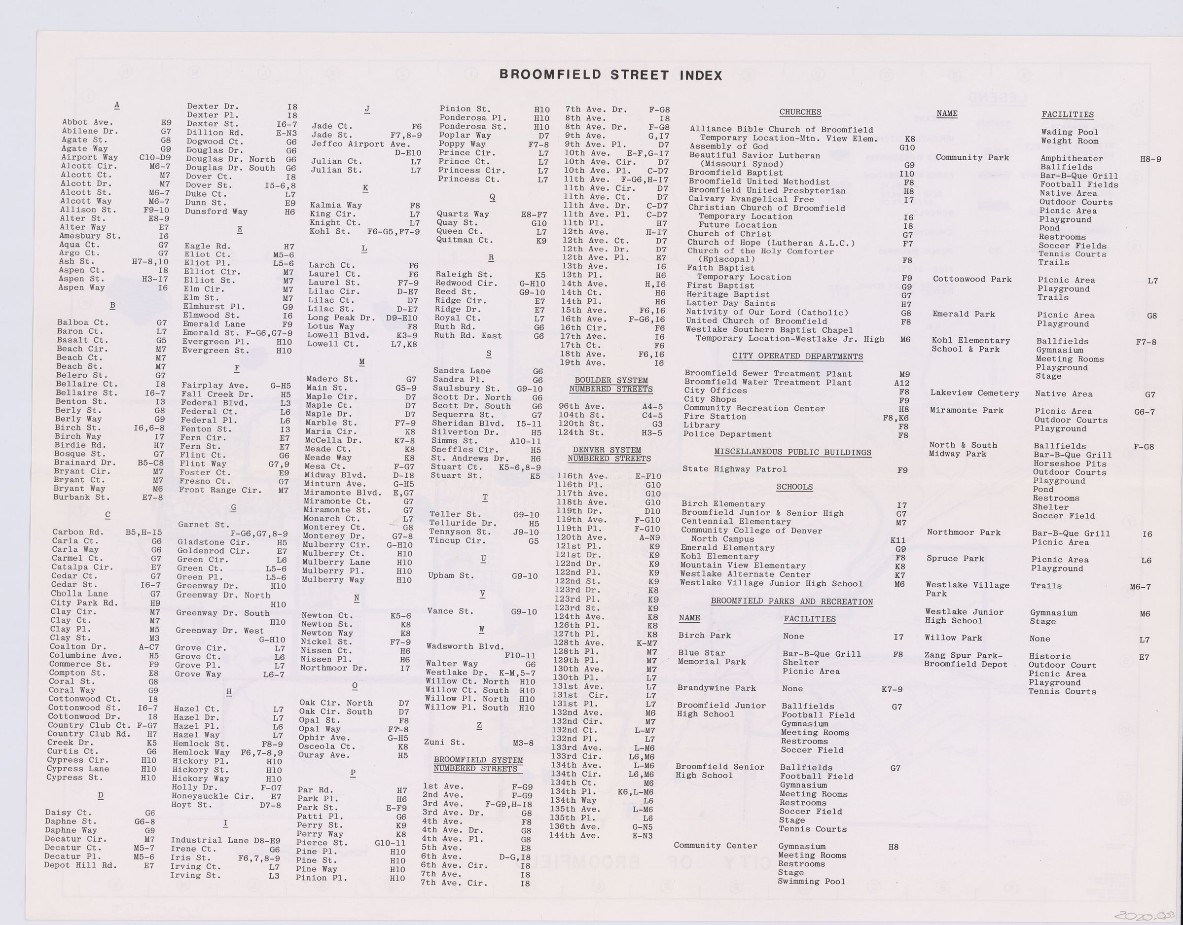
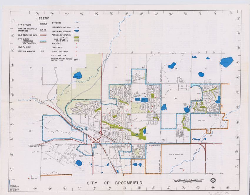
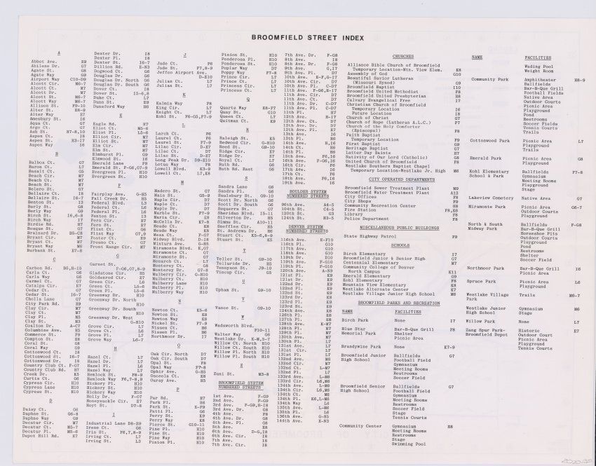
Name/Title
City of Broomfield MapEntry/Object ID
2020.0.53Scope and Content
Map of Broomfield with streets, city limits, highways, county lines, points of interest, parks, open spaces, bodies of water, and Boulder Valley School district. A street name index can be found on the backLexicon
Nomenclature 4.0
Nomenclature Secondary Object Term
MapNomenclature Primary Object Term
CartographNomenclature Sub-Class
Graphic DocumentsNomenclature Class
Documentary ObjectsNomenclature Category
Category 08: Communication ObjectsArchive Details
Date(s) of Creation
Jan 1981